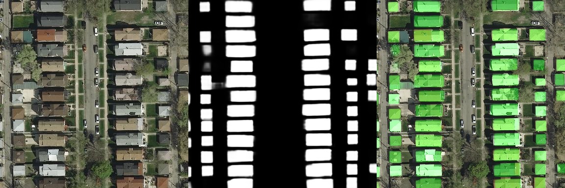
Building footprint segmentation from satellite and aerial imagery
Project description
Building Footprint Segmentation
Library to train building footprint on satellite and aerial imagery.


Installation
pip install building-footprint-segmentation
Dataset
Training
-
Train With Config , Use config template for generating training config
Segmentation for building footprint
- binary
- building with boundary (multi class segmentation)
Project details
Download files
Download the file for your platform. If you're not sure which to choose, learn more about installing packages.
Source Distribution
File details
Details for the file building-footprint-segmentation-0.0.1.tar.gz.
File metadata
- Download URL: building-footprint-segmentation-0.0.1.tar.gz
- Upload date:
- Size: 20.0 kB
- Tags: Source
- Uploaded using Trusted Publishing? No
- Uploaded via: twine/3.2.0 pkginfo/1.6.1 requests/2.24.0 setuptools/50.3.0.post20201006 requests-toolbelt/0.9.1 tqdm/4.51.0 CPython/3.7.9
File hashes
| Algorithm | Hash digest | |
|---|---|---|
| SHA256 | bf31dc2cc6ed7f6885b115b69c879474fd703fd798ffbac64a6b548adb00e54c |
|
| MD5 | d5f699dc5a2300f6a419ad13e543524e |
|
| BLAKE2b-256 | 66b8f0c7834ff655558d84218a7073a0d1c9267270e15d918a62851fcb5786cd |


