Collection of Python scripts to make beautiful deepsky charts in various formats

Project description
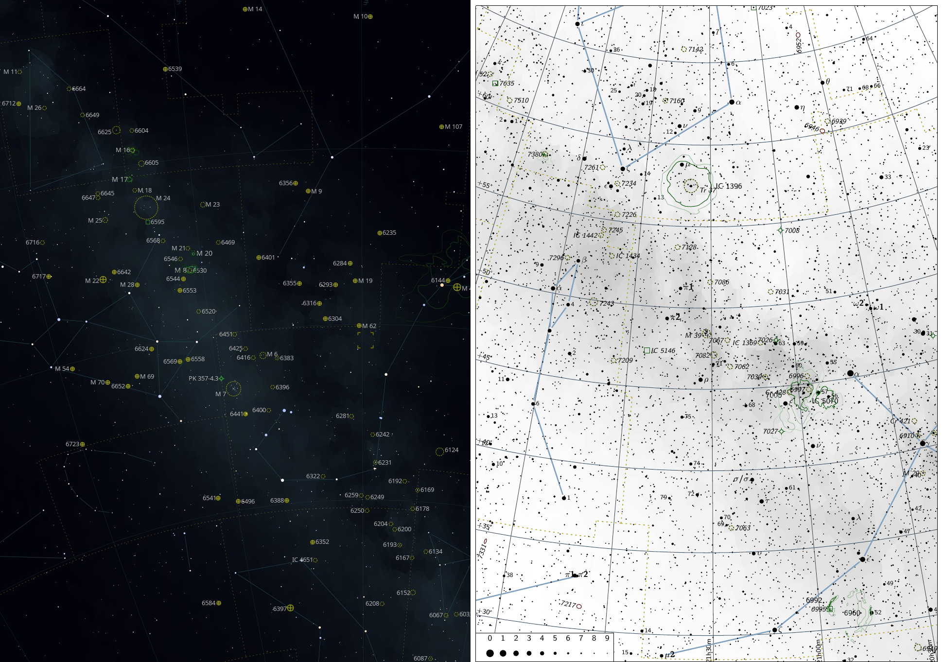
Fchart3
Fchart3 is a Python project for creating high-quality astronomical finder charts and maps. It uses data and catalogues based on Stellarium, KStars, HNSky and Gaia-derived deep star catalogues (hundreds of millions of stars, typically up to ~16–17 mag depending on the used catalog set).
In addition to single-object charts, the package also includes fchart3-atlas – a generator for multi-page sky atlases built on top of the same rendering engine.
It can generate:
- Offline charts with output to PDF, PNG, SVG or TikZ.
- Online interactive charts – the same rendering engine is used in the CzSkY project.
Online interactive version (CzSkY)
Interactive web charts using the fchart3 engine are available in the CzSkY project:
Features
- Deep-sky finder charts based on Gaia-derived star catalogues (hundreds of millions of stars).
- Deep-sky catalogue with hundreds of thousands of objects (from HNSky).
- Output formats: PDF, PNG, SVG, TikZ (format is determined by
--output-fileextension). - Multiple projections:
- stereographic (default)
- orthographic
- equidistant (fisheye-like)
- Equatorial and horizontal coordinate workflows:
- Equatorial maps (RA/Dec).
- Horizontal (Alt/Az) maps with observer location and time.
- CLI supports parsing both RA/Dec and Alt/Az positions.
- Solar system rendering (Sun, Moon, planets; and planetary moons):
- realistic radii and phases
- Saturn ring orientation
- optional moon magnitudes / label placement (as supported by the engine)
- Optional comet / minor planet resolving with trajectory plotting (requires time window).
- Optional polygon horizon from Stellarium landscape (
landscape.ini) for Alt/Az charts. - Flexible configuration: magnitude limits, labels, fonts, legends, colors, line widths, etc.
- Used as the map engine of the CzSkY online star atlas.
Install
Recommended: install from Git into a virtual environment:
git clone https://github.com/skybber/fchart3.git
cd fchart3

python3 -m venv venv
source venv/bin/activate

pip install -r requirements.txt
pip install ./
Linux build dependencies (common)
On some systems you may need development packages for Cairo and build tools before installing (example for Ubuntu):
sudo apt update
sudo apt install -y python3-dev pkg-config libcairo2-dev build-essential
Then:
pip install -U pip setuptools wheel
pip install pycairo
pip install .
Windows
git clone https://github.com/skybber/fchart3.git
cd fchart3

python -m venv venv
venv\Scripts\activate

pip install -U pip setuptools wheel
pip install .
Run
Show all CLI options:
fchart3 --help
Basic chart (default PDF) for Crab Nebula:
fchart3 M1
Output file / format
The output format is defined by --output-file extension:
something.pdfsomething.pngsomething.svgsomething.tikz
Example (PNG):
fchart3 --output-dir out --output-file m31.png M31
Example (TikZ):
fchart3 --output-dir out --output-file m39.tikz M39
Example: “complex” chart (PDF)
fchart3 -W 190 -H 270 -fov 40 -ls 9 -ld 9 \
  --show-nebula-outlines --show-enhanced-milky-way \
  --font-style-bayer bold --font-style-dso italic \
  --flamsteed-numbers-only --show-equatorial-grid \
  --hide-map-orientation-legend --hide-map-scale-legend \
  m39
Notes:
-ls/--limit-starcontrols star limiting magnitude.-ld/--limit-dsocontrols DSO limiting magnitude.-fov/--fieldsizeis the diameter of the field of view (degrees).
Sources (what you can pass on CLI)
A “source” can be:
- DSO names:
NGC891,IC1396,M31, … - Special:
ALLMESSIER(renders maps for all Messier objects) - Explicit coordinates:
Explicit equatorial position (RA,Dec)
fchart3 "9:35:00.8,-34:15:33,SomeCaption"
- RA is interpreted as hours (sexagesimal or decimal).
- Dec is interpreted as degrees (sexagesimal or decimal).
Explicit horizontal position (Az,Alt)
Prefix the first component with h: (or hor: / altaz:) and use degrees:
fchart3 --coord-system horizontal -L 14.42 -A 50.08 -t now \
  "h:180:00:00,45:00:00,AzAltCaption"
Decimal degrees are also accepted:
fchart3 --coord-system horizontal -L 14.42 -A 50.08 -t now \
  "h:180.5,45.25,AzAltCaption"
Horizontal coordinates (
h:) are allowed only when--coord-system horizontalis selected.
Observer location, time and coordinate systems
Coordinate system
- Default:
--coord-system equatorial - Horizontal:
--coord-system horizontal(Alt/Az)
Observer longitude/latitude
Required for horizontal charts and for time-dependent objects:
-L, --obs-longitude   Observer longitude in degrees (east positive)
-A, --obs-latitude    Observer latitude in degrees
Observation time
Use ISO-8601 UTC time or now:
-t now
-t 2026-01-02T21:15:00Z
-t 2026-01-02T21:15:00+01:00
All-sky (fisheye) mode
Fchart3 CLI supports a convenience all-sky mode for rendering a visible hemisphere (zenith-centered) fisheye chart.
It is designed for quick “what’s up now” sky maps and works best with the equidistant (azimuthal equidistant / fisheye-like) projection.
--all-sky
--all-sky is a shortcut that forces a suitable configuration:
--coord-system horizontal--projection equidistant- if
-fov/--fieldsizeis not set:-fov 180(full visible hemisphere) - if
-tis not set: usesnow(UTC)
It requires observer location (-L/-A).
Example:
fchart3 --all-sky --font-size 2 -ls 6 -ld 6 -L 14.42 -A 50.08
With explicit time:
fchart3 --all-sky --font-size 2 -ls 6 -ld 6 -L 14.42 -A 50.08 -t 2026-01-02T21:15:00Z
Notes
-
All-sky charts are typically used with:
--show-horizon(draw the horizon circle)- optional
--clip-to-horizon(hide objects below the horizon, if enabled in the engine)
-
For best results on portrait paper, consider using a square-ish page size or landscape orientation, because an all-sky chart is circular.
Stellarium landscape horizon (optional)
You can load a Stellarium landscape directory (must contain landscape.ini) and use its polygon horizon.
It can also provide location metadata (lon/lat) if present:
fchart3 --coord-system horizontal -t now \
  --stellarium-landscape "/path/to/stellarium/landscapes/MyLandscape" \
  "h:220,12,LookHere"
Extra marks (crosses)
Add a cross mark with -x:
Format:
"c1,c2[,label[,pos]]"pos=t|b|l|r(top/bottom/left/right)
Equatorial cross (RA/Dec):
fchart3 -x "20:35:25.4,+60:07:17.7,SN,t" NGC6946
Horizontal cross (Az/Alt; requires horizontal mode):
fchart3 --coord-system horizontal -L 14.42 -A 50.08 -t now \
  -x "h:180,45,Mark,r" "h:180,45,Center"
Solar system objects
Enable solar system rendering:
fchart3 --show-solar-system -t now -L 14.42 -A 50.08 Jupiter
For meaningful results, solar system objects require:
-ttime- observer lon/lat (or a Stellarium landscape that provides them)
Comets and minor planets (MPC) + trajectories
Fchart3 can resolve comets and minor planets using MPC files and plot their trajectories, when you provide a time window:
Required:
-tobservation time--trajectory-fromand--trajectory-to(UTC; date or datetime)
Example:
fchart3 -t 2026-01-02T21:00:00Z \
  --trajectory-from 2026-01-02 \
  --trajectory-to   2026-01-09 \
  "C/2023 A3"
MPC files are downloaded automatically if missing:
CometEls.txt(comets)MPCORB.9999.DAT(subset of numbered minor planets)
You can override paths and force refresh:
fchart3 --mpc-comets-file ./CometEls.txt --update-comets ...
fchart3 --mpc-minor-planets-file ./MPCORB.9999.DAT --update-minor-planets ...
Data files
This repository contains catalogues in data/catalogs (selection):
bsc5.dat– bright stars catalogueconstbnd.dat– constellation boundariesconstellationship_western.fab– constellation lines (Stellarium)milkyway.dat,milkyway_enhanced.dat– Milky Way outlines/shadingdeep_sky.hnd– deep-sky objects from HNSky (Han Kleijn)outlines_catgen.dat– nebula outlines (OpenNGC-based)PGC.dat,PGC_updates.dat– PGC galaxy catalogue (+ updates)namedstars.dat,starnames.dat,unamedstars.dat– star name catalogues (KStars)stars_0_0v*.cat– Gaia-based deep star catalogues (Stellarium)
Runtime-downloaded (not stored in repo by default):
CometEls.txt(MPC comet elements)MPCORB.9999.DAT(MPCORB subset)
fchart3-atlas (multi-page sky atlas generator)
fchart3-atlas is included in the fchart3 package and builds on top of the fchart3 CLI.
It generates a multi-page sky atlas by repeatedly rendering many overlapping chart tiles – similar in spirit to classic printed atlases
What it does
- Splits the sky into a grid of tiles (pages) based on:
--field-deg(tile field-of-view diameter in degrees)--overlap(tile overlap fraction to avoid gaps)
- For each tile, calls
fchart3with an explicit RA/Dec position source:"RA,Dec,Caption"
- Writes one output file per tile (PDF by default).
- Optionally merges all PDFs into a single
atlas.pdf(if a PDF merge tool is available).
Usage
Basic example (produce many pages into ./atlas_out):
fchart3-atlas \
  --out ./atlas_out \
  --config default \
  --field-deg 60 \
  --overlap 0.20 \
  --limit-star 8.0 \
  --limit-dso 9.0 \
  --projection stereographic \
  --show-enhanced-milky-way
Authors
- Vladimir Dvorak – fchart3
- Georg Zotti – fchart3
- Michiel Brentjens – original author of fchart
- Austin Riba – modern fchart for Python 2.7 + NumPy: https://github.com/Fingel/fchart
License
GNU GPL v2 (or later). See LICENSE.
Release history Release notifications | RSS feed


Download files
Download the file for your platform. If you're not sure which to choose, learn more about installing packages.
Source Distribution
File details
Details for the file fchart3-0.12.2.tar.gz.
File metadata
- Download URL: fchart3-0.12.2.tar.gz
- Upload date:
- Size: 32.0 MB
- Tags: Source
- Uploaded using Trusted Publishing? No
- Uploaded via: twine/6.2.0 CPython/3.13.11
File hashes
| Algorithm | Hash digest | |
|---|---|---|
| SHA256 |
3f1b922077dd27faf1cbf10b8c660cc0ad577a95db09278784a94da5bb40e563
|
|
| MD5 |
5649ba065dc654bb5c58098c4386e258
|
|
| BLAKE2b-256 |
b0689e879240d8852b3c1bfed88a95ee266b1f3accfe5024c4bba7c9153bc80d
|


