Description

Project description
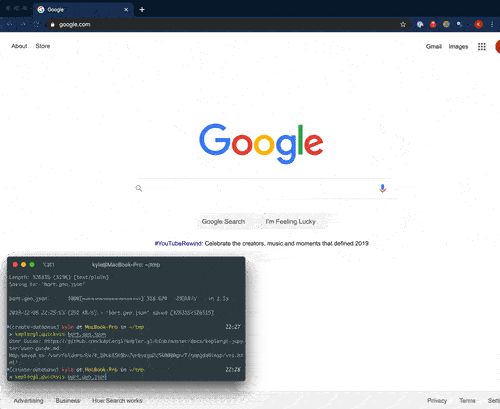
keplergl_quickvis
Overview
Uber's open-source kepler.gl is a great browser-based
platform for interactively visualizing geospatial data. The keplergl Python package's included
documentation
is almost entirely directed at use within Jupyter, and it took a little bit of
work to figure out how to use it from a non-Jupyter Python environment.
keplergl_quickvis is a simple wrapper to quickly get your geospatial objects from Python into kepler.gl in the browser. It's as simple as
keplergl_quickvis --style=outdoors data.geojson
from the command line, or from Python
from keplergl_quickvis import Visualize
Visualize(data)
Features
- One-line data visualization
- Automatically converts Shapely objects to GeoJSON
- No configuration needed
Install
Mapbox API key: in order to display Mapbox-hosted maps, you need to provide a Mapbox API key. Go to Mapbox.com to get an API key.
Package install:
pip install keplergl_quickvis
This package has dependencies on geojson, shapely, and geopandas. If you
get errors when installing this package through pip, it may be easier to first
install dependencies through Conda, then installing this package. I.e.:
conda install geojson shapely geopandas -c conda-forge
pip install keplergl_quickvis
Usage
CLI
The CLI is installed under the name keplergl_quickvis:
export MAPBOX_API_KEY=...
keplergl_quickvis --style=outdoors data.geojson
keplergl_quickvis --style=dark data1.geojson shapefile.shp geodatabase.gdb
You can supply data in any vector format readable by GeoPandas/GDAL.
Supply --help to see the CLI's help menu:
> keplergl_quickvis --help

Usage: keplergl_quickvis [OPTIONS] FILES...

  Interactively view geospatial data using kepler.gl

Options:
  --api_key TEXT  Mapbox API Key. Must be provided on the command line or
                  exist in the MAPBOX_API_KEY environment variable.
  --style TEXT    Mapbox style. Accepted values are: streets, outdoors, light,
                  dark, satellite, satellite-streets, or a custom style URL.
                  [default: streets]
  --help          Show this message and exit.
Python API
Simplest usage:
import geopandas as gpd
from keplergl_quickvis import Visualize

# Create your geospatial objects
gdf = gpd.GeoDataFrame(...)

# Visualize one or multiple objects at a time
Visualize(gdf, api_key=MAPBOX_API_KEY)
Visualize([gdf, shapely_object, geojson_string], api_key=MAPBOX_API_KEY)
More detail over the objects in your map:
from keplergl_quickvis import Visualize
vis = Visualize(api_key=MAPBOX_API_KEY)
vis.add_data(data=data, names='name of layer')
vis.add_data(data=data2, names='name of layer')
html_path = vis.render(open_browser=True, read_only=False)
Visualize
Visualize(data=None, names=None, read_only=False, api_key=None, style=None)
-
data(eitherNone, a single data object, or a list of data objects):A data object may be a GeoDataFrame from the GeoPandas library, any geometry from the Shapely library, any object from the GeoJSON library, or any GeoJSON string or dictionary. You can also provide a CSV file as a string or a Pandas DataFrame if the DataFrame has
LatitudeandLongitudecolumns. Full documentation on the accepted data formats is here.You can provide either a single data object, or an iterable containing multiple allowed data objects.
If data is not
None, then Visualize(data) will perform all steps, including rendering the data to an HTML file and opening it in a new browser tab. -
names(eitherNone, a string, or a list of strings):This defines the names shown for each layer in Kepler.gl. If
None, the layers will be nameddata_0,data_1, and so on. Otherwise, ifdatais a single object,namesshould be a string, and ifdatais an iterable, thennamesshould be an iterable of strings. -
read_only(boolean): IfTrue, hides side panel to disable map customization -
api_key(string): Mapbox API key. Go to Mapbox.com to get an API key. If not provided, theMAPBOX_API_KEYenvironment variable must be set, or thestyle_urlmust point to astyle.jsonfile that does not use Mapbox map tiles. -
style(string): The basemap style to use. Standard Mapbox options are:streetsoutdoorslightdarksatellitesatellite-streets
The default is
streets. Alternatively, you can supply a path to a custom style. A custom style created from Mapbox Studio should have a url that starts withmapbox://. Otherwise, a custom style using third-party map tiles should be a URL to a JSON file that conforms to the Mapbox Style Specification.
Visualize.add_data()
Visualize.add_data(data, names=None):
-
data(either a single data object, or a list of data objects):A data object may be a GeoDataFrame from the GeoPandas library, any geometry from the Shapely library, any object from the GeoJSON library, or any GeoJSON string or dictionary. You can also provide a CSV file as a string or a Pandas DataFrame if the DataFrame has
LatitudeandLongitudecolumns. Full documentation on the accepted data formats is here.You can provide either a single data object, or an iterable containing multiple allowed data objects.
-
names(eitherNone, a string, or a list of strings):This defines the names shown for each layer in Kepler.gl. If
None, the layers will be nameddata_0,data_1, and so on. Otherwise, ifdatais a single object,namesshould be a string, and ifdatais an iterable, thennamesshould be an iterable of strings.
Visualize.render()
Visualize.render(open_browser=True, read_only=False)
read_only(boolean): IfTrue, hides side panel to disable map customizationopen_browser(boolean): IfTrue, opens the saved HTML file in the default browser
Troubleshooting
The most common reasons why a map is not displayed are:
- Missing Mapbox API Key: in order to display Mapbox-hosted maps, you need get an API key from Mapbox to pass an API key
- Data projection: Kepler.gl works only with data projected into standard WGS84 (latitude, longitude) coordinates. If you have your data in a projected coordinate system, first reproject your data into WGS84 (EPGS 4326), then try again. The CLI attempts to automatically reproject into EPSG 4326, but the Python library doesn't.
If your data seems to be "floating" above the map, this is likely because your input data have Z coordinates, so kepler.gl displays them in 3-dimensional space.
Changelog
0.1.0 (2019-12-05)
- First release on PyPI.
0.2.0 (2019-12-09)
- Automatically attempt to reproject to EPSG 4326
Release history Release notifications | RSS feed


Download files
Download the file for your platform. If you're not sure which to choose, learn more about installing packages.
Source Distribution
File details
Details for the file keplergl_quickvis-0.2.0.tar.gz.
File metadata
- Download URL: keplergl_quickvis-0.2.0.tar.gz
- Upload date:
- Size: 11.8 kB
- Tags: Source
- Uploaded using Trusted Publishing? No
- Uploaded via: twine/3.1.1 pkginfo/1.5.0.1 requests/2.22.0 setuptools/41.4.0 requests-toolbelt/0.9.1 tqdm/4.36.1 CPython/3.7.4
File hashes
| Algorithm | Hash digest | |
|---|---|---|
| SHA256 |
61f18745accf2bd8f7e04cd92cc93f0228d0236808fe5c9a0033afaa04c6828f
|
|
| MD5 |
712c6e2cad1dff68b56cd7055c654670
|
|
| BLAKE2b-256 |
9720dd52510fb2453ac82b9def2dcd1b883fc033728247797d04da5d8fc92c6e
|


