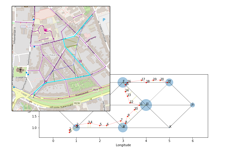
Match a trace of locations to a map
Project description
Align a trace of GPS measurements to a map or road segments.
The matching is based on a Hidden Markov Model (HMM) with non-emitting states. The model can deal with missing data and you can plug in custom transition and emission probability distributions.

example
Reference:
Meert Wannes, Mathias Verbeke, “HMM with Non-Emitting States for Map Matching”, European Conference on Data Analysis (ECDA), Paderborn, Germany, 2018.
Installation and usage
$ pip install leuvenmapmatching
More information and examples:
Dependencies
Required:
Optional (only loaded when methods are called to rely on these packages):
Contact
Developed with the support of Elucidata.be.
License
Copyright 2015-2018, KU Leuven - DTAI Research Group, Sirris -
Elucidata Group
Apache License, Version 2.0.
Project details
Release history Release notifications | RSS feed
Download files
Download the file for your platform. If you're not sure which to choose, learn more about installing packages.
Source Distribution
Built Distribution
Close
Hashes for leuvenmapmatching-0.5.2-py3-none-any.whl
| Algorithm | Hash digest | |
|---|---|---|
| SHA256 | a06f279b4c6ce80436b49f74a1819a40805aa27eae0dffb8dac5c7b0820e6ae6 |
|
| MD5 | 2232e3263e1ec8cbb128ecaf53a54067 |
|
| BLAKE2b-256 | e2a8bc73d614cc27e663a4c426a91f1121fdc43d23196bfbf71bce1a61893b00 |


