


A mappyfile plugin to convert GeoJSON to inline Mapfile features. Useful for adding dynamically created features (from web services, user created features, and other external data sources) to a map, or to quickly visualise a geometry.
Note - to display entire GeoJSON files MapServer can be configured to read GeoJSON as an input OGR source using the GeoJSON driver.
import geojson
import mappyfile
# import directly
import mappyfile_geojson
# can also be imported as plugin using
from mappyfile.plugins import mappyfile_geojson

gj = geojson.load(fn)
l = mappyfile_geojson.convert(gj)
print(mappyfile.dumps(l))
Converts the following JSON:
{
  "type": "Feature",
  "geometry": {
    "type": "LineString",
    "coordinates": [
      [ 102.0, 0.0 ],
      [ 103.0, 1.0 ],
      [ 104.0, 0.0 ],
      [ 105.0, 1.0 ]
    ]
  },
  "properties": {
    "prop0": "value0",
    "prop1": 0.0
  }
}
to the following Mapfile LAYER:
LAYER
    EXTENT 102 0 105 1
    STATUS ON
    TYPE LINE
    PROCESSING "ITEMS=prop0,prop1"
    FEATURE
        ITEMS "value0;0.0"
        POINTS
            102.0 0.0
            103.0 1.0
            104.0 0.0
            105.0 1.0
        END
    END
END
Demo
An example of using the plugin with mappyfile can be found in example.py along with an example.map.
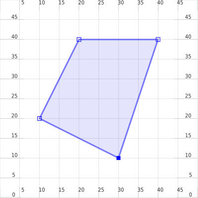
A further example, creating images for each of the test cases using mapscript is available at create_images.py.
The sample output images are in the images folder.
Requirements
Python 3.8+
mappyfile (the plugin can be used on its own but will create a dictionary object structured to use within mappyfile). Installing mappyfile should be done separately.
Installation
Note installing the mappyfile-geojson plugin will automatically install the required dependency geojson.
pip install mappyfile
pip install mappyfile-geojson
Notes
Can calculate extent of input features, with an optional buffer (by passing an extent_buffer to the convert function)
Multipart features are supported
Coordinate sequences with Z values are supported, but Z values are ignored as they are not supported in Mapserver inline features.
As a MapServer LAYER only supports a single geometry type, all features in the GeoJSON file should also be of the same type (however a mix of multipart and non-multipart features is supported e.g. LineString and MultiLineString)
Nested JSON properties are not supported:
"properties": {
    "prop0": "value0",
    "prop1": { "this": "that" }
}
Will become:
ITEMS "value0;{u'this': u'that'}"
Releases
1.0 (02/10/2023)
Drop support for Python 2.7
Update of GeoJSON and mappyfile dependencies
Code reformatted using black
0.4 (09/02/2020)
Automated Windows testing
Automated release process
Set geojson dependency version
Fix failing tests due to precision issue differences between py2 and py3
Use integers for layer EXTENT where possible e.g. 5 instead of 5.0
0.3 (29/08/2018)
Add support for MultiPoint, MultiLineString, and MultiPolygon
Allow coordinates with Z values (previously these would crash the script)
Updated README
0.2 (15/02/2018)
Unicode support
0.1 (06/02/2018)
Initial release
1 maintainer

Release files for mappyfile-geojson 1.0.0
For a detailed explanation of source distributions (sdists) and built distributions (wheels), please see the package formats documentation.
Source distribution (sdist)
| File | Size | Uploaded | |
|---|---|---|---|
| mappyfile-geojson-1.0.0.tar.gz | 7.8 kB | Details |
Built distribution (wheel)
| File | Interpreter | ABI | Platform | Reset |
|---|---|---|---|---|
| mappyfile_geojson-1.0.0-py2.py3-none-any.whl | Python 3, Python 2 | none | any | Details |
Total release size: 13.5 kB
Release files / mappyfile-geojson-1.0.0.tar.gz
| Download URL | mappyfile-geojson-1.0.0.tar.gz |
|---|---|
| Size | 7.8 kB |
| Tags | Source |
|
SHA-256 checksum How to use checksums |
5b14b7378001dd96cf6728230cc78f421ac8744d1537a19dec7a0ce2492c1207
|
|
BLAKE2b-256 checksum How to use checksums |
7bc39c7b5d00cf8660e89c493acd812051b17b4d11fceddbf18408b83c6cb52d
|
| Upload date | |
|
Uploaded using Trusted Publishing? What is trusted publishing? |
No |
| Uploaded via |
twine/4.0.2 CPython/3.10.9
|
Release files / mappyfile_geojson-1.0.0-py2.py3-none-any.whl
| Download URL | mappyfile_geojson-1.0.0-py2.py3-none-any.whl |
|---|---|
| Size | 5.7 kB |
| Tags | Python 2 Python 3 |
|
SHA-256 checksum How to use checksums |
ed4155afb91fcff622918e9203941c6dab5fe39d9c4f212b8f60c6cfc243b865
|
|
BLAKE2b-256 checksum How to use checksums |
c56cc1e2e028a098be25de4ccf2a4f5dc389845815f5691215fc874acba63e0c
|
| Upload date | |
|
Uploaded using Trusted Publishing? What is trusted publishing? |
No |
| Uploaded via |
twine/4.0.2 CPython/3.10.9
|














