This library helps user create raster files directly off postgis tables, rasterization and fishnet analysis.

Project description
postgis2raster
converts postgis vector geometry to Gdal Rasters
Eaxmple of Fishnets
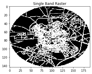
Single Band Circle
postgis2raster.analysis_circle(
    table='mytable',
    output_raster='myimage.tif',
    query_x=16.55268272,
    query_y=40.82717010,
    radius=2500,
    cell_size=30
)
Multi Band Circle
postgis2raster.analysis_circle(
    table='mytable',
    output_raster='myimage.tif',
    query_x=16.55268272,
    query_y=40.82717010,
    radius=2500,
    cell_size=30,
    classes_to_bands=True
)

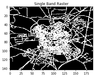
Single Band Polygon
postgis2raster.analysis_polygon(
    table='mytable',
    output_raster='myimage.tif',
    query_x=16.55268272,
    query_y=40.82717010,
    height=5000,
    width=5000,
    cell_size=30
)
Multi Band Polygon
postgis2raster.analysis_polygon(
    table='mytable',
    output_raster='myimage.tif',
    query_x=16.55268272,
    query_y=40.82717010,
    height=5000,
    width=5000,
    cell_size=30,
    classes_to_bands=True
)

Release history Release notifications | RSS feed

Download files
Download the file for your platform. If you're not sure which to choose, learn more about installing packages.
Source Distribution
postgis2raster-0.2.tar.gz
(1.9 kB
view details)
Built Distribution
Filter files by name, interpreter, ABI, and platform.
If you're not sure about the file name format, learn more about wheel file names.
Copy a direct link to the current filters
File details
Details for the file postgis2raster-0.2.tar.gz.
File metadata
- Download URL: postgis2raster-0.2.tar.gz
- Upload date:
- Size: 1.9 kB
- Tags: Source
- Uploaded using Trusted Publishing? No
- Uploaded via: twine/3.1.1 pkginfo/1.5.0.1 requests/2.23.0 setuptools/46.0.0.post20200309 requests-toolbelt/0.9.1 tqdm/4.43.0 CPython/3.8.1
File hashes
| Algorithm | Hash digest | |
|---|---|---|
| SHA256 |
a6aebfa7805a0d10be0f679a2e87e6214c56f94f818b796d9a70b9dd93867fad
|
|
| MD5 |
7ed8e940da9d7e70bcb75b9002f4d69c
|
|
| BLAKE2b-256 |
2fa65a42d7c472417190bbfa42fd3f4bb43acac5918d2a9fd004c12aeb738273
|
File details
Details for the file postgis2raster-0.2-py3-none-any.whl.
File metadata
- Download URL: postgis2raster-0.2-py3-none-any.whl
- Upload date:
- Size: 2.6 kB
- Tags: Python 3
- Uploaded using Trusted Publishing? No
- Uploaded via: twine/3.1.1 pkginfo/1.5.0.1 requests/2.23.0 setuptools/46.0.0.post20200309 requests-toolbelt/0.9.1 tqdm/4.43.0 CPython/3.8.1
File hashes
| Algorithm | Hash digest | |
|---|---|---|
| SHA256 |
4dcc97fbf01d5ed7277fedb6886a9e9cf34f8730fe5eaedf3f54f33f740aa684
|
|
| MD5 |
4f89e7b63ce0ed38dd507f776f2a20d9
|
|
| BLAKE2b-256 |
94f2ab008cd15ac2a5185667b11b8d9935347aa73e4d09aa435ab4cd645832e8
|


