
PyRossGeo: spatially resolved infectious disease models in Python 


About | Model | Installation | Documentation | License | Contact
About
PyRossGeo is a numerical library for spatially resolved mathematical modelling of infectious diseases. The library has a Python interface, but is coded in C using Cython. See below for more details on the model.
PyRoss is a companion library that offers tools for both deterministic and stochastic simulation of macroscopic compartmental models, as well as a complete suite of inference and optimal control tools.
Please open an issue, or join our public slack, if you have any queries, in preference to e-mailing us. For urgent enquiries, please contact Lukas Kikuchi at ltk26@cam.ac.uk.
The authors are part of the Rapid Assistance in Modelling the Pandemic (RAMP) taskforce at the University of Cambridge. In alphabetical order, we are: Jakub Dolezal, Tim Ekeh, Lukas Kikuchi, Hideki Kobayashi, Paul Rohrbach, Rajesh Singh and Fernando Caballero.
Model
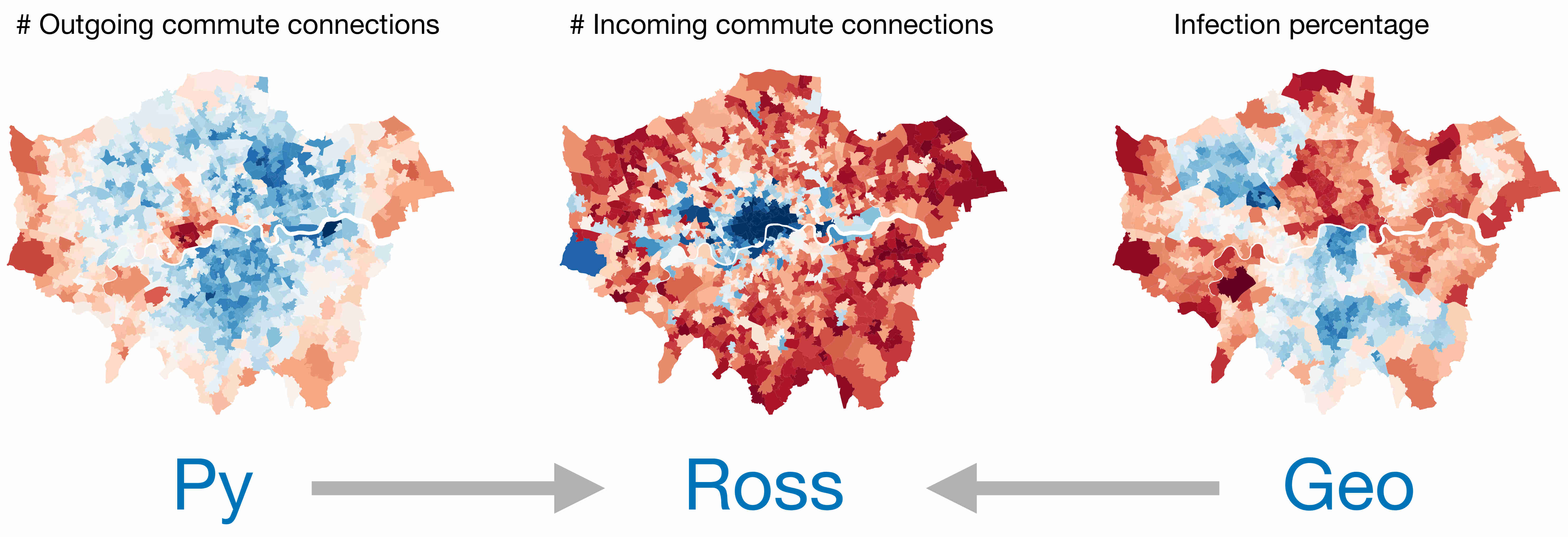
The PyRossGeo uses a spatially resolved infectious disease model. The model is distinct from other network-SIR models in that it explicitly considers movement between geographical nodes, by modelling the commuting patterns of the population.
Locally at each geographical node, we simulate compartmental epidemiological dynamics with an age-contact structure. The resident population at each node can move between nodes via the commuter network. The epidemics of the commute itself is modelled using the "commuterverse": People moving between geographical nodes must spend the requisite amount of time (corresponding to the distance travelled) with their fellow commuters in a commuter node. See the figure below for an example of a commuter network:
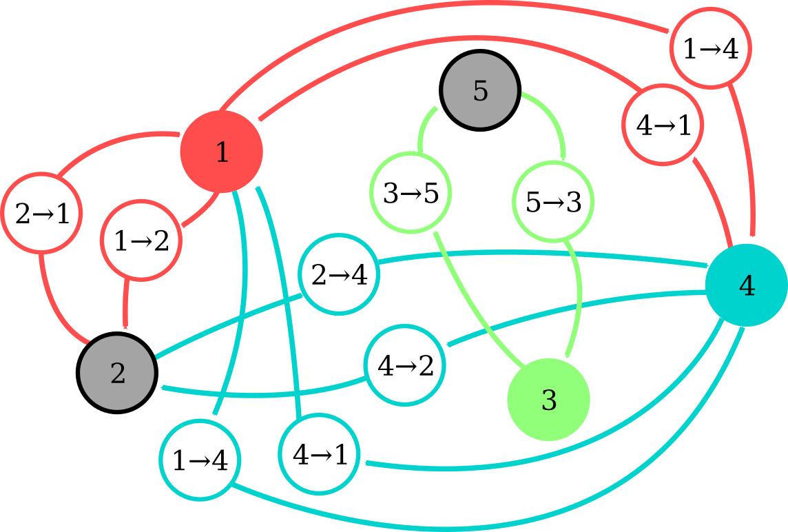
The local infective dynamics at a node-level is customizable, and any variant of the compartmental epidemiological models (e.g. SIR, SEIR, SEAIR, etc.) can be coded using a configuration file.
The model has been tested with synthetic data on London, at an MSOA (Middle Super Output Area) level. We used ~1000 geographical nodes, with a commuter network of ~300'000 edges, constructed using the 2011 UK Census data. We are currently developing a test for a UK-wide simulation at an LAD (Local Authority District) level.
For a more detailed description of the model, please read this.
Installation
You can take PyRossGeo for a spin without installation:
From a checkout of this repository
Install PyRossGeo and required dependencies using
>> git clone https://github.com/lukastk/PyRossGeo.git
>> cd PyRossGeo
>> pip install -r requirements.txt
>> python setup.py install
Via Anaconda
Install PyRossGeo and its dependencies in a pyrossgeo environment
>> git clone https://github.com/lukastk/PyRossGeo.git
>> cd PyRossGeo
>> make env
>> conda activate pyrossgeo
>> make
Via pip
Install the latest PyPI version
>> pip install pyrossgeo
PyRossGeo requires the following software
- Python 3.4+
- Cython 0.25.x+ | NumPy 1.x+ | Pandas | SciPy 1.1.x+
- Optional dependencies: | Zarr (Saving simulations results) | Matplotlib 2.0.x+ (Example notebooks) | Jupyter (Example notebooks) | PyTest (Testing) | GeoPandas (Visualisations) | PyRoss (Example notebooks, contact matrices)
Documentation
See here for documentation, tutorials and example notebooks.
License
We believe that openness and sharing improves the practice of science and increases the reach of its benefits. This code is released under the MIT license. Our choice is guided by the excellent article on Licensing for the scientist-programmer.
Contact
For inquiries about PyRossGeo, please join the #pyrossgeo channel of our public slack here.
1 maintainer

Metadata
1 maintainer
Release files for pyrossgeo 1.0.8
For a detailed explanation of source distributions (sdists) and built distributions (wheels), please see the package formats documentation.
Source distribution (sdist)
| File | Size | Uploaded | Provenance | |
|---|---|---|---|---|
| pyrossgeo-1.0.8.tar.gz | 1.0 MB | Without provenance | Details |
Built distribution (wheel)
| File | Interpreter | ABI | Platform | Reset |
|---|---|---|---|---|
| pyrossgeo-1.0.8-cp37-cp37m-macosx_10_9_x86_64.whl | CPython 3.7 | CPython 3.7 pymalloc | macOS 10.9+ x86-64 | Details |
Total release size: 4.2 MB
Release files / pyrossgeo-1.0.8.tar.gz
| Download URL | pyrossgeo-1.0.8.tar.gz |
|---|---|
| Size | 1.0 MB |
| Tags | Source |
|
SHA-256 checksum How to use checksums |
fa0b8927ac6f03a07aeff6235381893443ea556809394e154d2ab58c78ea1e7e
|
|
BLAKE2b-256 checksum How to use checksums |
4bbb926d18085e6b6114200abb64ba1501411a065806ee47d3b7050a487f1127
|
| Upload date | |
|
Uploaded using Trusted Publishing? What is trusted publishing? |
No |
| Uploaded via |
twine/3.1.1 pkginfo/1.5.0.1 requests/2.23.0 setuptools/47.1.1 requests-toolbelt/0.9.1 tqdm/4.46.0 CPython/3.7.3
|
Release files / pyrossgeo-1.0.8-cp37-cp37m-macosx_10_9_x86_64.whl
| Download URL | pyrossgeo-1.0.8-cp37-cp37m-macosx_10_9_x86_64.whl |
|---|---|
| Size | 3.1 MB |
| Tags | CPython 3.7 CPython 3.7 pymalloc macOS 10.9+ x86-64 |
|
SHA-256 checksum How to use checksums |
d40261c55b04c21690331a672373445d45c0521acf53d31c29b94e36ea303261
|
|
BLAKE2b-256 checksum How to use checksums |
72ac1a3b791875d3bce71f0eb466145129dcec841f920da9610d5818c29ef45f
|
| Upload date | |
|
Uploaded using Trusted Publishing? What is trusted publishing? |
No |
| Uploaded via |
twine/3.1.1 pkginfo/1.5.0.1 requests/2.23.0 setuptools/47.1.1 requests-toolbelt/0.9.1 tqdm/4.46.0 CPython/3.7.3
|
Security for pyrossgeo 1.0.8
Provenance
Provenance describes where a file came from. On PyPI, provenance is shared via attestations, which provide a verifiable record of the build or publishing details. View details, limitations and caveats.
No provenance found
None of the files in this release were uploaded with provenance metadata.
A note on package security
PyPI is a repository for distributing packages, not a service for auditing them. While third-party security researchers and our staff do their best to detect and remove malicious packages, PyPI cannot guarantee the quality, security or suitability of any given package.














