
sensormapgeo
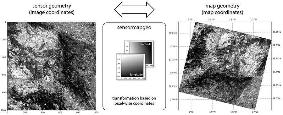
Sensormapgeo transforms a remote sensing image from sensor geometry (image coordinates without geocoding/projection) to map geometry (projected map coordinates) or vice-versa based on a pixel-wise longitude/latitude coordinate array.
Free software: Apache-2.0
Documentation: https://enmap.git-pages.gfz-potsdam.de/sensormapgeo/doc/
Submit feedback by filing an issue here.
Status






See also the latest coverage report and the pytest HTML report.
Features
transformation from sensor geometry (image coordinates) to map geometry (map coordinates)
transformation from map geometry (map coordinates) to sensor geometry (image coordinates)
Credits
The sensormapgeo package was developed within the context of the EnMAP project supported by the DLR Space Administration with funds of the German Federal Ministry of Economic Affairs and Energy (on the basis of a decision by the German Bundestag: 50 EE 1529) and contributions from DLR, GFZ and OHB System AG.
This package was created with Cookiecutter and the audreyr/cookiecutter-pypackage project template.
1 maintainer

Metadata
1 maintainer
Release files for sensormapgeo 1.2.3
For a detailed explanation of source distributions (sdists) and built distributions (wheels), please see the package formats documentation.
Source distribution (sdist)
| File | Size | Uploaded | |
|---|---|---|---|
| sensormapgeo-1.2.3.tar.gz | 204.3 kB | Details |
Release files / sensormapgeo-1.2.3.tar.gz
| Download URL | sensormapgeo-1.2.3.tar.gz |
|---|---|
| Size | 204.3 kB |
| Tags | Source |
|
SHA-256 checksum How to use checksums |
3a80f7d295e4d23210c2d7f9c2263cb4b74df9a8e9a696431f8d84d253f600b1
|
|
BLAKE2b-256 checksum How to use checksums |
df64a9224af5b92954367edaa387920b9f0c4f3955af12e9da4a76bbba1e8362
|
| Upload date | |
|
Uploaded using Trusted Publishing? What is trusted publishing? |
No |
| Uploaded via |
twine/7.0.0 CPython/3.12.1
|














