A Datasette plugin that renders GeoJSON columns using Leaflet

Project description
datasette-leaflet-geojson


Datasette plugin that replaces any GeoJSON column values with a Leaflet map
Installation
Install this plugin in the same environment as Datasette.
$ datasette install datasette-leaflet-geojson
Usage
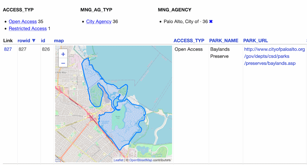
Any columns containing valid GeoJSON strings will have their contents replaced with a Leaflet map when they are displayed in the Datasette interface.
Demo
You can try this plugin out at https://calands.datasettes.com/calands/superunits_with_maps
Configuration
By default this plugin displays maps for the first ten rows, and shows a "Click to load map" prompt for rows past the first ten.
You can change this limit using the default_maps_to_load plugin configuration setting. Add this to your metadata.json:
{
    "plugins": {
        "datasette-leaflet-geojson": {
            "default_maps_to_load": 20
        }
    }
}
Then run Datasette with datasette mydb.db -m metadata.json.


Download files
Download the file for your platform. If you're not sure which to choose, learn more about installing packages.
Source Distribution
Built Distribution
Filter files by name, interpreter, ABI, and platform.
If you're not sure about the file name format, learn more about wheel file names.
Copy a direct link to the current filters
File details
Details for the file datasette_leaflet_geojson-0.8.2.tar.gz.
File metadata
- Download URL: datasette_leaflet_geojson-0.8.2.tar.gz
- Upload date:
- Size: 5.0 kB
- Tags: Source
- Uploaded using Trusted Publishing? Yes
- Uploaded via: twine/5.0.0 CPython/3.12.3
File hashes
| Algorithm | Hash digest | |
|---|---|---|
| SHA256 |
d72e5390b7cb3bafcc8792d1353e053165920876d56ee6185c7b4480bbec6d06
|
|
| MD5 |
8fbfe06ce86e2714284f44626612d9ce
|
|
| BLAKE2b-256 |
0f80914c65057714798c97bdcdaaa480dcdcb94c246358d00cd185e9e9c91fa1
|
File details
Details for the file datasette_leaflet_geojson-0.8.2-py3-none-any.whl.
File metadata
- Download URL: datasette_leaflet_geojson-0.8.2-py3-none-any.whl
- Upload date:
- Size: 5.1 kB
- Tags: Python 3
- Uploaded using Trusted Publishing? Yes
- Uploaded via: twine/5.0.0 CPython/3.12.3
File hashes
| Algorithm | Hash digest | |
|---|---|---|
| SHA256 |
cbc64db5c6ec8d75de2c3390e6ce0cc680ab71105434692aad5e7400393a8a24
|
|
| MD5 |
8481a71a27f211e996cfd9f33d40dfda
|
|
| BLAKE2b-256 |
a342f119c40f5e436300a3ae8bc9e23e6667c6964da5974238bf05298b2f0a59
|


