A package to fetch, process, store and plot aircraft trace data from ADS-B Exchange

Project description
FlightTracer: Tracking ADS-B Exchange flights


FlightTracer is a Python package for fetching, processing, storing and plotting flight trace data from ADS-B Exchange. It provides tools for managing flight data and offers flexible options for users. The project is new and under development.
Features
- Fetches flight trace data from ADS-B Exchange
- Identifies flight legs by detecting time gaps and handling Zulu day transitions
- Converts raw flight trace data into GeoDataFrames for easy analysis
- Saves processed flight data in CSV, GeoJSON or shapefile formats
- Visualizes flight paths with customizable basemaps and clear leg differentiation
- Supports AWS S3 uploads for cloud storage
- Offers customization options for file formats and filtering
- Now includes a command-line interface (CLI) for easy execution
Installation
FlightTracer is available on PyPI and can be installed using:
pip install flight-tracer
Alternatively, install the latest development version from GitHub:
pip install git+https://github.com/stiles/flight_tracer.git
Dependencies
FlightTracer requires the following Python packages:
requestspandasgeopandasboto3matplotlibcontextilyshapelyclick(for CLI support)
These dependencies will be installed automatically with pip.
Using FlightTracer via CLI
With the new CLI support, FlightTracer can be run directly from the command line.
CLI options overview
| Option | Description |
|---|---|
--icao |
ICAO aircraft ID (required, can be multiple) |
--start |
Start date (YYYY-MM-DD) |
--end |
End date (YYYY-MM-DD) |
--output |
Directory for saving fetched data |
--input |
Path to input file for processing/exporting/uploading |
--format |
Output format: csv, geojson, shp |
--filter-ground |
Filter out ground-level points (default: True) |
--plot |
Generate a visualization of the flight trace |
--bucket |
AWS S3 bucket name for uploads |
--aws-profile |
AWS profile for authentication when uploading |
These commands ensure seamless of FlightTracer's features via the command line.
Basic command: Fetch raw flight trace data
flight-tracer fetch --icao A11F59 --start 2025-02-07 --end 2025-02-08 --output data/
This fetches flight data for aircraft A11F59 for the given date range and saves it as a CSV file.
Processing fetched data
flight-tracer process --input data/raw_A11F59_2025-02-07_2025-02-08.csv --filter-ground
This processes the fetched flight trace data, filtering out ground-level points and saving the result in a structured format.
Exporting processed data
flight-tracer export --input data/processed_A11F59_2025-02-07_2025-02-08.geojson --format geojson
This exports the processed flight data in GeoJSON format (CSV and shapefile options are also available).
Plotting the flight trace
flight-tracer plot --input data/processed_A11F59_2025-02-07_2025-02-08.geojson --output visuals/flight_map_A11F59_2025-02-07_2025-02-08.png
This generates a visualization of the flight trace and saves it as an image file.
Uploading processed data to AWS S3
flight-tracer upload --input data/processed_A11F59_2025-02-07_2025-02-08.geojson --bucket my-bucket --aws-profile my-profile
This uploads the processed flight trace data to the specified AWS S3 bucket using the provided AWS profile.
Using FlightTracer in Python
FlightTracer can also be used as a Python library for more flexibility.
Basic example
from flight_tracer import FlightTracer
from datetime import date

# Initialize the FlightTracer with an aircraft ID
tracer = FlightTracer(aircraft_ids=["A11F59"])

# Define the date range for fetching trace data
start = date(2025, 2, 7)
end = date(2025, 2, 8)

# Fetch flight data
raw_df = tracer.get_traces(start, end)

# Process the raw data into a GeoDataFrame
if not raw_df.empty:
    gdf = tracer.process_flight_data(raw_df)
    print(gdf.head())
Converting to a Specific Time Zone
By default, ADS-B times are in UTC. Users can convert point_time to their local time zone as needed:
import pytz

# Convert to US/Pacific Time
gdf["point_time_pacific"] = gdf["point_time"].dt.tz_localize("UTC").dt.tz_convert("US/Pacific")

# Convert to Eastern Time
gdf["point_time_eastern"] = gdf["point_time"].dt.tz_localize("UTC").dt.tz_convert("America/New_York")
To see all available time zones:
import pytz
print(pytz.all_timezones)
Customizing output
FlightTracer provides options to save data in different formats and configure the output directory:
Supported file formats
- CSV
- GeoJSON
- Esri shapefile
Example: Exporting data
# Save processed data locally
tracer.export_flight_data(gdf, base_path="data/flight_traces", export_format="geojson") # or "shp"
AWS S3 integration
Easily upload processed data to AWS S3 for cloud storage. Provide your AWS credentials or use an AWS profile:
Example: Uploading to S3
aws_creds = {
    "aws_access_key_id": "your-access-key",
    "aws_secret_access_key": "your-secret-key"
}

tracer.upload_to_s3(
    gdf,
    bucket_name="your-bucket",
    csv_object_name="flight_data.csv",
    geojson_object_name="flight_data.geojson"
)
Advanced features
Metadata mapping
Enrich your flight data with custom metadata using mapping options.
Example: Adding metadata
meta_df = pd.DataFrame({
    "flight": ["AAL124", "UAL1053"],
    "airline": ["American Airlines", "United Airlines"]
})
mapping_info = (meta_df, "flight", "airline", "airline")

# Pass mapping_info to process_flight_data
gdf = tracer.process_flight_data(raw_df, mapping_info=mapping_info)
Custom time thresholds for legs
Customize the time gap threshold for detecting new flight legs:
Example: Adjusting time gap threshold
tracer.set_time_gap_threshold(minutes=45)
Outputs
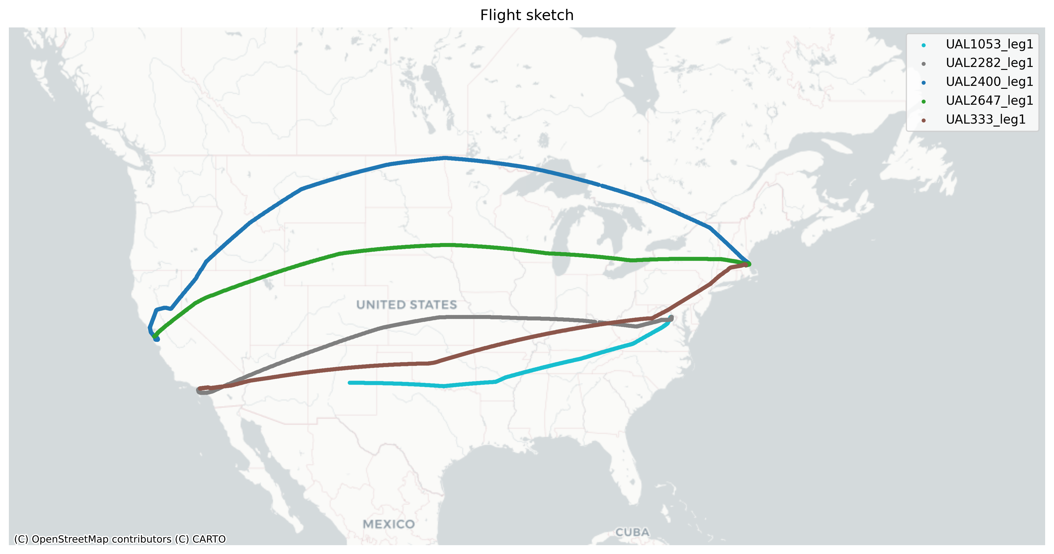
The example above would output two GeoJSON files: One with point features for each moment captured during the aircraft's flight and another with lines representing the overall route(s). Legs of the flights are differentiated in the flight_leg item. The script also outputs a CSV and a simple map plot.
"features": [
    {
        "type": "Feature",
        "properties": {
            "point_time": "2025-02-08T02:38:02.920",
            "flight_date_pst": "2025-02-07",
            "altitude": "30000",
            "ground_speed": 408.4,
            "heading": 253.2,
            "lat": 35.968307,
            "lon": -97.348509,
            "icao": "a11f59",
            "call_sign": "UAL333",
            "leg_id": 1,
            "flight_leg": "UAL333_leg1"
        },
        "geometry": {
            "type": "Point",
            "coordinates": [
                -97.348509,
                35.968307
            ]
        }
    }
]
Notes:
- Values such as altitude and ground speed are raw and uncorrected
- ADS-B datetimes are UTC, or Zulu, but FlightTracer users can concert that to a local time zone.
The plot has different colors for the various legs that day to help you identify them more clearly as you use the data for more advanced visualizations using QGIS or other tools.
Roadmap
- CLI option: Add a command-line interface for easier usage
- Improved metadata integration: Automatically enrich flight data with external sources (e.g., FAA, ICAO)
- Parallel processing: Optimize for large datasets
- Better visualizations: Add support for tools like Altair or Plotly
- Analysis tools: Better understand a flight's speed and altitude changes
Credits
Thanks to ADS-B Exchange for providing open flight data. Please consider supporting their service by subscribing or contributing data.
License
This project is licensed under the Creative Commons CC0 1.0 Universal Public Domain Dedication.


Download files
Download the file for your platform. If you're not sure which to choose, learn more about installing packages.
Source Distribution
Built Distribution
Filter files by name, interpreter, ABI, and platform.
If you're not sure about the file name format, learn more about wheel file names.
Copy a direct link to the current filters
File details
Details for the file flight_tracer-0.1.7.tar.gz.
File metadata
- Download URL: flight_tracer-0.1.7.tar.gz
- Upload date:
- Size: 18.1 kB
- Tags: Source
- Uploaded using Trusted Publishing? No
- Uploaded via: twine/6.1.0 CPython/3.9.15
File hashes
| Algorithm | Hash digest | |
|---|---|---|
| SHA256 |
af935cc141208d0280ba45b0c5f1616b6f90ffa4e05ed3c66ba035d67a4956e5
|
|
| MD5 |
88ae46cc52b3e71b2548b2d9d0ed8021
|
|
| BLAKE2b-256 |
288b0ff0aec9418b75327573c5252db0ba042b296bbeda7580a96f3d6cfa6d77
|
File details
Details for the file flight_tracer-0.1.7-py3-none-any.whl.
File metadata
- Download URL: flight_tracer-0.1.7-py3-none-any.whl
- Upload date:
- Size: 15.2 kB
- Tags: Python 3
- Uploaded using Trusted Publishing? No
- Uploaded via: twine/6.1.0 CPython/3.9.15
File hashes
| Algorithm | Hash digest | |
|---|---|---|
| SHA256 |
51a41e9cfdc74258568868cac13b3ae880ec8cac6306859c67c97e1780ecf67b
|
|
| MD5 |
8b9b080fd6564ffaaa68e57291b378cb
|
|
| BLAKE2b-256 |
261f6789b778b9ef0907dab2a32a51f6250ce9348852bdcce1cd1c98bc1f93b7
|


