
🌍 Geo Anki







🗺️ Overview
Generate map-based Anki flashcards from real geographic boundary data. Choose the subdivisions you want to learn and export a deck with embedded maps. Cards show the country and subdivision on the front, and a highlighted map on the back.
🚀 Getting started
Geo Anki is available on PyPI.
- To install Geo Anki, see Installation.
- To create a deck, see Usage.
🖼️ Example flashcards
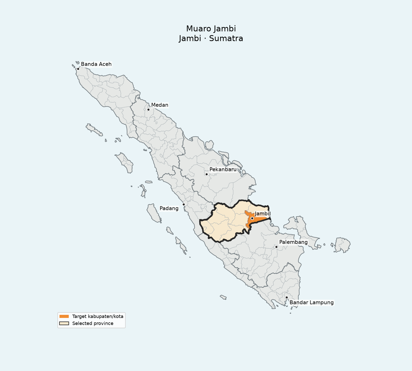
Indonesia
Front: Indonesia: Muaro Jambi
Back: Kabupaten Muaro Jambi — Jambi
Here, Jambi is the province, highlighted with a pale fill and bold outline.
Philippines
Front: Philippines: Camarines Sur
Back: Camarines Sur
Camarines Sur is highlighted in orange on a map of the whole Philippines.
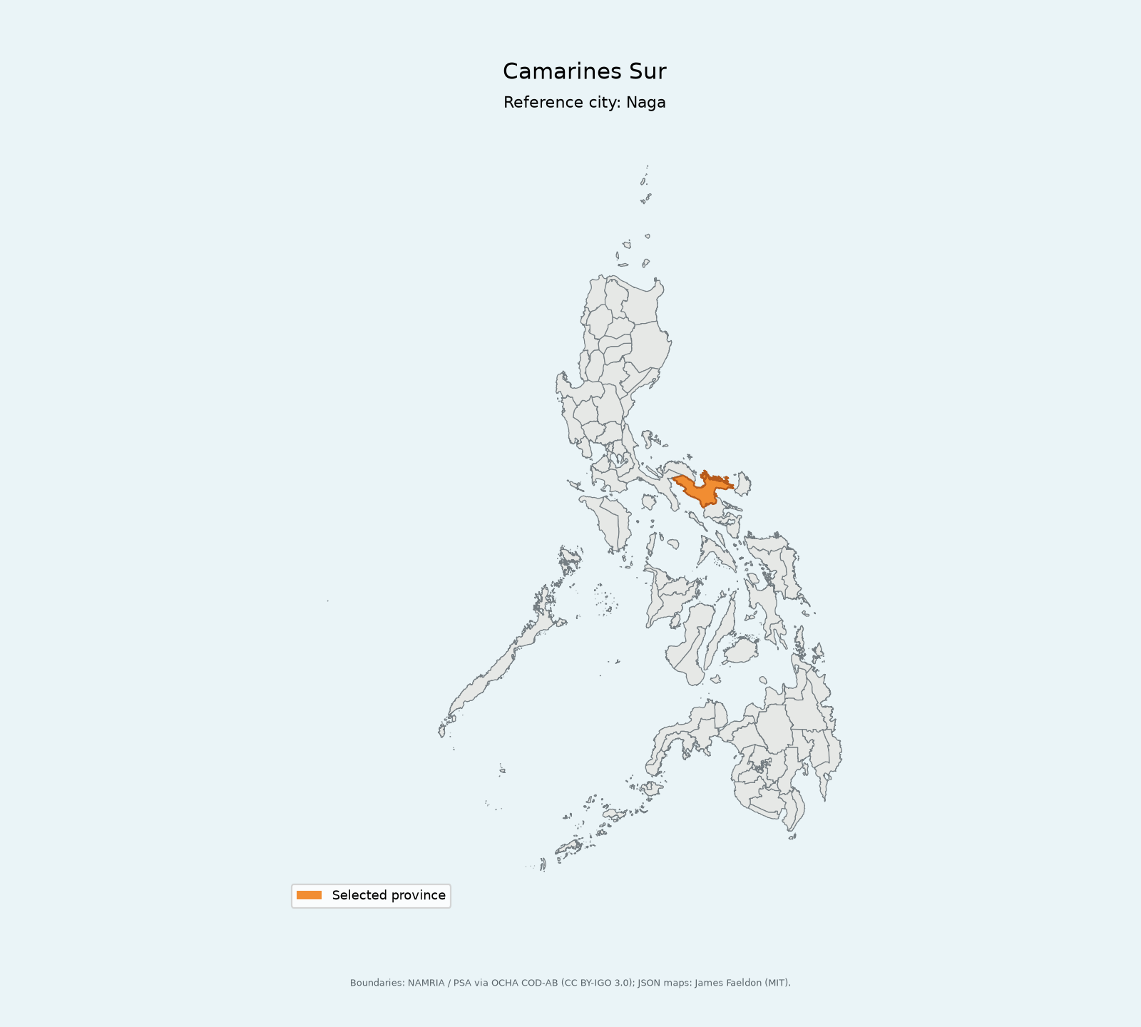
The map also names a reference city or town for the province.
Bangladesh
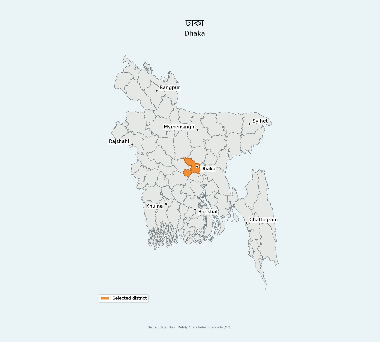
Front: Bangladesh: ঢাকা
Back: Dhaka
Dhaka district is highlighted in orange on a map of the whole country, with reference cities marked. Card fronts use the English country name followed by the Bengali district name; map titles show both Bengali and English names.
Germany
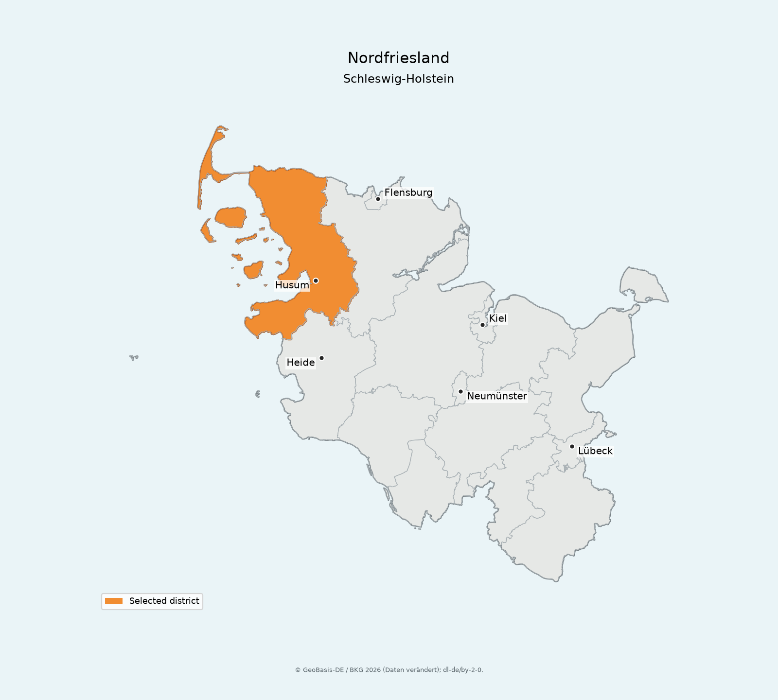
Front: Germany: Nordfriesland
Back: Kreis Nordfriesland — Schleswig-Holstein
The district is highlighted on a map of its entire Bundesland, with fixed reference cities for that state.
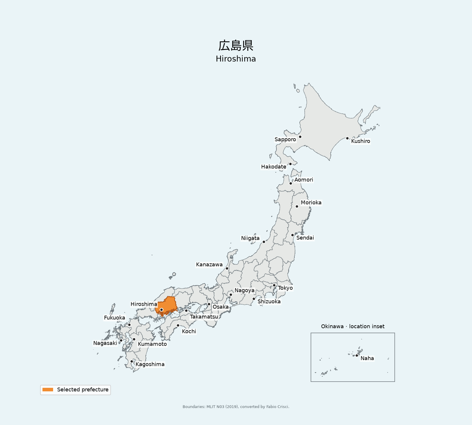
Japan
Front: Japan: 広島県
Back: Hiroshima
Hiroshima is highlighted on a map of Japan's main islands, with reference cities and Okinawa in a boxed inset. Remote southern and southeastern islands are omitted. Card fronts use Japanese prefecture names; map titles show Japanese and English.
📦 Installation
Requires Python 3.12+. Install the current release from PyPI:
pip install geo-anki
For development installation, see Development.
🃏 Usage
Generate a deck using the example Indonesia selection:
geo_anki \
  --country indonesia \
  --targets examples/indonesia.txt \
  --output outputs/indonesia.apkg
--targets accepts your own UTF-8 text file with one subdivision name per line.
For Indonesia, use kabupaten/kota names without a province. For example:
Kutai Kartanegara
Muaro Jambi
Each supported country has a sample selection of 10 subdivisions in examples/, with generated decks in examples/outputs/:
- Indonesia: example input · generated deck
- Philippines: example input · generated deck
- Bangladesh: example input · generated deck
- Germany: example input · generated deck
- Japan: example input · generated deck
Copy or edit an example input to choose your own subdivisions.
🧭 Build your own selection: targets/ contains the full lists, with the exact dataset spellings to copy into your target file.
- Indonesia: kabupaten/kota names
- Philippines: province names
- Bangladesh: district names
- Germany: district names
- Japan: prefecture names
We recommend using an AI chatbot of your choice to filter a list from
targets/ into the subset you want, for example, "only Java kabupaten
& kota". Save the resulting list as your --targets file.
Boundary data downloads automatically and is cached locally. Unknown or ambiguous
names raise an error. The command produces an .apkg to import into Anki, PNG
maps, and a JSON manifest. Run geo_anki --help for additional options.
For Bangladesh, target files accept either Bengali or English district names.
For Japan, target files accept English or Japanese prefecture names (including Japanese names without their suffix) and two-digit JIS codes. Card fronts use the Japanese name, while backs show its English name and a map with reference cities and a boxed Okinawa inset. Remote southern and southeastern islands are omitted. Map titles show both names.
For Germany, a shared name such as München selects the Landkreis;
München (kreisfreie Stadt) selects the separate city. Official five-digit
district codes (AGS) are also accepted.
📍 Data sources
Geo Anki's code is MIT-licensed; third-party data and fonts retain their own terms. See Third-party notices for source and license links, attribution, and outstanding source-license verification.
Indonesia boundaries come from Indonesia-Geojson-2026 (MIT; mashadinoor and ardian28). Coverage may be incomplete or outdated.
Philippines boundaries come from philippines-json-maps (PSGC 3Q 2026; MIT maps by James Faeldon), based on NAMRIA and PSA boundaries via OCHA COD-AB (CC BY-IGO 3.0).
Bangladesh district boundaries and bilingual names come from bangladesh-geocode (MIT; Nuhil Mehdy). Bengali text uses the bundled Noto Sans Bengali font (SIL Open Font License 1.1).
Germany uses BKG VG250 state and district boundaries (2026-01-01), converted to GeoJSON by Michael Kreil. © GeoBasis-DE / BKG 2026 (Daten verändert), licensed under Datenlizenz Deutschland – Namensnennung 2.0.
Japan prefecture boundaries come from MLIT National Land Numerical Information (N03, 2019-01-01), converted by Fabio Crisci in open-data-jp-prefectures-geojson (MIT conversion; MLIT source and terms). Japanese text uses a renamed subset of Noto Sans CJK JP, bundled under the SIL Open Font License 1.1.
💻 Development
Clone the repository and install its dependencies with uv:
git clone https://github.com/chrbrunk/geo-anki.git
cd geo-anki
uv sync --locked
From a repository checkout, use uv run geo_anki instead of geo_anki for
the commands in Usage.
After setup, install the Git hooks once per checkout:
uv run pre-commit install
Hooks check configuration files, merge conflicts, filename case conflicts,
debugger statements, whitespace, Ruff linting and formatting, and ty types.
Commit messages must follow Conventional Commits,
for example feat: add a country or fix: correct a map label.
To run all configured checks across the repository manually:
uv run pre-commit run --all-files
Tox tests the built wheel with independently resolved dependencies on Python
3.12–3.15 in CI, without using uv.lock. To run locally (requires those Python
versions), use uvx tox; for just Python 3.12, use uvx tox -e py312.
1 maintainer

Metadata
1 maintainer
Release files for geo-anki 0.2.0
For a detailed explanation of source distributions (sdists) and built distributions (wheels), please see the package formats documentation.
Built distribution (wheel)
| File | Interpreter | ABI | Platform | Actions Reset |
|---|---|---|---|---|
| geo_anki-0.2.0-py3-none-any.whl | Python 3 | none | any | Details for geo_anki-0.2.0-py3-none-any.whl |
Release files / geo_anki-0.2.0-py3-none-any.whl
| Download URL | geo_anki-0.2.0-py3-none-any.whl |
|---|---|
| Size | 189.0 kB |
| Tags | Python 3 |
|
SHA-256 checksum How to use checksums |
456f2b61bf7cf51815b0ac4a106443f60d85c99fe9a0a1e0efb35e2ff022f7ea
|
|
BLAKE2b-256 checksum How to use checksums |
25966adc258fabc4067c1034a12fb89be471cdbd6d31f75ddef9a4464d8d1ef9
|
| Upload date | |
|
Uploaded using Trusted Publishing? What is trusted publishing? |
No |
| Uploaded via |
uv/0.13.6 {"installer":{"name":"uv","version":"0.13.6","subcommand":["publish"]},"python":null,"implementation":{"name":null,"version":null},"distro":{"name":"Ubuntu","version":"26.04","id":"resolute","libc":null},"system":{"name":null,"release":null},"cpu":null,"openssl_version":null,"setuptools_version":null,"rustc_version":null,"ci":true}
|
Security for geo-anki 0.2.0
Provenance
Provenance describes where a file came from. On PyPI, provenance is shared via attestations, which provide a verifiable record of the build or publishing details. View details, limitations and caveats.
No provenance found
None of the files in this release were uploaded with provenance metadata.
A note on package security
PyPI is a repository for distributing packages, not a service for auditing them. While third-party security researchers and our staff do their best to detect and remove malicious packages, PyPI cannot guarantee the quality, security or suitability of any given package.
To learn more about protecting yourself from malicious actors, visit our package security documentation.














