📍 command-line tool for clustering geolocations.

Project description
geoclustering
📍 command-line tool for clustering geolocations.
Features
- Uses DBSCAN or OPTICS to perform clustering.
- Outputs clustering results as
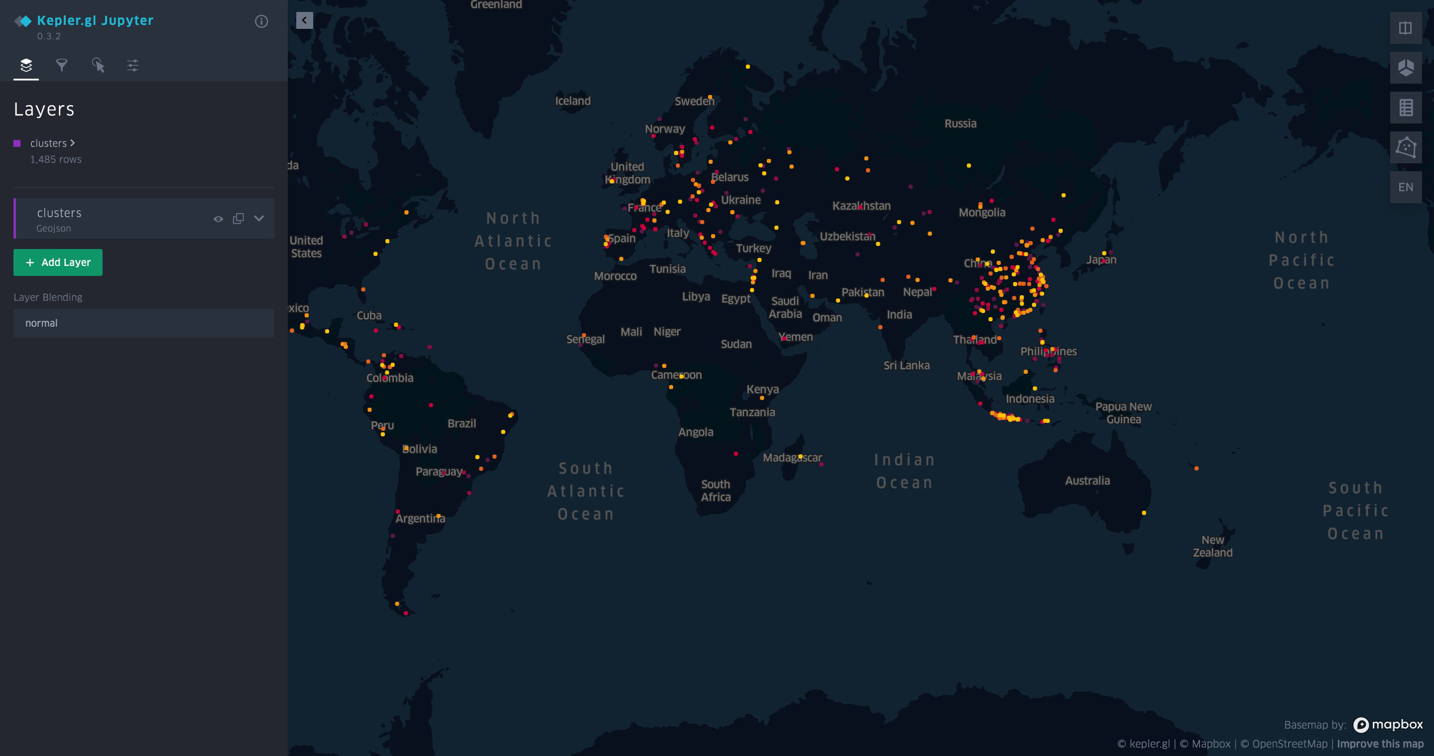
json,txtandgeojson. - Creates a kepler.gl visualization of clusters.
Clustering Method
A cluster is created when a certain number of points (defined with --size) each are within a given distance (defined with --distance) of at least one other point in the cluster.
Install
Install with uv:
# with kepler.gl visualization support
uv tool install 'geoclustering[full]'

# only text-based output
uv tool install geoclustering
If the full install fails, you might need to install kepler.gl build dependencies:
# macos
brew install proj gdal
Usage
Usage: geoclustering [OPTIONS] FILENAME

  Tool to cluster geolocations. A cluster is created when a certain number of
  points (defined with --size) each are within a given distance (defined with
  --distance) of at least one other point in the cluster. Input is supplied as
  a csv file. At a minimum, each row needs to have a 'lat' and a 'lon' column.
  Other rows are reflected to the output.

Options:
  -d, --distance FLOAT            (in km) Max. distance between two points in
                                  a cluster.  [required]
  -s, --size INTEGER              Min. number of points in a cluster.
                                  [required]
  -o, --output PATH               Output directory for results. Default:
                                  ./output
  -a, --algorithm [dbscan|optics]
                                  Clustering algorithm to be used. `optics`
                                  produces tighter clusters but is slower.
                                  Default: dbscan
  --open                          Open the generated visualization in the
                                  default browser automatically.
  --debug                         Print debug output.
  --help                          Show this message and exit.
Input
Inputs are supplied as a .csv file. At a minimum, each row needs to have a lat and a `lon`` column. Other rows are reflected to the output.
id,name,lat,lon
1,Bonnibelle Mathwen,40.1324085,64.4911086
...
Output
If at least one cluster was found, the tool outputs a folder with output as json, geojson, txt, csv files. A kepler.gl html file is generated as well.
JSON
Encodes an array of clusters, each containing an array of points.
[
  {
    "cluster_id": 0,
    "points": [
      {
        "id": 9,
        "name": "Rosanna Foggo",
        "lat": -6.2074293,
        "lon": 106.8915948
      }
    ]
  }
]
GeoJSON
Encodes a single FeatureCollection, containing all points as Feature objects.
{
  "type": "FeatureCollection",
  "features": [
    {
      "type": "Feature",
      "geometry": {
        "type": "Point",
        "coordinates": [
          106.891595,
          -6.207429
        ]
      },
      "properties": {
        "id": 9,
        "name": "Rosanna Foggo",
        "cluster_id": 0
      }
    }
  ]
}
Text
Encodes cluster as blocks separated by a newline, where each line in a cluster block contains one point.
Cluster 0
id 9, name Rosanna Foggo, lat -6.2074293, lon 106.8915948

// ...
CSV
Encodes each event in one line with cluster_id information associated.
cluster_id,name,lat,lon
9,Rosanna Foggo,-6.2074293,106.8915948
...
kepler.gl
Develop
It is assumed that you are using Python3.14+ and uv.
# install dependencies and dev tools
uv sync --group dev --extra full

# run tests
uv run pytest

# run the linter
uv run ruff check .

# install a git hook that runs the linter before each commit
uv run prek install
We use Ruff for linting.
Release
- Update
versionin pyproject.toml - Run
scripts/release.sh - Confirm GH action completed successfully
Release history Release notifications | RSS feed


Download files
Download the file for your platform. If you're not sure which to choose, learn more about installing packages.
Source Distribution
Built Distribution
Filter files by name, interpreter, ABI, and platform.
If you're not sure about the file name format, learn more about wheel file names.
Copy a direct link to the current filters
File details
Details for the file geoclustering-0.5.0.tar.gz.
File metadata
- Download URL: geoclustering-0.5.0.tar.gz
- Upload date:
- Size: 398.1 kB
- Tags: Source
- Uploaded using Trusted Publishing? No
- Uploaded via: twine/6.2.0 CPython/3.14.6
File hashes
| Algorithm | Hash digest | |
|---|---|---|
| SHA256 |
bf4e9103448575aff7059e9d9b711b5d6bc003579d5828873d4f9f03283539fc
|
|
| MD5 |
784f8232919a978c575aad5899c18fdb
|
|
| BLAKE2b-256 |
ffa2cf62e5ed187e756df60e099d38e12ebabf447c380aef18b2144d086936ec
|
File details
Details for the file geoclustering-0.5.0-py3-none-any.whl.
File metadata
- Download URL: geoclustering-0.5.0-py3-none-any.whl
- Upload date:
- Size: 9.8 kB
- Tags: Python 3
- Uploaded using Trusted Publishing? No
- Uploaded via: twine/6.2.0 CPython/3.14.6
File hashes
| Algorithm | Hash digest | |
|---|---|---|
| SHA256 |
aae681a142b331ce011dd8840745f47518c0f7eca68588c323906f6d269238e7
|
|
| MD5 |
ef190bcc46e3097ef30b2ce716dd4eda
|
|
| BLAKE2b-256 |
4d11edd22782bcb3a9372f81dd35ad2277e50ff6a3f2497b2f6c1fb958826573
|


