GeoDist Package
Project description
Geodist
Finds the distance between a POI (point of interest) and a geometric shape on Earth's surface
Objective
Find the distance between a point of interest and a geometric shape – polygon, circle, line string and a Point on earth’s surface using latitude and longitude associated with the geographic coordinate system
Install
pip install geodist
How Does It Work?
First, we convert an array of points (lng, lat) to a planar geometric object.
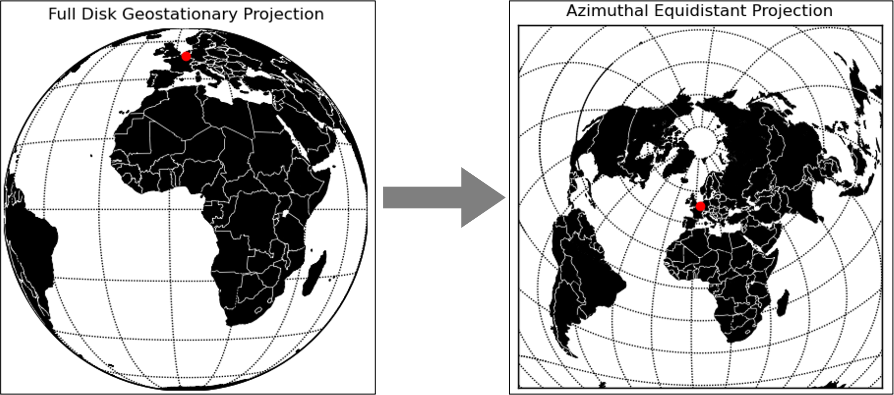
Then, we project the geometric object from the World Geodetic System (aka: WGS84) to the World Azimuthal Equidistant Projection (aka: ESRI:54032) with our POI as the center point of the projection.
The azimuthal equidistant projection is a map projection where all points on the map are at proportionally correct distances from the center.
Examples
Polygon
The distance between a polygon and a POI
>>> from geodist import GeoDist
>>> coords = [(4.3466824, 50.8584046), (4.3371552, 50.8490306), (4.3429917, 50.8336379), (4.3488282, 50.8330958),
...           (4.3658226, 50.8409013), (4.3695992, 50.8473506), (4.3679684, 50.8526612), (4.3466824, 50.8584046)]
...
>>> lng, lat = 4.3821081, 50.8133681
>>> GeoDist(coords).distance(lng, lat)
3153.3015428957347
Circle
The distance between circles and a POI
>>> from geodist import GeoDist
>>> coords = [(-77.120923, 39.056418)]
>>> lng, lat = -77.145146, 39.047193
>>> GeoDist(coords, radius=1000).distance(lng, lat)
1334.582257003439
>>> GeoDist(coords, radius=2000).distance(lng, lat)
335.7868006642301
>>> GeoDist(coords, radius=3000).distance(lng, lat)
663.0086557682768
Another feature of GeoDist can tell if the POI is inside or outside the shape:
>>> a = GeoDist(coords, radius=1000)
>>> distance = a.distance(lng, lat)
>>> a.within
False

>>> b = GeoDist(coords, radius=3000)
>>> distance = b.distance(lng, lat)
>>> b.within
True
Linestring
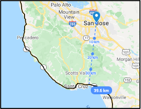
The distance between a Linestring and a POI
>>> from geodist import GeoDist
>>> coords = [(-121.77919, 36.24285), (-121.77939, 36.24317), (-121.77955, 36.24336), (-121.77967, 36.24347),
          (-121.77977, 36.24358), (-121.78, 36.24378), (-121.78033, 36.24409), (-121.78052, 36.24433),
..............]
>>> lng, lat = -121.88728, 37.33901
>>> GeoDist(coords).distance(lng, lat)
39603.30198998547
Project details
Download files
Download the file for your platform. If you're not sure which to choose, learn more about installing packages.


