
Stunning pre-designed map themes and styling templates for Matplotlib, Seaborn, and GeoPandas

Project description
GeoPlot-Themes 🌍🎨
Stunning pre-designed map themes, custom geographic colormaps, and cartographic templates for Matplotlib, Seaborn, and GeoPandas.




geoplot-themes bridges the gap between Python's data processing ecosystem (GeoPandas, Shapely, Pandas) and R's layout rendering engine (ggplot2, ggspatial, ggnewscale). Create publication-quality, aesthetically gorgeous maps instantly without spent hours tweaking grid lines, legend alignment, or north arrow coordinates.
🌟 Visual Showcase
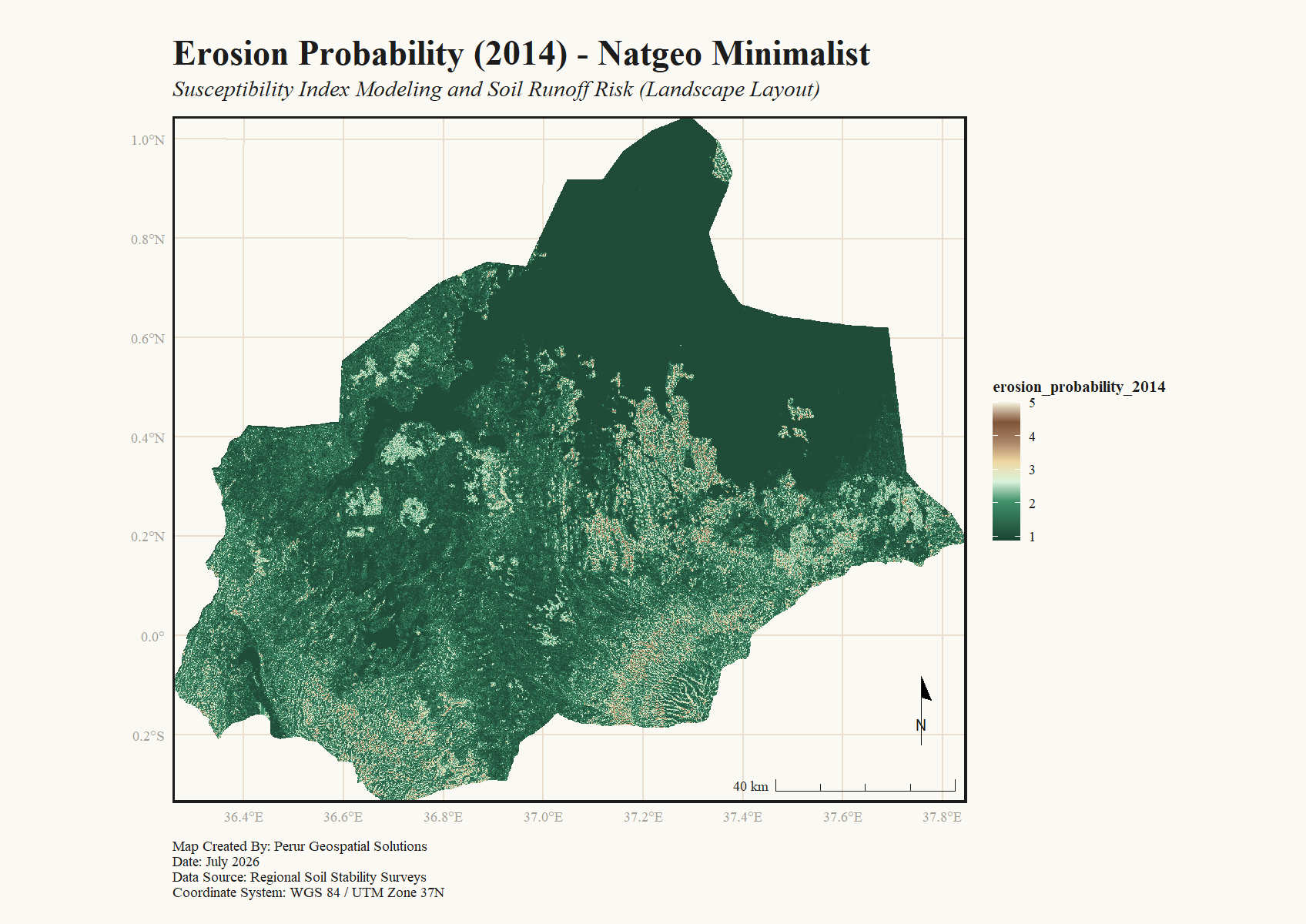
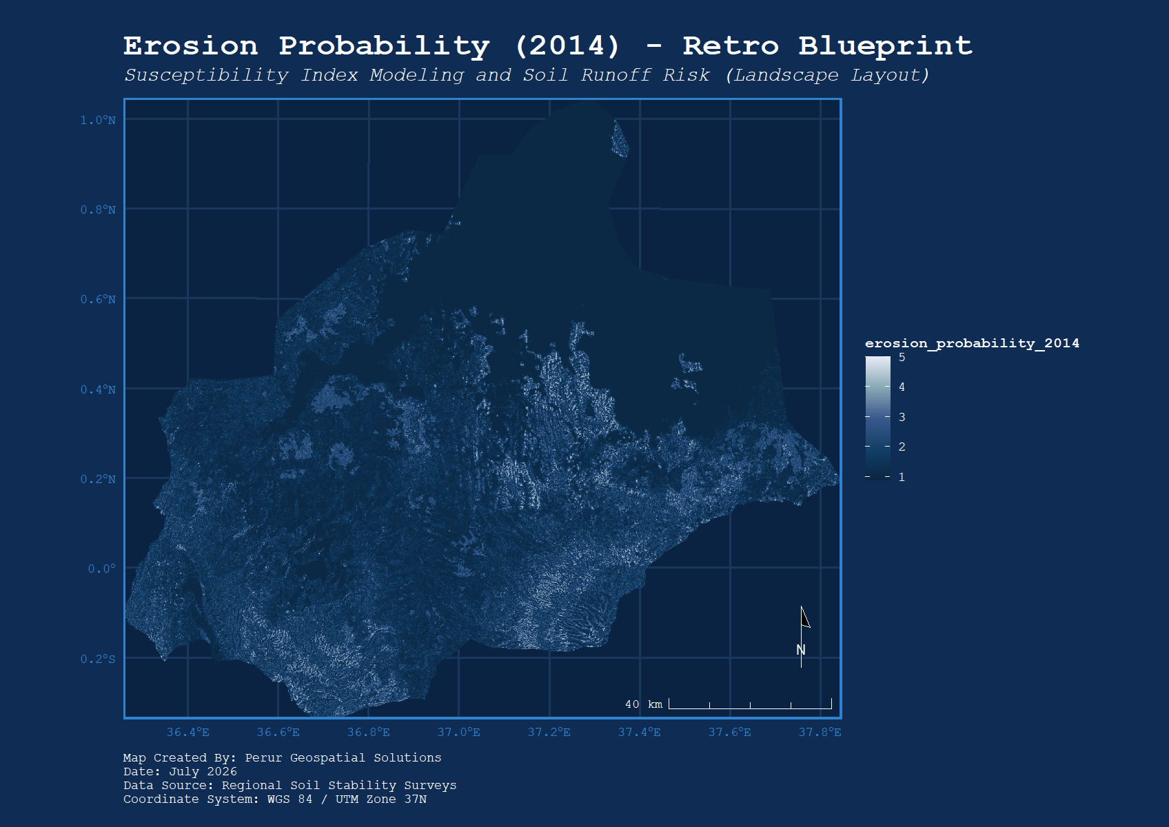
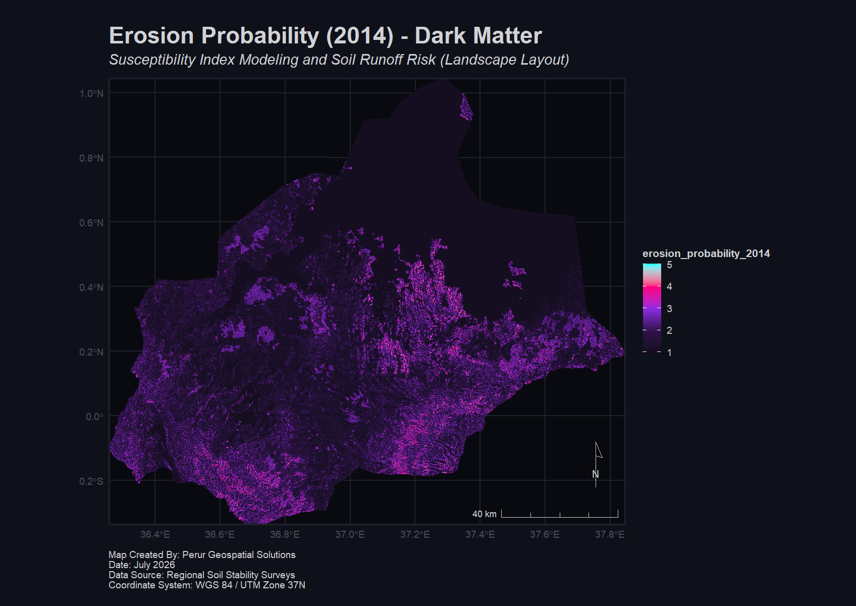
Handcrafted Cartographic Themes
natgeo_minimalist (Cream/Editorial) |
retro_blueprint (Classic Technical) |
dark_matter (Neon/Dark Mode) |
|---|---|---|
 |
 |
 |
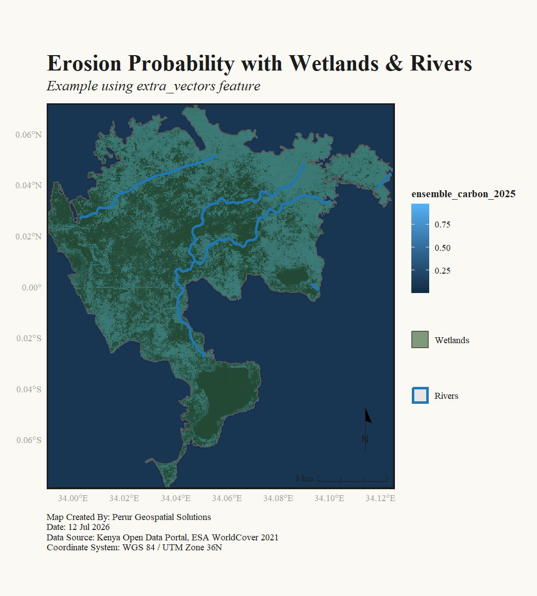
Complex Vector Overlays with Independent Legends
A base raster (elevation/erosion) layered with multiple separate vector shapefiles (wetlands and rivers), featuring automatically styled, independent, conflict-free scales:
🚀 Key Features
- Pre-designed Themes: Instantly switch visual aesthetics (
natgeo_minimalist,dark_matter,retro_blueprint) without altering your plotting code. - Geographic Colormaps: Built-in, science-backed palettes optimized for terrain (
elevation), oceanography (bathymetry), technical grids (blueprint), and digital screens (neon). - Conflict-Free Legends: Stack infinite shapefile layers (polygons, lines, points) with independent, color-coordinated legends.
- Auto-Orientation & Fit: Calculates data bounding boxes dynamically (
orientation="auto") to yield tightly cropped maps without margins or white padding. - Floating Inset Maps: Sub-coordinate map inserts that automatically render a global or country-level context and draw a reference box of your zoom location.
- Automatic Label Repulsion: Non-overlapping text labels powered by
ggrepelthat cleanly connect text back to point coordinates.
📦 Installation
To install geoplot-themes with uv (recommended):
uv add geoplot-themes
Or via standard pip:
pip install geoplot-themes
📚 Documentation
For full documentation, including Quickstart guides, API reference, and detailed Design reference, please visit our official website:
https://charles483.github.io/geoplot-themes/
🤝 Contributing & Support
Contributions are welcome! Please read the Contributing Guidelines and submit Pull Requests.
For questions, issues, or feedback, please contact us at info@perurgeospatial.com.
Created and maintained by Perur Geospatial Solutions.
Release history Release notifications | RSS feed

Download files
Download the file for your platform. If you're not sure which to choose, learn more about installing packages.
Source Distribution
Built Distribution
Filter files by name, interpreter, ABI, and platform.
If you're not sure about the file name format, learn more about wheel file names.
Copy a direct link to the current filters
File details
Details for the file geoplot_themes-0.1.4.tar.gz.
File metadata
- Download URL: geoplot_themes-0.1.4.tar.gz
- Upload date:
- Size: 6.9 MB
- Tags: Source
- Uploaded using Trusted Publishing? No
- Uploaded via: twine/6.2.0 CPython/3.14.6
File hashes
| Algorithm | Hash digest | |
|---|---|---|
| SHA256 |
573c3da96c90598a0d69b1fe25d7cb442316c6fdeaa34723346279ca09f2a670
|
|
| MD5 |
efc30156bb2dd20c86296b1a1c0912db
|
|
| BLAKE2b-256 |
a79741ca17b207e66ec0ab2b8427ea1e96f285b6931489607daca03ef5f83a37
|
File details
Details for the file geoplot_themes-0.1.4-py3-none-any.whl.
File metadata
- Download URL: geoplot_themes-0.1.4-py3-none-any.whl
- Upload date:
- Size: 1.2 MB
- Tags: Python 3
- Uploaded using Trusted Publishing? No
- Uploaded via: twine/6.2.0 CPython/3.14.6
File hashes
| Algorithm | Hash digest | |
|---|---|---|
| SHA256 |
e35c25ce556108d7be044c5989c154825eef4e176ec2c42959133d8516850981
|
|
| MD5 |
d7de4a543d0478e8a88d7b12090692ab
|
|
| BLAKE2b-256 |
e99b546be299d0a2fe0b8fd978cf6c5416824474622dc980644a3c2a2b2cde41
|






