Fast multi-threaded high-spatial, high-temporal interpolation

Project description
LADI
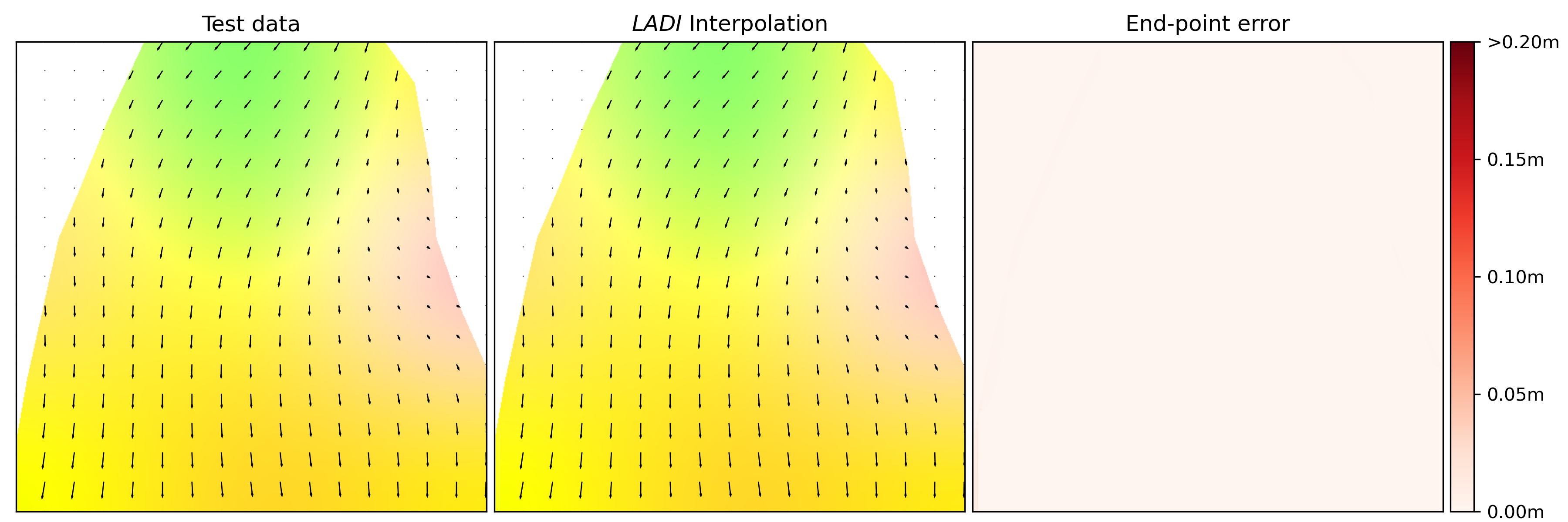
LADI: LAndslide Displacement Interpolation is a python library designed for performing high-spatial, high-temporal interpolation of landslide surface displacements. LADI is specifically useful for combining in-situ monitoring data with remote sensing geospatial data.
- Github repository: https://github.com/asenogles/ladi
- PyPI: https://pypi.org/project/ladi
Motivation
LADI was developed to serve as a method of combining high-spatial, low-temporal resolution data with low-spatial, high-temporal resolution data to produce a high-spatial, high-temporal interpolation. Specifically enabling the combination of high-spatial resolution landslide surface displacement data derived from remote-sensing sources (such as sequential lidar, photogrammetry, or InSAR) with high-temporal in-situ surface displacement data (such as in-place inclinometer, extensometer, or GNSS).
Installation
LADI has currently been tested on Linux and Microsoft Windows operating systems. It is recommended to install LADI within a virtual environment.
Install using pip
To install LADI from PyPI using pip:
pip install ladi
Install from source
To build LADI from source. Download this repository and run:
python3 setup.py build_ext --inplace
Note: You will need to have the required build dependencies installed.
Example
You can run the example on the provided test data:
python3 example.py
Release history Release notifications | RSS feed

Download files
Download the file for your platform. If you're not sure which to choose, learn more about installing packages.
Source Distribution
File details
Details for the file ladi-0.0.1.tar.gz.
File metadata
- Download URL: ladi-0.0.1.tar.gz
- Upload date:
- Size: 22.1 kB
- Tags: Source
- Uploaded using Trusted Publishing? No
- Uploaded via: twine/4.0.2 CPython/3.10.9
File hashes
| Algorithm | Hash digest | |
|---|---|---|
| SHA256 |
7cdd2d4162be827a92ab7df98bfc2f80678a4eb8cbe6075edf669a5ae2678323
|
|
| MD5 |
15889956639e75d5e55c3a67bd33c7c2
|
|
| BLAKE2b-256 |
b2821aa73d9ead44c369d06cb028003bcecaf70d594f5a0c40849b05b139a5a5
|


