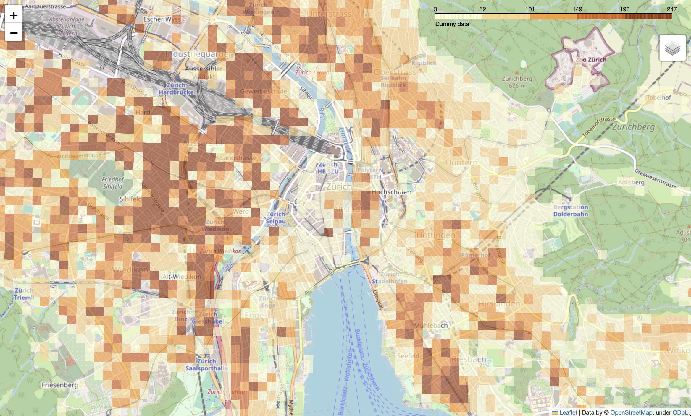
Interactive map with a choropleth displaying some statistics as color per hectare

Project description
Map with statistics


The package allows to display an interactive map with a choropleth displaying some statistics as color per hectare (100x100 meter square).
!!! question "What is the use-case?"
  The typical use-case would be to visualise and do plausibility checks of hectare-level data
  as well as to compare statistics between geographic areas.
The package is created and tested to work for the Switzerland coordinates, however, one could try to use it for any other map with hectare statistics.
Read about usage in Quick start guide


Download files
Download the file for your platform. If you're not sure which to choose, learn more about installing packages.
Source Distribution
Built Distribution
Filter files by name, interpreter, ABI, and platform.
If you're not sure about the file name format, learn more about wheel file names.
Copy a direct link to the current filters
File details
Details for the file map_with_stats-0.2.0.tar.gz.
File metadata
- Download URL: map_with_stats-0.2.0.tar.gz
- Upload date:
- Size: 1.0 MB
- Tags: Source
- Uploaded using Trusted Publishing? Yes
- Uploaded via: twine/5.0.0 CPython/3.12.3
File hashes
| Algorithm | Hash digest | |
|---|---|---|
| SHA256 |
f704240372da98419941207185cd45294f198b8757b93b01866fbc1fabc630bd
|
|
| MD5 |
1e1d595ee26e49778603437768a13e78
|
|
| BLAKE2b-256 |
00cc71ff130f5155419592322a2a085ba35217050581fd0ada36a903e0b418cb
|
File details
Details for the file map_with_stats-0.2.0-py3-none-any.whl.
File metadata
- Download URL: map_with_stats-0.2.0-py3-none-any.whl
- Upload date:
- Size: 9.4 kB
- Tags: Python 3
- Uploaded using Trusted Publishing? Yes
- Uploaded via: twine/5.0.0 CPython/3.12.3
File hashes
| Algorithm | Hash digest | |
|---|---|---|
| SHA256 |
4353da7bd7ff9e5a16c416e2ce5c70ab835f72e8b93f56320e29a6642987ba0c
|
|
| MD5 |
8c8be2072f3d54496d7a0d2d558e5441
|
|
| BLAKE2b-256 |
4e462ad52934bb3f81c013b634e31f7b9d9820ed83b0d302609384ccaf73b517
|


