Generate administrative boundaries from OpenStreetMap via Overpass

Project description
99boundaries


A simple command line utility to generate administrative boundaries from OpenStreetMap via Overpass and OSM Land Polygons.
Features
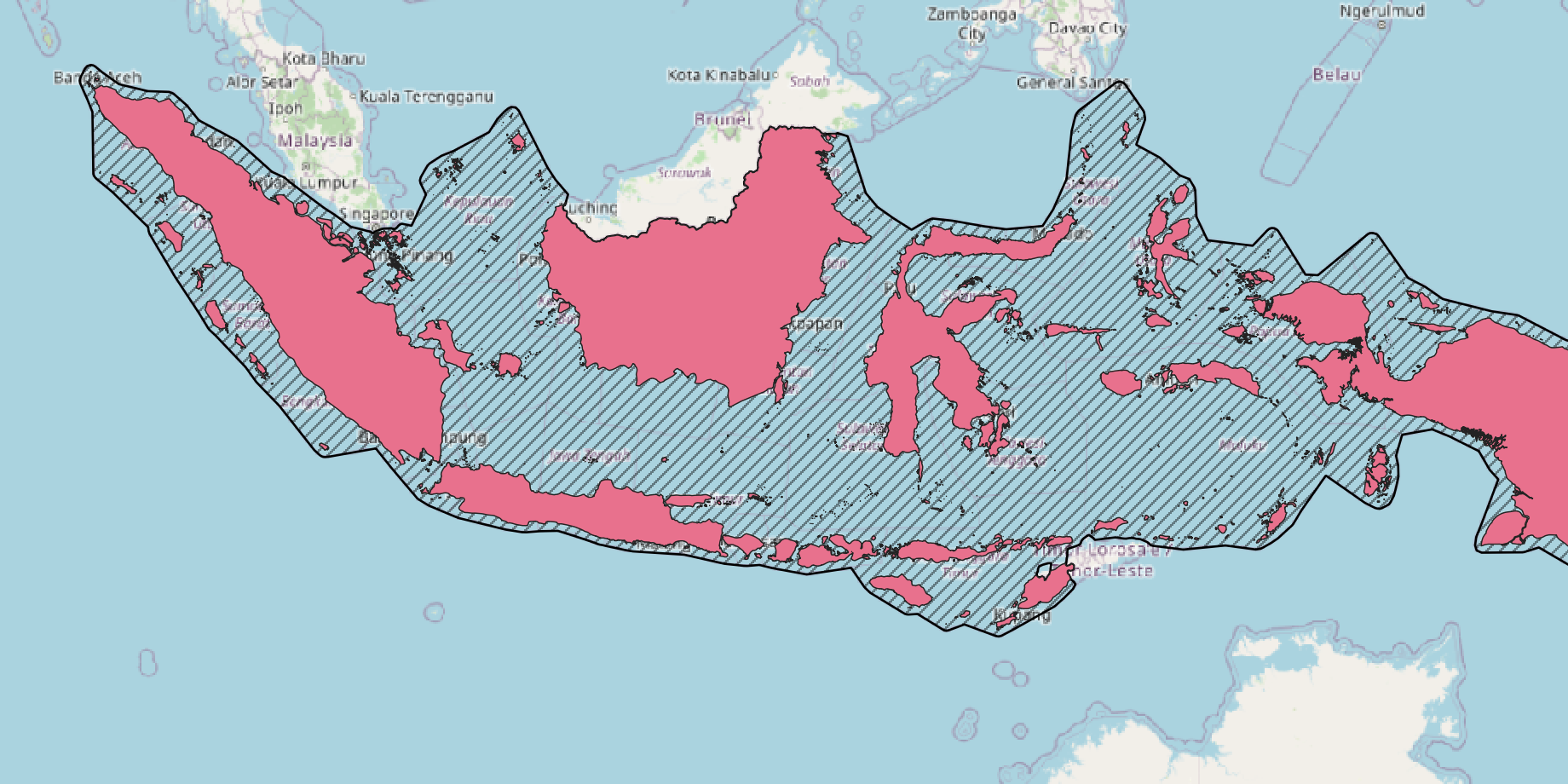
- Generate maritime and land boundaries for any country
- Multiple output formats: GeoJSON, ESRI Shapefile, GeoPackage, CSV (WKT), MapInfo, KML, FlatGeobuf, PostgreSQL dump
- Batch processing for multiple countries at once
- Uses OpenStreetMap data via Overpass API
- High-quality land boundary generation with OSM land polygons
Installation
For Users
Install via pip:
pip install nintynine-boundaries
For Development
Please make sure you have installed poetry locally. Then clone this repository and run poetry install from the root folder.
To activate the virtual environment:
eval $(poetry env activate)
Prerequisites
- Python 3.10 or higher
- GDAL/GEOS libraries (installed automatically with geopandas on most systems)
- Optional: OSM Land Polygons for generating land boundaries
- Download the WGS84 split variant (~600MB) for faster processing
- Unzip to a local directory and reference with
--land_data_dirflag
Usage & Examples
make_boundary --help
usage: make_boundary [-h] -a ALPHA2 [ALPHA2 ...] -f FORMATS [FORMATS ...] [-l ADMIN_LEVEL] [-d LAND_DATA_DIR]
                     [--debug] [--no-debug]

required arguments:
  -a ALPHA2 [ALPHA2 ...], --alpha2 ALPHA2 [ALPHA2 ...]
                        List of ISO-3166-1 alpha2 country codes, e.g. ES FR DE
  -f FORMATS [FORMATS ...], --formats FORMATS [FORMATS ...]
                        Output formats, one or multiple of shp, gpkg, csv, geojson, mapinfo, kml, fgb, pgdump

optional arguments:
  -l ADMIN_LEVEL, --admin_level ADMIN_LEVEL
                        OSM administrative level, currently only level 2 supported. Read more at
                        https://wiki.openstreetmap.org/wiki/Key:admin_level
  -d LAND_DATA_DIR, --land_data_dir LAND_DATA_DIR
                        Path to the OSM land data polygons folder, read more and download from
                        https://osmdata.openstreetmap.de/data/land-polygons.html
  --debug
  --no-debug
Depending on the selected country the processing time will vary. While the maritime boundaries will take a few seconds to be generated, the land boundaries will take longer due superior spatial detail. Land boundaries for countries with with greater coverage, e.g. the United States, Canada or France, can take up to 45 minutes to be generated and will require up to 8g of memory. The reasons are resource hungry geopandas overlay operations intersecting the maritime boundaries with the OSM land polygons dataset.
Generate the maritime boundary as GeoJSON for Australia:
make_boundary --alpha2 AU --formats geojson
Generate the maritime and land boundary as GeoJSON, GeoPackage and ESRI Shapefile for Spain:
make_boundary --alpha2 ES --formats geojson shp gpkg --land_data_dir /path/to/land-polygons-split-4326
Generate the maritime and land boundaries as CSV (geometry as WKT) for France and Canada:
make_boundary --alpha2 FR CA --formats csv --land_data_dir /path/to/land-polygons-split-4326
The file output formats can be ESRI Shapefile, GeoJSON, CSV, GeoPackage, MapInfo, KML, FlatGeobuf, or PostgreSQL dump and will be saved as archives into the data within this repository.
Output
Generated files are saved as ZIP archives in the data folder with the naming pattern:
{country_code}_admin_level_{level}_maritime.{format}.zip- Maritime boundaries only{country_code}_admin_level_{level}_land.{format}.zip- Land boundaries (if--land_data_diris provided)
Each archive contains the boundary data in the requested format with attributes including country code, name, and administrative level.
Known Limitations
- Currently only supports admin level 2 (country-level boundaries)
- Land boundary generation for countries with large territories (US, Canada, France, Russia) can take 30-45 minutes and require up to 8GB of memory
- Requires active internet connection to query Overpass API
Troubleshooting
Memory errors for large countries:
- The land boundary intersection process is memory-intensive for countries with extensive coastlines
- Consider processing one country at a time
- Ensure you have at least 8GB of available RAM
Missing GDAL/GEOS libraries:
- On Ubuntu/Debian:
sudo apt-get install gdal-bin libgdal-dev libgeos-dev - On macOS:
brew install gdal geos - On Windows: Install via conda or use OSGeo4W
Overpass API timeouts:
- The Overpass API may be slow or timeout for very large queries
- Try again later or use the
--debugflag to see detailed error messages
Contributing
Contributions are welcome! Please feel free to submit a Pull Request to the GitHub repository.
Future Work
The plan is to include further administrative levels for individual countries at a later stage.
License
This project is licensed under the MIT License - see the LICENSE file for details.


Download files
Download the file for your platform. If you're not sure which to choose, learn more about installing packages.
Source Distribution
Built Distribution
Filter files by name, interpreter, ABI, and platform.
If you're not sure about the file name format, learn more about wheel file names.
Copy a direct link to the current filters
File details
Details for the file nintynine_boundaries-0.1.1.tar.gz.
File metadata
- Download URL: nintynine_boundaries-0.1.1.tar.gz
- Upload date:
- Size: 11.1 kB
- Tags: Source
- Uploaded using Trusted Publishing? No
- Uploaded via: poetry/2.2.1 CPython/3.13.11 Linux/6.17.12-200.fc42.x86_64
File hashes
| Algorithm | Hash digest | |
|---|---|---|
| SHA256 |
fbb6c8aa688ee1518e684c8b0d7601a3da39a200ca01f9853d892ee5b8f79418
|
|
| MD5 |
94527c073373123a68adbac3a8d2310b
|
|
| BLAKE2b-256 |
d17c4519d14bc6152d9b4b3c69089e03cca0c863c4e3e47b6a8bda3cafb39ca3
|
File details
Details for the file nintynine_boundaries-0.1.1-py3-none-any.whl.
File metadata
- Download URL: nintynine_boundaries-0.1.1-py3-none-any.whl
- Upload date:
- Size: 11.1 kB
- Tags: Python 3
- Uploaded using Trusted Publishing? No
- Uploaded via: poetry/2.2.1 CPython/3.13.11 Linux/6.17.12-200.fc42.x86_64
File hashes
| Algorithm | Hash digest | |
|---|---|---|
| SHA256 |
3f7fed2eb0769c5bc7684ee41486c4b61fdd5e083a70e22c46ab9f0af5feeb26
|
|
| MD5 |
894bd12afbc60f148d6cd90029c531a5
|
|
| BLAKE2b-256 |
f9e4f0847ac46bc15dfdf25c6bd6b3d47be9957072b5ac4c1d5a6fe3172556e2
|


