🌍 IP Geolocator & Coordinate Mapping tool 📍

Project description
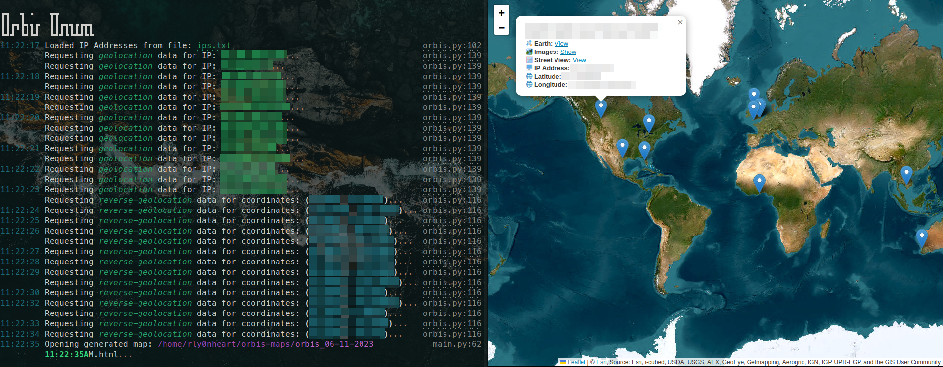
Orbis Unum is a cross-platform geolocation tool that transforms raw IP addresses and geographical coordinates into interactive visualizations on a map. With its intuitive interface, users can effortlessly navigate whether they're operating from the command line or using its web-based instance.


🔍 What Does Orbis Unum Offer?
Command-Line Interface
- Accepts either a standalone IP or a file loaded with multiple IP addresses.
- Generates an interactive OpenStreetMap with pinpoint accuracy for each IP's location.
On selecting any pin, you uncover:
- Vital IP/Coordinates metadata.
- Seamless links to:
- Google Earth for a top-down view or the location.
- Google Maps Street View for a closer look at the surroundings of the location.
- Google Image Search to view images of the location and its surroundings.
Web Interface
- Accepts individual or bulk pairs of coordinates.
- Mirrors the CLI's functionality, providing an immersive mapping experience.
Installation
Orbis Unum can be installed from PyPI with the following command
pip install orbis-unum
Usage
Orbis Command-Line Interface
orbis-cli <ip>
Orbis Web Interface
orbis-web


Download files
Download the file for your platform. If you're not sure which to choose, learn more about installing packages.
Source Distribution
orbis_unum-1.2.1.tar.gz
(10.8 kB
view hashes)
Built Distribution
orbis_unum-1.2.1-py3-none-any.whl
(12.4 kB
view hashes)
Close
Hashes for orbis_unum-1.2.1-py3-none-any.whl
| Algorithm | Hash digest | |
|---|---|---|
| SHA256 | 5083ea4d42a38278e0ae08b9694e0df0c4060263a8c66c4ebb6232ae55e0d2ad |
|
| MD5 | af29a6d31bf2c144662d49ea2b5458a3 |
|
| BLAKE2b-256 | 745103ad1e9ac70eb60ed74481c3157e4074602d4dc015b93f223ff035642f6c |


