Link your photos into a KML ("Google Earth") file based on their geolocation
Project description
photokml
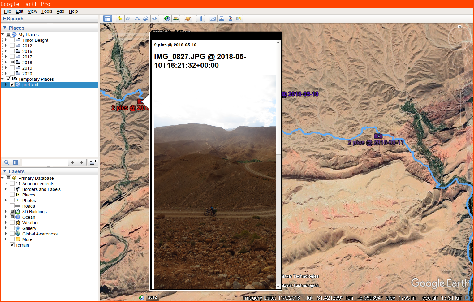
Generates a .kml geoindex of photographs based on GPS information in EXIF tags.
Run it on a bunch of photos, load up the .kml in Google Earth, and click the icons to view your pictures. Screenshot:
usage: photokml.py [-h] [-x MAXWIDTH] [-y MAXHEIGHT] [-b BUNCHUP]
                   FILE [FILE ...]

Generates a .kml geoindex (on stdout) of photographs based on GPS information
in EXIF tags.

positional arguments:
  FILE

optional arguments:
  -h, --help            show this help message and exit
  -x MAXWIDTH, --maxwidth MAXWIDTH
                        Limit picture display width to N pixels (1200 by
                        default)
  -y MAXHEIGHT, --maxheight MAXHEIGHT
                        Limit picture display height to N pixels (700 by
                        default)
  -b BUNCHUP, --bunchup BUNCHUP
                        Form clusters of pictures within N meters of eachother
                        (10 by default)
Project details
Release history Release notifications | RSS feed
Download files
Download the file for your platform. If you're not sure which to choose, learn more about installing packages.
Source Distribution
photokml-0.1.1rc1.tar.gz
(16.2 kB
view hashes)
Built Distribution
Close
Hashes for photokml-0.1.1rc1-py3-none-any.whl
| Algorithm | Hash digest | |
|---|---|---|
| SHA256 | 71ea62f3940567a1b71d618ebc4b79dc2182273ff75c3d913400aaaef9f8d460 |
|
| MD5 | d2bd0aebcd78cae34c8acbc5cd0efb4d |
|
| BLAKE2b-256 | 30f06c0fbe0421b18d795c38296a87af76e674572935031f9bf6440ad708c7fc |


