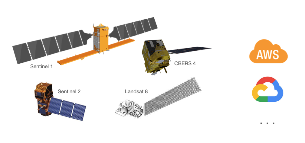
Get mercator tile from cloud hosted dataset such as CBERS-4, Sentinel-2, Sentinel-1 and Landsat-8 AWS PDS.

Project description
Rio-Tiler-PDS: A rio-tiler plugin for Public Datasets
A rio-tiler plugin to read from publicly-available datasets.


Important This is the new module for rio-tiler missions specific (ref: https://github.com/cogeotiff/rio-tiler/issues/195)
Documentation: https://cogeotiff.github.io/rio-tiler-pds/
Source Code: https://github.com/cogeotiff/rio-tiler-pds
Installation
You can install rio-tiler-pds using pip
$ pip install -U pip
$ pip install rio-tiler-pds
or install from source:
$ pip install -U pip
$ pip install git+https://github.com/cogeotiff/rio-tiler-pds.git
Datasets
| Data | Level/Product | Format | Owner | Region | Bucket Type |
|---|---|---|---|---|---|
| Sentinel 2 | L1C | JPEG2000 | Sinergise / AWS | eu-central-1 | Requester-pays |
| Sentinel 2 | L2A | JPEG2000 | Sinergise / AWS | eu-central-1 | Requester-pays |
| Sentinel 2 | L2A | COG | Digital Earth Africa / AWS | us-west-2 | Public |
| Sentinel 1 | L1C GRD (IW, EW, S1-6) | COG (Internal GCPS) | Sinergise / AWS | eu-central-1 | Requester-pays |
| Landsat Collection 2 | L1,L2 | COG | USGS / AWS | us-west-2 | Requester-pays |
| CBERS 4/4A | L2/L4 | COG | AMS Kepler / AWS | us-east-1 | Requester-pays |
| MODIS (modis-pds) | MCD43A4, MOD09GQ, MYD09GQ, MOD09GA, MYD09GA | GTiff (External Overviews) | - | us-west-2 | Public |
| MODIS (astraea-opendata) | MCD43A4, MOD11A1, MOD13A1, MYD11A1 MYD13A1 | COG | Astraea / AWS | us-west-2 | Requester-pays |
| Copernicus Digital Elevation Model | GLO-30, GLO-90 | COG | Sinergise / AWS | eu-central-1 | Public |
Adding more dataset:
If you know of another publicly-available dataset that can easily be described with a "scene id", please feel free to open an issue.
Warnings
Requester-pays Buckets
On AWS, sentinel2, sentinel1, cbers and modis (in astraea-opendata) datasets are stored in requester
pays
buckets. This means that the cost of GET and LIST requests and egress fees for
downloading files outside the AWS region will be charged to the accessing
users, not the organization hosting the bucket. For rio-tiler and
rio-tiler-pds to work with such buckets, you'll need to set
AWS_REQUEST_PAYER="requester" in your shell environment.
Partial reading on Cloud hosted dataset
When reading data, rio-tiler-pds performs partial reads when possible. Hence
performance will be best on data stored as Cloud Optimized GeoTIFF
(COG). It's important to note that Sentinel-2 scenes hosted
on AWS are not in Cloud Optimized format but in JPEG2000. Partial reads from
JPEG2000 files are inefficient, and GDAL (the library underlying rio-tiler-pds
and rasterio) will need to make many GET requests and transfer a lot of
data. This will be both slow and expensive, since AWS's JPEG2000 collection of
Sentinel 2 data is stored in a requester pays bucket.
Ref: Do you really want people using your data blog post.
Overview
Readers
Each dataset has its own submodule (e.g sentinel2: rio_tiler_pds.sentinel.aws)
from rio_tiler_pds.landsat.aws import LandsatC2Reader
from rio_tiler_pds.sentinel.aws import S1L1CReader
from rio_tiler_pds.sentinel.aws import (
    S2JP2Reader,  # JPEG2000
    S2COGReader,   # COG
)

from rio_tiler_pds.cbers.aws import CBERSReader
from rio_tiler_pds.modis.aws import MODISPDSReader, MODISASTRAEAReader
from rio_tiler_pds.copernicus.aws import Dem30Reader, Dem90Reader
All Readers are subclass of rio_tiler.io.BaseReader and inherit its properties/methods.
Properties
- bounds: Scene bounding box
- crs: CRS of the bounding box
- geographic_bounds: bounding box in geographic projection (e.g WGS84)
- minzoom: WebMercator MinZoom (e.g 7 for Landsat 8)
- maxzoom: WebMercator MaxZoom (e.g 12 for Landsat 8)
Methods
- info: Returns band's simple info (e.g nodata, band_descriptions, ....)
- statistics: Returns band's statistics (percentile, histogram, ...)
- tile: Read web mercator map tile from bands
- part: Extract part of bands
- preview: Returns a low resolution preview from bands
- point: Returns band's pixel value for a given lon,lat
- feature: Extract part of bands
Other
- bands (property): List of available bands for each dataset
Scene ID
All readers take scene id as main input. The scene id is used internaly by the reader to derive the full path of the data.
e.g: Landsat on AWS
Because the Landsat AWS PDS follows a regular schema to store the data (s3://{bucket}/c1/L8/{path}/{row}/{scene}/{scene}_{band}.TIF"), we can easily reconstruct the full band's path by parsing the scene id.
from rio_tiler_pds.landsat.aws import LandsatC2Reader
from rio_tiler_pds.landsat.utils import sceneid_parser

sceneid_parser("LC08_L2SP_001062_20201031_20201106_02_T2")

> {'sensor': 'C',
 'satellite': '08',
 'processingCorrectionLevel': 'L2SP',
 'path': '001',
 'row': '062',
 'acquisitionYear': '2020',
 'acquisitionMonth': '10',
 'acquisitionDay': '31',
 'processingYear': '2020',
 'processingMonth': '11',
 'processingDay': '06',
 'collectionNumber': '02',
 'collectionCategory': 'T2',
 'scene': 'LC08_L2SP_001062_20201031_20201106_02_T2',
 'date': '2020-10-31',
 '_processingLevelNum': '2',
 'category': 'standard',
 'sensor_name': 'oli-tirs',
 '_sensor_s3_prefix': 'oli-tirs',
 'bands': ('QA_PIXEL',
  'QA_RADSAT',
  'SR_B1',
  'SR_B2',
  'SR_B3',
  'SR_B4',
  'SR_B5',
  'SR_B6',
  'SR_B7',
  'SR_QA_AEROSOL',
  'ST_ATRAN',
  'ST_B10',
  'ST_CDIST',
  'ST_DRAD',
  'ST_EMIS',
  'ST_EMSD',
  'ST_QA',
  'ST_TRAD',
  'ST_URAD')}

with LandsatC2Reader("LC08_L2SP_001062_20201031_20201106_02_T2") as landsat:
    print(landsat._get_band_url("SR_B2"))

> s3://usgs-landsat/collection02/level-2/standard/oli-tirs/2020/001/062/LC08_L2SP_001062_20201031_20201106_02_T2/LC08_L2SP_001062_20201031_20201106_02_T2_SR_B2.TIF
Each dataset has a specific scene id format:
!!! note "Scene ID formats"
- Landsat
    - link: [rio_tiler_pds.landsat.utils.sceneid_parser](https://github.com/cogeotiff/rio-tiler-pds/blob/e4421d3cf7c23b7b3552b8bb16ee5913a5483caf/rio_tiler_pds/landsat/utils.py#L35-L56)
    - regex: `^L[COTEM]0[0-9]_L\d{1}[A-Z]{2}_\d{6}_\d{8}_\d{8}_\d{2}_(T1|T2|RT)$`
    - example: `LC08_L1TP_016037_20170813_20170814_01_RT`

- Sentinel 1 L1C
    - link: [rio_tiler_pds.sentinel.utils.s1_sceneid_parser](https://github.com/cogeotiff/rio-tiler-pds/blob/e4421d3cf7c23b7b3552b8bb16ee5913a5483caf/rio_tiler_pds/sentinel/utils.py#L98-L121)
    - regex: `^S1[AB]_(IW|EW)_[A-Z]{3}[FHM]_[0-9][SA][A-Z]{2}_[0-9]{8}T[0-9]{6}_[0-9]{8}T[0-9]{6}_[0-9A-Z]{6}_[0-9A-Z]{6}_[0-9A-Z]{4}$`
    - example: `S1A_IW_GRDH_1SDV_20180716T004042_20180716T004107_022812_02792A_FD5B`

- Sentinel 2 JPEG2000 and Sentinel 2 COG
    - link: [rio_tiler_pds.sentinel.utils.s2_sceneid_parser](https://github.com/cogeotiff/rio-tiler-pds/blob/e4421d3cf7c23b7b3552b8bb16ee5913a5483caf/rio_tiler_pds/sentinel/utils.py#L25-L60)
    - regex: `^S2[AB]_[0-9]{2}[A-Z]{3}_[0-9]{8}_[0-9]_L[0-2][A-C]$` or `^S2[AB]_L[0-2][A-C]_[0-9]{8}_[0-9]{2}[A-Z]{3}_[0-9]$`
    - example: `S2A_29RKH_20200219_0_L2A`, `S2A_L1C_20170729_19UDP_0`, `S2A_L2A_20170729_19UDP_0`

- CBERS
    - link: [rio_tiler_pds.cbers.utils.sceneid_parser](https://github.com/cogeotiff/rio-tiler-pds/blob/e4421d3cf7c23b7b3552b8bb16ee5913a5483caf/rio_tiler_pds/cbers/utils.py#L28-L43)
    - regex: `^CBERS_(4|4A)_\w+_[0-9]{8}_[0-9]{3}_[0-9]{3}_L\w+$`
    - example: `CBERS_4_MUX_20171121_057_094_L2`, `CBERS_4_AWFI_20170420_146_129_L2`, `CBERS_4_PAN10M_20170427_161_109_L4`, `CBERS_4_PAN5M_20170425_153_114_L4`, `CBERS_4A_WPM_20200730_209_139_L4`

- MODIS (PDS and Astraea)
    - link: [rio_tiler_pds.modis.utils.sceneid_parser](https://github.com/cogeotiff/rio-tiler-pds/blob/c533d38330f46738c46cb9927dbe91b299dc643d/rio_tiler_pds/modis/utils.py#L29-L42)
    - regex: `^M[COY]D[0-9]{2}[A-Z0-9]{2}\.A[0-9]{4}[0-9]{3}\.h[0-9]{2}v[0-9]{2}\.[0-9]{3}\.[0-9]{13}$`
    - example: `MCD43A4.A2017006.h21v11.006.2017018074804`
Band Per Asset/File
rio-tiler-pds Readers assume that bands (e.g eo:band in STAC) are stored in separate files.
$ aws s3 ls s3://usgs-landsat/collection02/level-2/standard/oli-tirs/2020/001/062/LC08_L2SP_001062_20201031_20201106_02_T2/ --request-payer
LC08_L2SP_001062_20201031_20201106_02_T2_ANG.txt
LC08_L2SP_001062_20201031_20201106_02_T2_MTL.json
LC08_L2SP_001062_20201031_20201106_02_T2_MTL.txt
LC08_L2SP_001062_20201031_20201106_02_T2_MTL.xml
LC08_L2SP_001062_20201031_20201106_02_T2_QA_PIXEL.TIF
LC08_L2SP_001062_20201031_20201106_02_T2_QA_RADSAT.TIF
LC08_L2SP_001062_20201031_20201106_02_T2_SR_B1.TIF
LC08_L2SP_001062_20201031_20201106_02_T2_SR_B2.TIF
LC08_L2SP_001062_20201031_20201106_02_T2_SR_B3.TIF
LC08_L2SP_001062_20201031_20201106_02_T2_SR_B4.TIF
LC08_L2SP_001062_20201031_20201106_02_T2_SR_B5.TIF
LC08_L2SP_001062_20201031_20201106_02_T2_SR_B6.TIF
LC08_L2SP_001062_20201031_20201106_02_T2_SR_B7.TIF
LC08_L2SP_001062_20201031_20201106_02_T2_SR_QA_AEROSOL.TIF
LC08_L2SP_001062_20201031_20201106_02_T2_SR_stac.json
LC08_L2SP_001062_20201031_20201106_02_T2_ST_ATRAN.TIF
LC08_L2SP_001062_20201031_20201106_02_T2_ST_B10.TIF
LC08_L2SP_001062_20201031_20201106_02_T2_ST_CDIST.TIF
LC08_L2SP_001062_20201031_20201106_02_T2_ST_DRAD.TIF
LC08_L2SP_001062_20201031_20201106_02_T2_ST_EMIS.TIF
LC08_L2SP_001062_20201031_20201106_02_T2_ST_EMSD.TIF
LC08_L2SP_001062_20201031_20201106_02_T2_ST_QA.TIF
LC08_L2SP_001062_20201031_20201106_02_T2_ST_TRAD.TIF
LC08_L2SP_001062_20201031_20201106_02_T2_ST_URAD.TIF
LC08_L2SP_001062_20201031_20201106_02_T2_ST_stac.json
LC08_L2SP_001062_20201031_20201106_02_T2_thumb_large.jpeg
LC08_L2SP_001062_20201031_20201106_02_T2_thumb_small.jpeg
When reading data or metadata, readers will merge them.
e.g
with S2COGReader("S2A_L2A_20170729_19UDP_0") as sentinel:
    img = sentinel.tile(78, 89, 8, bands=("B01", "B02"))
    assert img.data.shape == (2, 256, 256)

    stats = sentinel.statistics(bands=("B01", "B02"))
    print(stats)
    >> {
      'B01': BandStatistics(
        min=2.0,
        max=17132.0,
        mean=2183.7570706659685,
        count=651247.0,
        sum=1422165241.0,
        std=3474.123975478363,
        median=370.0,
        majority=238.0,
        minority=2.0,
        unique=15112.0,
        histogram=[
          [476342.0, 35760.0, 27525.0, 24852.0, 24379.0, 23792.0, 20891.0, 13602.0, 3891.0, 213.0],
          [2.0, 1715.0, 3428.0, 5141.0, 6854.0, 8567.0, 10280.0, 11993.0, 13706.0, 15419.0, 17132.0]
        ],
        valid_percent=62.11,
        masked_pixels=397329.0,
        valid_pixels=651247.0,
        percentile_2=179.0,
        percentile_98=12465.0
      ),
      'B02': BandStatistics(
        min=1.0,
        max=15749.0,
        mean=1941.2052554560712,
        count=651247.0,
        sum=1264204099.0,
        std=3130.545395156859,
        median=329.0,
        majority=206.0,
        minority=11946.0,
        unique=13904.0,
        histogram=[
          [479174.0, 34919.0, 27649.0, 25126.0, 24913.0, 24119.0, 20223.0, 12097.0, 2872.0, 155.0],
          [1.0, 1575.8, 3150.6, 4725.4, 6300.2, 7875.0, 9449.8, 11024.6, 12599.4, 14174.199999999999, 15749.0]
        ],
        valid_percent=62.11,
        masked_pixels=397329.0,
        valid_pixels=651247.0,
        percentile_2=134.0,
        percentile_98=11227.079999999958
      )}

      print(stats["B01"].min)
      >> 2.0
Mosaic Reader: Copernicus DEM
The Copernicus DEM GLO-30 and GLO-90 readers are not per scene but mosaic readers. This is possible because the dataset is a global dataset with file names having the geo-location of the COG, meaning we can easily contruct a filepath from a coordinate.
from rio_tiler_pds.copernicus.aws import Dem30Reader

with Dem30Reader() as dem:
    print(dem.assets_for_point(-57.2, -11.2))

>> ['s3://copernicus-dem-30m/Copernicus_DSM_COG_10_S12_00_W058_00_DEM/Copernicus_DSM_COG_10_S12_00_W058_00_DEM.tif']
Changes
See CHANGES.md.
Contribution & Development
See CONTRIBUTING.md
License
See LICENSE.txt
Authors
The rio-tiler project was begun at Mapbox and has been transferred in January 2019.
See AUTHORS.txt for a listing of individual contributors.
Release history Release notifications | RSS feed


Download files
Download the file for your platform. If you're not sure which to choose, learn more about installing packages.
Source Distribution
Built Distribution
Filter files by name, interpreter, ABI, and platform.
If you're not sure about the file name format, learn more about wheel file names.
Copy a direct link to the current filters
File details
Details for the file rio_tiler_pds-0.11.1.tar.gz.
File metadata
- Download URL: rio_tiler_pds-0.11.1.tar.gz
- Upload date:
- Size: 33.8 kB
- Tags: Source
- Uploaded using Trusted Publishing? No
- Uploaded via: python-requests/2.32.3
File hashes
| Algorithm | Hash digest | |
|---|---|---|
| SHA256 |
a30de394a299a057c7998e76401971963116751ff115abafe11c6811794c43f7
|
|
| MD5 |
52fd2de6162b195e959f566dc69f6180
|
|
| BLAKE2b-256 |
a1ccbc836521aa4c747087ed6fc0a72f3c713addb6ad2b3463b6085b72afa46a
|
File details
Details for the file rio_tiler_pds-0.11.1-py3-none-any.whl.
File metadata
- Download URL: rio_tiler_pds-0.11.1-py3-none-any.whl
- Upload date:
- Size: 34.8 kB
- Tags: Python 3
- Uploaded using Trusted Publishing? No
- Uploaded via: python-requests/2.32.3
File hashes
| Algorithm | Hash digest | |
|---|---|---|
| SHA256 |
5489531624cbac106c4888ee6dc4494bbc83e06a81cdfab179117f129c857352
|
|
| MD5 |
e7b6fa5fd6378affb5702045fded7d33
|
|
| BLAKE2b-256 |
f8159635a79ce17231b09c4754d5691f685dc7f4bd3458b76a125c99403c7e5d
|


