
segment-geospatial





A Python package for segmenting geospatial data with the Segment Anything Model (SAM)
The segment-geospatial package draws its inspiration from segment-anything-eo repository authored by Aliaksandr Hancharenka. To facilitate the use of the Segment Anything Model (SAM) for geospatial data, I have developed the segment-anything-py and segment-geospatial Python packages, which are now available on PyPI and conda-forge. My primary objective is to simplify the process of leveraging SAM for geospatial data analysis by enabling users to achieve this with minimal coding effort. I have adapted the source code of segment-geospatial from the segment-anything-eo repository, and credit for its original version goes to Aliaksandr Hancharenka.
- Free software: MIT license
- Documentation: https://samgeo.gishub.org
Features
- Download map tiles from Tile Map Service (TMS) servers and create GeoTIFF files
- Segment GeoTIFF files using the Segment Anything Model (SAM)
- Save segmentation results as common vector formats (GeoPackage, Shapefile, GeoJSON, etc.)
- Visualize segmentation results on interactive maps
Examples
Demos
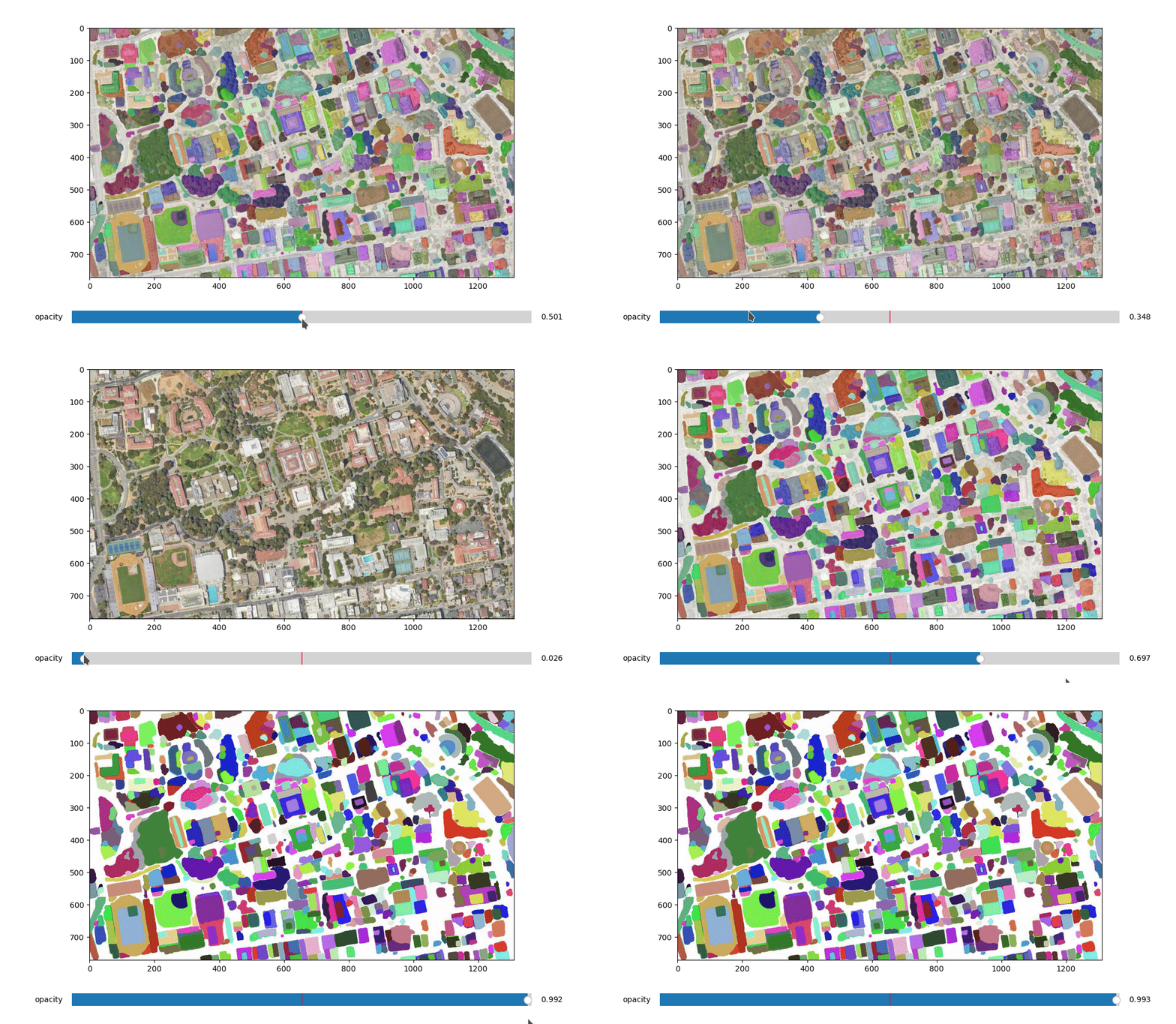
- Automatic mask generator
Acknowledgements
This package was made possible by the following open source projects. Credit goes to the developers of these projects.
1 maintainer

Metadata
1 maintainer
Release files for segment-geospatial 0.4.0
For a detailed explanation of source distributions (sdists) and built distributions (wheels), please see the package formats documentation.
Source distribution (sdist)
| File | Size | Uploaded | |
|---|---|---|---|
| segment-geospatial-0.4.0.tar.gz | 19.6 kB | Details |
Built distribution (wheel)
| File | Interpreter | ABI | Platform | Reset |
|---|---|---|---|---|
| segment_geospatial-0.4.0-py2.py3-none-any.whl | Python 2, Python 3 | none | any | Details |
Total release size: 38.9 kB
Release files / segment-geospatial-0.4.0.tar.gz
| Download URL | segment-geospatial-0.4.0.tar.gz |
|---|---|
| Size | 19.6 kB |
| Tags | Source |
|
SHA-256 checksum How to use checksums |
2ce499b2193e213fc9fe81a75a89d47d6857425729d85a979403b02e94d35d79
|
|
BLAKE2b-256 checksum How to use checksums |
2457efad5d3926626160247a10b5df7ea2d85fd6c9abf1a4c24362a8ddf248de
|
| Upload date | |
|
Uploaded using Trusted Publishing? What is trusted publishing? |
No |
| Uploaded via |
twine/4.0.2 CPython/3.11.3
|
Release files / segment_geospatial-0.4.0-py2.py3-none-any.whl
| Download URL | segment_geospatial-0.4.0-py2.py3-none-any.whl |
|---|---|
| Size | 19.2 kB |
| Tags | Python 2 Python 3 |
|
SHA-256 checksum How to use checksums |
fb07b43242233e20728feea80ba20338f44cc6f996d3830ffd01a6862596794a
|
|
BLAKE2b-256 checksum How to use checksums |
a29122e9d7fcbd219261dd0094959cea503baa808bb30bcea44fbbe98e9a0afa
|
| Upload date | |
|
Uploaded using Trusted Publishing? What is trusted publishing? |
No |
| Uploaded via |
twine/4.0.2 CPython/3.11.3
|














