
topo-tools




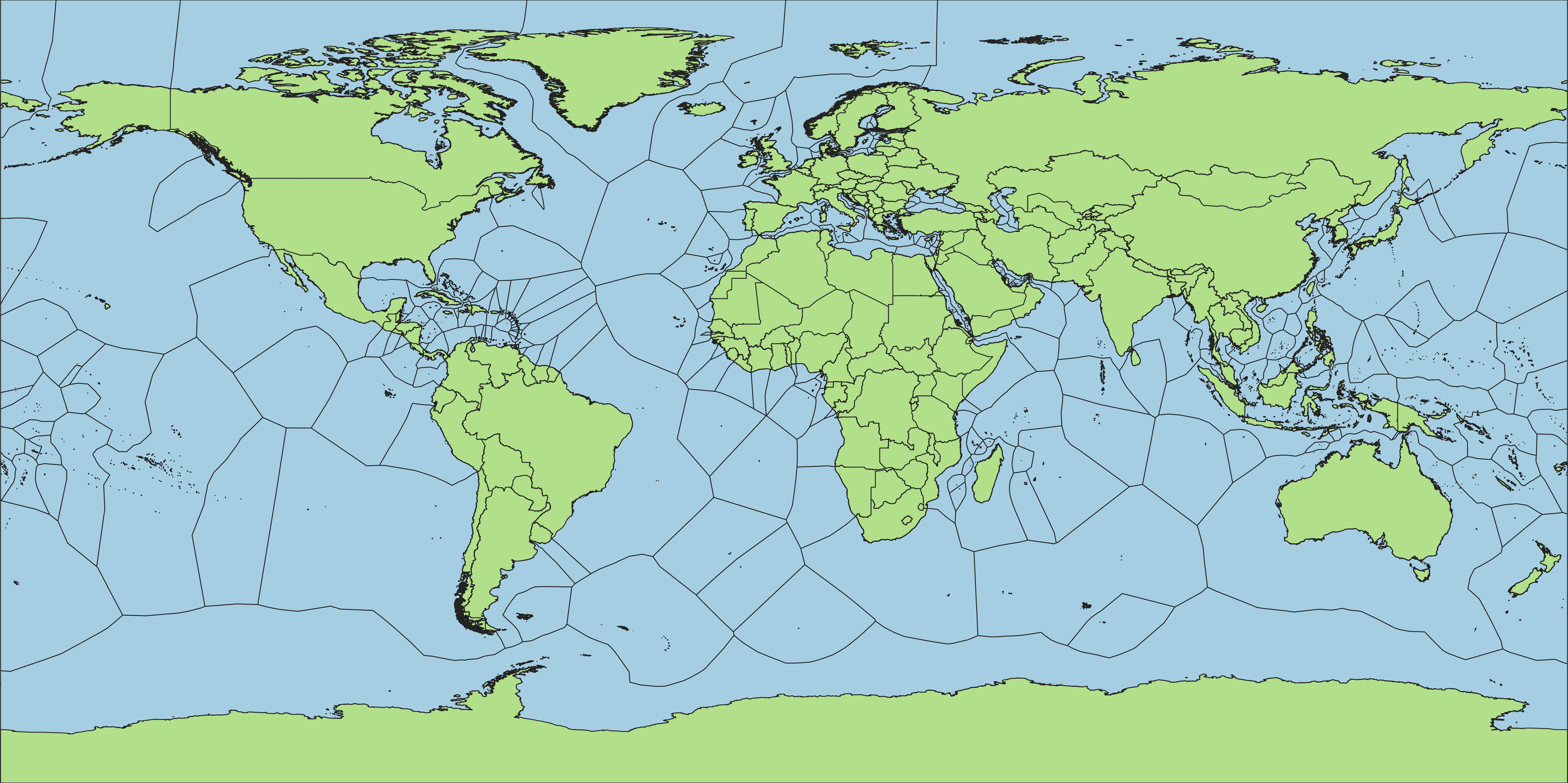
topo-tools is a collection of DuckDB-powered geospatial topology utilities
for cleaning and reconciling administrative boundary polygons. It ships
sixteen tools, usable from the CLI or as a Python package. Composite tools
are nested under the primitives they chain internally; every primitive is
also usable standalone:
- schema-crosswalk: infers a source-column to target-schema crosswalk and immediately applies it, in one call.
- schema-map: infers a polygon layer's admin hierarchy structurally and proposes a source to target-schema crosswalk for review.
- schema-refactor: applies a crosswalk CSV, from schema-map or hand-edited, to rename or drop columns. Geometry passes through unchanged.
- schema-fill: cascades each admin-hierarchy column down from its nearest non-NULL shallower level and stamps a depth column.
- topo-clean: detects and fixes gap/overlap defects in a single polygon layer, reporting issues for manual review.
- topo-detect: scans a single polygon layer for gap/overlap coverage defects and reports them, without fixing anything.
- edge-match: fits a finer child polygon layer into a coarser parent layer, grouping and extending each child to fill gaps within its own parent.
- edge-extend: fills gaps around a polygon layer (missing coastline, disputed areas, water bodies) with a Voronoi extension, producing full coverage.
- edge-mosaic: re-clips an already-extended child layer into a new/different parent layer, skipping Voronoi extension entirely.
- edge-clip: assigns each child to its parent, then clips it to that parent's geometry.
- edge-stitch: closes seams in an already-tiled polygon layer with one whole-table coverage-clean pass.
- change: compares two versions of a polygon layer and classifies every unit as unchanged, renamed, modified, split, merged, created, or removed.
- package: runs package-polygons, package-points, and package-lines against one input in a single call.
- package-polygons: dissolves a polygon layer into every detected coarser admin level in a single call.
- package-points: one label point per admin unit per detected level, using the pole of inaccessibility.
- package-lines: one deduplicated line network of admin boundaries, tagged by the coarsest level each segment belongs to.
Installation
Install with uv (recommended):
uv tool install topo-tools   # CLI
uv add topo-tools            # Python library
Or with pip/pipx:
pip install topo-tools       # CLI or library
pipx install topo-tools      # CLI
On macOS/Linux, topo-tools is also available via Homebrew, no Python
tooling required:
brew install OCHA-DAP/topo-tools/topo-tools
Each linked doc above covers that tool's CLI/Python usage, options, and examples.
Supported Formats
Polygon inputs/outputs: GeoParquet (.parquet), GeoPackage (.gpkg),
Shapefile (.shp), GeoJSON (.geojson). Output format matches input format.
change's tabular changelog is CSV or GeoParquet only; its spatial overlay
layer supports the same four formats as the other tools.
See CONTRIBUTING.md for development setup.
1 maintainer

Release files for topo-tools 0.6.0
For a detailed explanation of source distributions (sdists) and built distributions (wheels), please see the package formats documentation.
Source distribution (sdist)
| File | Size | Uploaded | |
|---|---|---|---|
| topo_tools-0.6.0.tar.gz | 8.3 MB | Details |
Built distribution (wheel)
| File | Interpreter | ABI | Platform | Reset |
|---|---|---|---|---|
| topo_tools-0.6.0-py3-none-any.whl | Python 3 | none | any | Details |
Total release size: 8.4 MB
Release files / topo_tools-0.6.0.tar.gz
| Download URL | topo_tools-0.6.0.tar.gz |
|---|---|
| Size | 8.3 MB |
| Tags | Source |
|
SHA-256 checksum How to use checksums |
39c1b0b790e1cbbce85a9d96bc9770e30b159660e5e970c4d5a3793fb77babd0
|
|
BLAKE2b-256 checksum How to use checksums |
557fc78972e5df7f11dc8fa1183c09b23f3f3818fc18be7c3073e93435c552c3
|
| Upload date | |
|
Uploaded using Trusted Publishing? What is trusted publishing? |
Yes |
| Uploaded via |
twine/7.0.0 CPython/3.13.14
|
Provenance
Provenance describes where a file came from. On PyPI, provenance is shared via attestations, which provide a verifiable record of the build or publishing details. View details, limitations and caveats.


PyPI Publish Attestation
PyPI verified that this artifact, at this checksum, originated from the publisher listed below.
Signed by GitHub Actions, verified by PyPI on Sep 14, 2026.
Transparency logRelease files / topo_tools-0.6.0-py3-none-any.whl
| Download URL | topo_tools-0.6.0-py3-none-any.whl |
|---|---|
| Size | 145.5 kB |
| Tags | Python 3 |
|
SHA-256 checksum How to use checksums |
79e8c76ffcda2aa8a92f1a75a201634a70d117015ed3701bceeff6e3f33c889f
|
|
BLAKE2b-256 checksum How to use checksums |
1079a619941aea02df46dc6437d1e791b22a0a50bfce2ffbee96fb89d3eb2db1
|
| Upload date | |
|
Uploaded using Trusted Publishing? What is trusted publishing? |
Yes |
| Uploaded via |
twine/7.0.0 CPython/3.13.14
|
Provenance
Provenance describes where a file came from. On PyPI, provenance is shared via attestations, which provide a verifiable record of the build or publishing details. View details, limitations and caveats.
PyPI Publish Attestation
PyPI verified that this artifact, at this checksum, originated from the publisher listed below.
Signed by GitHub Actions, verified by PyPI on Sep 14, 2026.
Transparency log













