
tracklib library provides a variety of tools, operators and functions to manipulate GPS trajectories

Project description
Tracklib
 |
Tracklib library provide a variety of tools, operators and functions to manipulate GPS trajectories |









More and more datasets of GPS trajectories are now available and they are studied very frequently in many scientific domains. Currently available Python libraries for trajectories can separately load, simplify, interpolate, summarize or visualize them. But, as far as we know, there is no Python library that would contain all these basic functionalities. This is what tracklib is modestly trying to do. The library provides some conventions, capabilities and techniques to manipulate GPS trajectories.
In tracklib, the core model supports a wide range of trajectory applications:
1/ trajectory can be seen as a concept of (geo)located timestamps sequence to study for example an athlete's performance,
2/ trajectory can be seen as a concept of a curve which makes it possible to study trajectory shapes,
3/ a full trajectory dataset can be reduced into a regular grid of summarized features,
4/ with map matching process, trajectories can be seen as a network of routes.
Furthermore, adding analytical features (e.g. speed, curvilinear abscissa, inflection point, heading, acceleration, speed change, etc.) on a observation or on all observations of a trajectory (function of coordinates or timestamp) is, in general, a complex and a boring task. So, to make it easier, Tracklib module offers a multitude of operators and predicates to simplify the creation of analytical features on a GPS tracks.
Documentation
The official online documentation is available at ReadTheDocs
In particular, the docs include practical guides and some Use cases
Installation
from pypi (i.e. via pip)
pip install tracklib
Citation
If you use tracklib, please cite the following references:
@softwareversion{meneroux:hal-04356178v3,
  TITLE = {{Tracklib: a python library  with a variety of tools, operators and functions to manipulate GPS trajectories}},
  AUTHOR = {M{\'e}neroux, Yann and van Damme, Marie-Dominique},
  URL = {https://hal.science/hal-04356178},
  NOTE = {},
  INSTITUTION = {{Laboratoire sciences et technologies de l'information g{\'e}ographique}},
  YEAR = {2024},
  MONTH = Dec,
  DOI = {10.5281/zenodo.19556814},
  SWHID = {swh:1:dir:315fb3ee21367d92767906fbdea7c380d5fa5ea0;origin=https://hal.archives-ouvertes.fr/hal-04356178;visit=swh:1:snp:3a6cbb574ce276c4bd97a74e6a21f2fc77ae9149;anchor=swh:1:rel:d3d2d6a6b0411f01dc2063280e2ad916eeed17a7;path=/},
  VERSION = {v0.8.2},
  REPOSITORY = {https://github.com/umrlastig/tracklib},
  LICENSE = {CeCILL-C Free Software License Agreement},
  KEYWORDS = {Open Source ; Segmenting GPS tracks ; Synthetic trajectory ; Trajectory aggregation ; Map-matching ; Python library ; GPS track},
  FILE = {https://hal.science/hal-04356178v3/file/tracklib-0.8.2.zip},
  HAL_ID = {hal-04356178},
  HAL_VERSION = {v3},
}
Scientific papers whose experiments use the Tracklib library
- Dawson, J., Peralta, V., Olteanu-Raimond, A.-M., Devogele, T., and Garel, M.: A Method for Spatializing Disturbance by Detecting Human-Wildlife Encounters from GNSS Trajectories, AGILE GIScience Ser., 7, 2, https://doi.org/10.5194/agile-giss-7-2-2026, 2026.
- Méneroux, Y., Muller, J.M., Seba, A., Bouquet, P., Ruaud, A., & Pierrot-Deseilligny, M.. 2025. Vers un couplage fort des approches topométrique et photogrammétrique pour le contrôle de trajectoire d’un véhicule autonome. XYZ : revue de l'Association française de topographie (n°183), 33-40.
- Marie-Dominique Van Damme, Yann Méneroux, and Ana-Maria Olteanu-Raimond. 2024. A metrological analysis of a modular and iterative aggregation algorithm of GNSS trajectories. In Proceedings of the 32nd ACM International Conference on Advances in Geographic Information Systems (SIGSPATIAL '24). Association for Computing Machinery, New York, NY, USA, 633–636. https://doi.org/10.1145/3678717.3691325
- Méneroux, Y., Maidaneh Abdi, I., Le Guilcher, A., & Olteanu-Raimond, A. M. (2022). Is the radial distance really a distance? An analysis of its properties and interest for the matching of polygon features. International Journal of Geographical Information Science, 37(2), 438–475. https://doi.org/10.1080/13658816.2022.2123487
Projects using Tracklib
footprint2graph
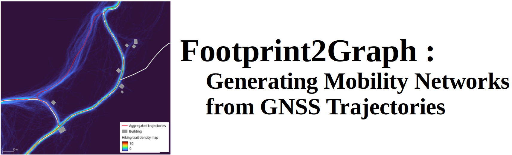
Automatic mobility graph reconstruction from GPS trajectories.
The project relies on Tracklib for trajectory processing, map matching, track aggregation, and geometric operations (e.g., interpolation and smoothing).
About
| version | See pypi |
| status | Active since 2020 November 1st, 2020 |
| license | Cecill C |
Development
Institute: LASTIG, Univ Gustave Eiffel, ENSG, IGN
Authors
- Yann Méneroux
- Marie-Dominique Van Damme
- Nisar Hakam
- Lâmân LELÉGARD
- Mattia Bunel
Release history Release notifications | RSS feed


Download files
Download the file for your platform. If you're not sure which to choose, learn more about installing packages.
Source Distribution
File details
Details for the file tracklib-0.8.4.1.tar.gz.
File metadata
- Download URL: tracklib-0.8.4.1.tar.gz
- Upload date:
- Size: 37.1 MB
- Tags: Source
- Uploaded using Trusted Publishing? No
- Uploaded via: twine/5.1.1 CPython/3.10.12
File hashes
| Algorithm | Hash digest | |
|---|---|---|
| SHA256 |
8b99070a4c78c816af638b1bb02e19c90f6333be9394fe0ab42bcec9c3040868
|
|
| MD5 |
2693ac8d86ae3f21e66597a81b29c17a
|
|
| BLAKE2b-256 |
b0918b9495c9c44e5bebcb90d590167e49a47a682cdebf88b607fcfa0b2baf75
|






