
Vgrid
A unified framework for working with DGGS
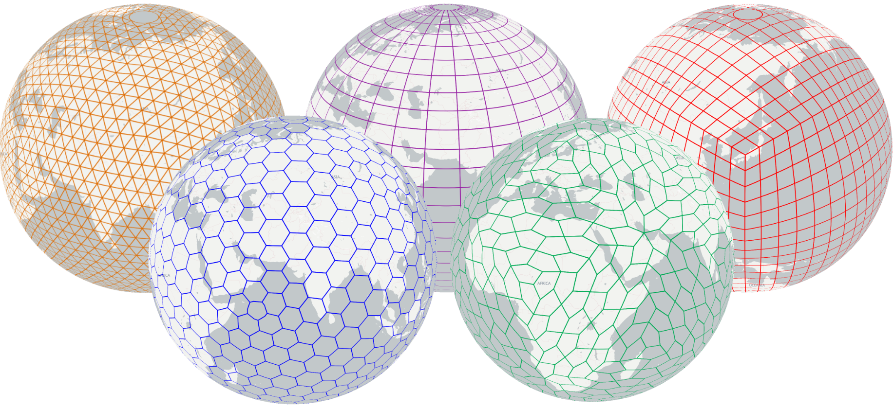
Vgrid User Guide








Vgrid Introduction
Vgrid DGGS is a python package for working with popular geodesic DGGS and graticule-based DGGS, including conversion, compact/expand, resampling between grids, binning, raster ingestion, and grid generation.
Vgrid supports a wide range of popular DGGSs, including H3, S2, A5, rHEALPix, DGGAL, DGGRID, Open-EAGGR ISEA4T, ISEA3H, EASE-DGGS, QTM, OLC, Geohash, GEOREF, MGRS, TileCode, Quadkey, Maidenhead, and GARS.
Vgrid supports popular input and output GIS formats, including CSV, GeoJSON, Pandas/GeoPandas, Shapefile, GeoPackage, and GeoParquet.
The following Vgrid user guide is intended for use in a Command Line Interface (CLI) environment. Full Vgrid DGGS documentation is available at vgrid document.
To work with Vgrid DGGS directly in GeoPandas and Pandas, please use vgridpandas. Full Vgridpandas DGGS documentation is available at vgridpandas document
To work with Vgrid DGGS in QGIS, install the Vgrid Plugin.
To visualize DGGS in Maplibre GL JS, try the vgrid-maplibre library.
For an interactive demo, visit the Vgrid Homepage.
Citation
If you use Vgrid DGGS in your work, please cite it. Vgrid is archived on Zenodo
Acknowledgements
Vgrid is built upon free and open-source software and would like to acknowledge the maintainers and contributors of the following projects, together with the many transitive dependencies that make them possible.
- h3-py by Uber.
- s2sphere by Sidewalk Labs.
- a5-py by Felix Palmer and Thang Quach.
- rhealpixdggs-py by Manaaki Whenua – Landcare Research.
- open-eaggr by Riskaware.
- EASE-DGGS by GEMS-UMN.
- pydggal by Jerome St-Louis from Ecere.
- DGGRID by Kevin Sahr.
- dggrid4py by Alex Kmoch.
- QTM by Thang Quach, with reference to QTM by Paulo Raposo.
- Lat Lon Tools QGIS Plugin by Calvin Hamilton.
- geohash by Hiroaki Kawai.
- gars-field by Corteva Agriscience.
- Tilecode & Quadkey by Thang Quach, utilizing mercantile by Mapbox.
- antimeridian by gadomski.
- The DGGS Inspect feature in Vgrid is inspired by Area and shape distortions in open-source discrete global grid systems by Alex Kmoch et al. (2022) (resources).
- The Vgrid Document is inspired by leafmap developed by Qiusheng Wu from Open Geospatial Solutions.
Vgrid Installation
- Using pip:
pip install vgrid --upgrade
DGGS Conversion
Lat lon to DGGS
Convert lat, long in WGS84 CRS to DGGS cellID (H3, S2, A5, rHEALPix, DGGAL, DGGRID, Open-EAGGR ISEA4T and ISEA3H, EASE-DGGS, QTM, OLC, Geohash, GEOREF, MGRS, Tilecode, Quadkey, Maidenhead, GARS, DIGIPIN).
> latlon2h3 10.775276 106.706797 13 # latlon2h3 <lat> <lon> <resolution> [0..15]
> latlon2s2 10.775276 106.706797 21 # latlon2s2 <lat> <lon> <resolution> [0..30]
> latlon2a5 10.775276 106.706797 18 # latlon2a5 <lat> <lon> <resolution> [0..29]
> latlon2rhealpix 10.775276 106.706797 14 # latlon2rhealpix <lat> <lon> <resolution> [0..15]
> latlon2dggal 10.775276 106.706797 gnosis 5 # latlon2dggal <lat> <lon> <dggal_type> <resolution>
> latlon2dggrid 10.775276 106.706797 FULLER4D 10 # Linux only: latlon2dggrid <lat> <lon> <dggs_type> <resolution>
> latlon2isea4t 10.775276 106.706797 21 # latlon2isea4t <lat> <lon> <resolution> [0..39]
> latlon2isea3h 10.775276 106.706797 27 # latlon2isea3h <lat> <lon> <resolution> [0..40]
> latlon2ease 10.775276 106.706797 6 # latlon2ease <lat> <lon> <resolution> [0..6]
> latlon2qtm 10.775276 106.706797 11  # latlon2qtm <lat> <lon> <resolution> [1..24]
> latlon2olc 10.775276 106.706797 11 # latlon2olc <lat> <lon> <resolution> [2,4,6,8,10..15]
> latlon2geohash 10.775276 106.706797 9 # latlon2geohash <lat> <lon> <resolution> [1..10]
> latlon2georef 10.775276 106.706797 4 # latlon2georef <lat> <lon> <resolution> [0..10]
> latlon2mgrs 10.775276 106.706797 4 # latlon2mgrs <lat> <lon> <resolution> [0..5]
> latlon2tilecode 10.775276 106.706797 23 # latlon2tilecode <lat> <lon> <resolution> [0..29]
> latlon2quadkey 10.775276 106.706797 23 # latlon2quadkey <lat> <lon> <resolution> [0..29]
> latlon2maidenhead 10.775276 106.706797 4 # latlon2maidenhead <lat> <lon> <resolution> [1..4]
> latlon2gars 10.775276 106.706797 1 # latlon2gars <lat> <lon> <resolution> [1..4] (30,15,5,1 minutes)
> latlon2digipin 10.775276 106.706797 10 # latlon2digipin <lat> <lon> <resolution>

DGGS to GeoJSON
Convert DGGS cell IDs to GeoJSON.
> h32geojson 8d65b56628e46bf
> s22geojson 31752f45cc94
> a52geojson 8e65b56628e0d07
> rhealpix2geojson R31260335553825
> dggal2geojson isea3h A4-0-A # dggal2geojson <dggal_type> <zone_id> [-split]
> dggrid2geojson 8478420 FULLER4D 10 # Linux only: dggrid2geojson <DGGRID code> <DGGS Type> <resolution>
# <DGGS Type>: SUPERFUND, PLANETRISK, ISEA3H, ISEA4H, ISEA4T, ISEA4D, ISEA43H, ISEA7H, IGEO7, FULLER3H, FULLER4H, FULLER4T, FULLER4D, FULLER43H, FULLER7H
> isea4t2geojson 13102313331320133331133
> isea3h2geojson 1327916769,-55086
> ease2geojson L6.165767.02.02.22.45.63.05
> qtm2geojson 42012323131
> olc2geojson 7P28QPG4+4P7
> geohash2geojson w3gvk1td8
> georef2geojson VGBL42404651
> mgrs2geojson 34TGK56063228
> gzd # Create Grid Zone Designators - used by MGRS
> tilecode2geojson z23x6680749y3941729
> quadkey2geojson 13223011131020212310000
> maidenhead2geojson OK30is46
> gars2geojson 574JK1918
> digipin2geojson F3K
{"type": "FeatureCollection", "features": [{"type": "Feature", "geometry": {"type": "Polygon", "coordinates": [[[106.70789209957029, 10.77601109480422], [106.70745212203926, 10.777918172217145], [106.7055792173179, 10.778494886227104], [106.70414629547702, 10.777164500398262], [106.70458630070586, 10.775257408234628], [106.70645920007833, 10.774680716650128], [106.70789209957029, 10.77601109480422]]]}, "properties": {"h3": "8965b56628fffff", "resolution": 9, "center_lat": 10.7765878, "center_lon": 106.7060192, "avg_edge_len": 215.295, "cell_area": 120421.396}}]}
Vector to DGGS
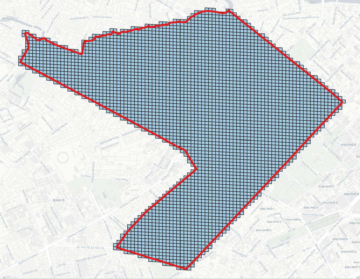
Convert vector layers (Point/MultiPoint, LineString/MultiLineString, Polygon/MultiPolygon) to DGGS cells.
Common vector2* options: -i / --input, -r / --resolution, -p / --predicate (intersect, within, centroid_within, largest_overlap for polygons), -c / --compact, -t / --topology, -f / --output_format. Antimeridian: -fix for H3, S2, rHEALPix, ISEA4T/ISEA3H; -split for A5, DGGAL, DGGRID; A5/DGGRID also support -options / --options (JSON).
> vector2h3 -i polygon.geojson -r 11 -p intersect -c -fix split -f geojson # vector2h3 -i <input> -r <resolution[0..15]> [-p predicate] [-c] [-t] [-f output_format] [-fix method]
> vector2s2 -i polygon.geojson -r 18 -p intersect -c -fix split # vector2s2 -r <resolution[0..30]>
> vector2a5 -i polyline.geojson -r 18 -p intersect -split # vector2a5 -r <resolution[0..29]>; polylines use great-circle path cells
> vector2rhealpix -i polygon.geojson -r 11 -p largest_overlap -fix split # vector2rhealpix -r <resolution[0..15]>
> vector2dggal -i polygon.geojson -dggs gnosis -r 8 -p intersect -c # vector2dggal -i <input> -dggs <dggal_type> -r <resolution> [-p predicate] [-c compact] [-t topology]
> vector2dggrid -i polyline.geojson -t ISEA4H -r 17 -split -aggregate # Linux: vector2dggrid -i <input> -t <DGGS Type> -r <resolution> [-a address_type] [-split] [-aggregate] [-options JSON]
> vector2isea4t -i polygon.geojson -r 17 -p intersect # vector2isea4t -r <resolution[0..25]> (Windows)
> vector2isea3h -i polygon.geojson -r 18 -p intersect # vector2isea3h -r <resolution[0..40]> (Windows)
> vector2ease -i polygon.geojson -r 4 -p intersect # vector2ease -r <resolution[0..6]>
> vector2qtm -i polygon.geojson -r 18 -p intersect -c # vector2qtm -r <resolution[1..24]>
> vector2olc -i polygon.geojson -r 10 -p intersect # vector2olc -r <resolution[2,4,6,8,10..15]>
> vector2geohash -i polygon.geojson -r 7 -p intersect # vector2geohash -r <resolution[1..10]>
> vector2georef -i polygon.geojson -r 4 # vector2georef -r <resolution[0..10]>
> vector2mgrs -i polygon.geojson -r 3 # vector2mgrs -r <resolution[0..5]>
> vector2tilecode -i polygon.geojson -r 18 -p intersect # vector2tilecode -r <resolution[0..29]>
> vector2quadkey -i polygon.geojson -r 18 -p intersect # vector2quadkey -r <resolution[0..29]>
> vector2maidenhead -i polygon.geojson -r 4 # vector2maidenhead -r <resolution[1..4]>
> vector2gars -i polygon.geojson -r 1 # vector2gars -r <resolution[1..4]>
> vector2digipin -i polygon.geojson -r 10 # vector2digipin -r <resolution>
- Uncompact:
- Compact:
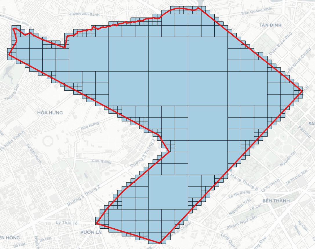
DGGS Compact
> h3compact -i h3.geojson -cellid h3 -fix split # h3compact -i <input> -cellid [optional] [-d depth] [-agg ...] [-numeric_col] -f [output_format] -fix [antimeridian method]
> s2compact -i s2.geojson -cellid s2 -fix split # s2compact -i <input> -cellid [optional] [-d depth] [-agg ...] [-numeric_col] -fix [antimeridian method]
> a5compact -i a5.geojson -cellid a5 -split # a5compact -i <input> -cellid [optional] [-d depth] [-agg ...] [-numeric_col] -split
> rhealpixcompact -i rhealpix.geojson -cellid rhealpix -fix split # rhealpixcompact -i <input> -cellid [optional] [-d depth] [-agg ...] [-numeric_col] -fix [antimeridian method]
> dggalcompact -i dggal_cells.geojson -dggs gnosis # dggalcompact -i <input> -dggs <dggal_type> [-zoneid field] [-d depth] [-agg ...] [-numeric_col] [-f output_format]
> dggridcompact -i dggrid_cells.geojson -dggs ISEA4T -r 10 -split -aggregate # Linux API: dggridcompact -i <input> -dggs <DGGS Type> -r <resolution> [-cellid] [-d depth] [-agg ...] [-numeric_col] [-split] [-aggregate]
> isea4tcompact -i isea4t.geojson -cellid isea4t -fix split # isea4tcompact -i <input> -cellid [optional] [-d depth] [-agg ...] [-numeric_col] -fix [antimeridian method]
> isea3hcompact -i isea3h.geojson -cellid isea3h -fix split # isea3hcompact -i <input> -cellid [optional] [-d depth] [-agg ...] [-numeric_col] -fix [antimeridian method]
> easecompact -i ease.geojson -cellid ease # easecompact -i <input> -cellid [optional] [-d depth] [-agg ...] [-numeric_col]
> qtmcompact -i qtm.geojson -cellid qtm # qtmcompact -i <input> -cellid [optional] [-d depth] [-agg ...] [-numeric_col]
> olccompact -i olc.geojson -cellid olc # olccompact -i <input> -cellid [optional] [-d depth] [-agg ...] [-numeric_col]
> geohashcompact -i geohash.geojson -cellid geohash # geohashcompact -i <input> -cellid [optional] [-d depth] [-agg ...] [-numeric_col]
> tilecodecompact -i tilecode.geojson -cellid tilecode # tilecodecompact -i <input> -cellid [optional] [-d depth] [-agg ...] [-numeric_col]
> quadkeycompact -i quadkey.geojson -cellid quadkey # quadkeycompact -i <input> -cellid [optional] [-d depth] [-agg ...] [-numeric_col]
> digipincompact -i digipin.geojson -cellid digipin # digipincompact -i <input> -cellid [optional] [-d depth] [-agg ...] [-numeric_col]
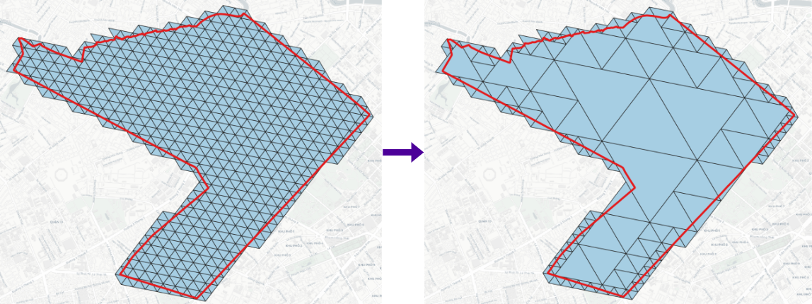
DGGS Expand
> h3expand -i h3_11.geojson -r 12 -cellid h3 -fix split # h3expand -i <input> -r <higher resolution> -cellid [optional] -fix [antimeridian method]
> s2expand -i s2_18.geojson -r 19 -cellid s2 -fix split # s2expand -i <input> -r <higher resolution> -cellid [optional] -fix [antimeridian method]
> a5expand -i a5_18.geojson -r 19 -cellid a5 -split # a5expand -i <input> -r <higher resolution> -cellid [optional] -split
> rhealpixexpand -i rhealpix_10.geojson -r 11 -cellid rhealpix -fix split # rhealpixexpand -i <input> -r <higher resolution> -cellid [optional] -fix [antimeridian method]
> dggalexpand -i dggal_cells.geojson -dggs gnosis -r 6 # dggalexpand -i <input> -dggs <dggal_type> -r <higher resolution>
> dggridexpand -i dggrid_cells.geojson -dggs ISEA4T -r 11 -split -aggregate # Linux API: dggridexpand -i <input> -dggs <DGGS Type> -r <higher resolution> [-cellid] [-split] [-aggregate]
> isea4texpand -i isea4t_18.geojson -r 19 -cellid isea4t -fix split # isea4texpand -i <input> -r <higher resolution> -cellid [optional] -fix [antimeridian method]
> isea3hexpand -i isea3h_18.geojson -r 19 -cellid isea3h -fix split # isea3hexpand -i <input> -r <higher resolution> -cellid [optional] -fix [antimeridian method]
> easeexpand -i ease_4.geojson -r 5 -cellid ease # easeexpand -i <input> -r <higher resolution> -cellid [optional]
> qtmexpand -i qtm_18.geojson -r 19 -cellid qtm # qtmexpand -i <input> -r <higher resolution> -cellid [optional]
> olcexpand -i olc_8.geojson -r 10 -cellid olc # olcexpand -i <input> -r <higher resolution> -cellid [optional]
> geohashexpand -i geohash_7.geojson -r 8 -cellid geohash # geohashexpand -i <input> -r <higher resolution> -cellid [optional]
> tilecodeexpand -i tilecode_18.geojson -r 19 -cellid tilecode # tilecodeexpand -i <input> -r <higher resolution> -cellid [optional]
> quadkeyexpand -i quadkey_18.geojson -r 19 -cellid quadkey # quadkeyexpand -i <input> -r <higher resolution> -cellid [optional]
> digipinexpand -i digipin.geojson -r 11 -cellid digipin # digipinexpand -i <input> -r <higher resolution> -cellid [optional]
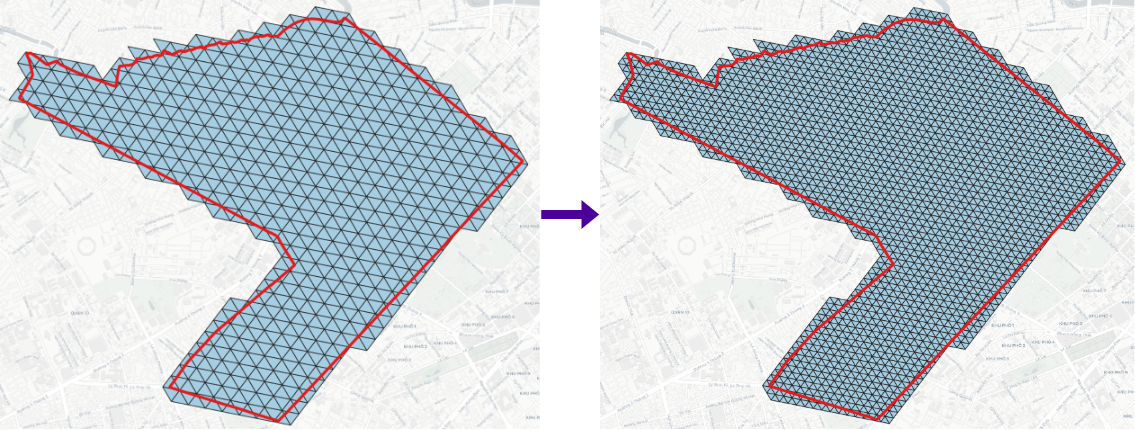
DGGS Resample
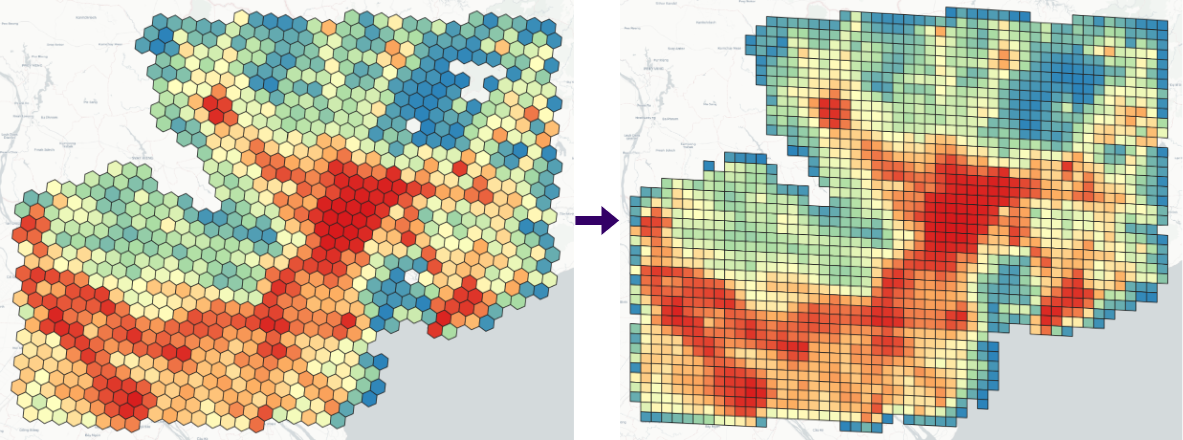
Resample a source DGGS layer to another DGGS type (or resolution): build a target grid over the source footprint, then optionally transfer a numeric attribute by area-weighted overlap (default) or nearest-neighbour assignment from source cells. Keep target cells with -p centroid_within (default: the target cell contains a source centroid) or -p intersects. Omit -r or pass -1 to pick the target resolution that best matches mean source cell area.
> dggsresample -i h3_cells.geojson --from_dggs h3 --to_dggs s2 -r 15 -resample_col elevation -m area_weighted -p centroid_within -f geojson # dggsresample -i <source layer> --from_dggs <source type> --to_dggs <target type> [-r <resolution> | -1] [-dggs_col <id column>] [-resample_col <numeric field>] [-m area_weighted|nearest] [-p centroid_within|intersects] [-f output_format] [-o output_name] [-fix antimeridian method] [-split] [-aggregate] [--dggrid_options JSON] [--a5_options JSON]
DGGS Binning
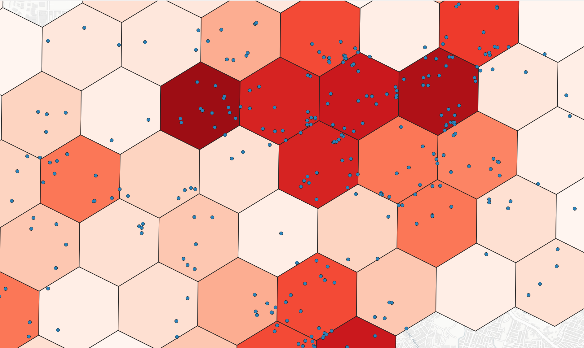
Binning point layers to DGGS cells with spatial joins and aggregation.
Common options for all *bin CLIs: -i / --input (vector file or URL), -r / --resolution, -agg / --agg (count, min, max, sum, mean, median, std, var, range, minority, majority, variety), -numeric_col / --numeric_col (required when agg ≠ count), -category / --category (optional grouping field), -f / --output_format (default gpd), -v / --verbose (progress bar; --no-verbose to hide).
> h3bin -i point.geojson -r 8 -agg count -numeric_col value -category group -fix split # h3bin -i <input> -r <resolution[0..15]> -agg [...] -numeric_col [optional] -category [optional] -f [output_format] -fix [antimeridian method]
> s2bin -i point.geojson -r 13 -agg count -numeric_col value -category group -fix split # s2bin -i <input> -r <resolution[0..30]> -agg [...] -numeric_col [optional] -category [optional] -f [output_format] -fix [antimeridian method]
> a5bin -i point.geojson -r 18 -agg count -numeric_col value -category group -split # a5bin -i <input> -r <resolution[0..29]> -agg [...] -numeric_col [optional] -category [optional] -f [output_format] -split [-options JSON]
> rhealpixbin -i point.geojson -r 8 -agg count -numeric_col value -category group -fix split # rhealpixbin -i <input> -r <resolution[0..15]> -agg [...] -numeric_col [optional] -category [optional] -f [output_format] -fix [antimeridian method]
> dggalbin -i point.geojson -t gnosis -r 5 -agg count -numeric_col value -category group -split # dggalbin -i <input> -t <dggal_type> -r <resolution> -agg [...] -numeric_col [optional] -category [optional] -f [output_format] -split
# dggridbin: Linux API — same options as dggalbin plus -aggregate
> isea4tbin -i point.geojson -r 13 -agg count -numeric_col value -category group -fix split # isea4tbin -i <input> -r <resolution[0..25]> -agg [...] -numeric_col [optional] -category [optional] -f [output_format] -fix [antimeridian method]
> easebin -i point.geojson -r 4 -agg count -numeric_col value -category group # easebin -i <input> -r <resolution[0..6]> -agg [...] -numeric_col [optional] -category [optional] -f [output_format]
> qtmbin -i point.geojson -r 13 -agg count -numeric_col value -category group # qtmbin -i <input> -r <resolution[1..24]> -agg [...] -numeric_col [optional] -category [optional] -f [output_format]
> olcbin -i point.geojson -r 9 -agg count -numeric_col value -category group # olcbin -i <input> -r <resolution[2,4,6,8,10..15]> -agg [...] -numeric_col [optional] -category [optional] -f [output_format]
> geohashbin -i point.geojson -r 6 -agg count -numeric_col value -category group # geohashbin -i <input> -r <resolution[1..10]> -agg [...] -numeric_col [optional] -category [optional] -f [output_format]
> georefbin -i point.geojson -r 4 -agg count # georefbin -i <input> -r <resolution[0..10]>
> tilecodebin -i point.geojson -r 15 -agg count -numeric_col value -category group # tilecodebin -i <input> -r <resolution[0..29]> -agg [...] -numeric_col [optional] -category [optional] -f [output_format]
> quadkeybin -i point.geojson -r 13 -agg count -numeric_col value -category group # quadkeybin -i <input> -r <resolution[0..29]> -agg [...] -numeric_col [optional] -category [optional] -f [output_format]
> maidenheadbin -i point.geojson -r 4 -agg count # maidenheadbin -i <input> -r <resolution[1..4]>
> garsbin -i point.geojson -r 1 -agg count # garsbin -i <input> -r <resolution[1..4]>
> digipinbin -i point.geojson -r 10 -agg count # digipinbin -i <input> -r <resolution> (Python API; no console script yet)
> polygonbin -i points.geojson -p polygons.geojson -agg count # polygonbin -i <points> -p <polygons> [-agg] [-numeric_col] [-category]
DGGRID binning (dggrid_bin / dggridbin Python API, Linux): -split, -aggregate, same as vector2dggrid and dggridgen.
Raster to DGGS
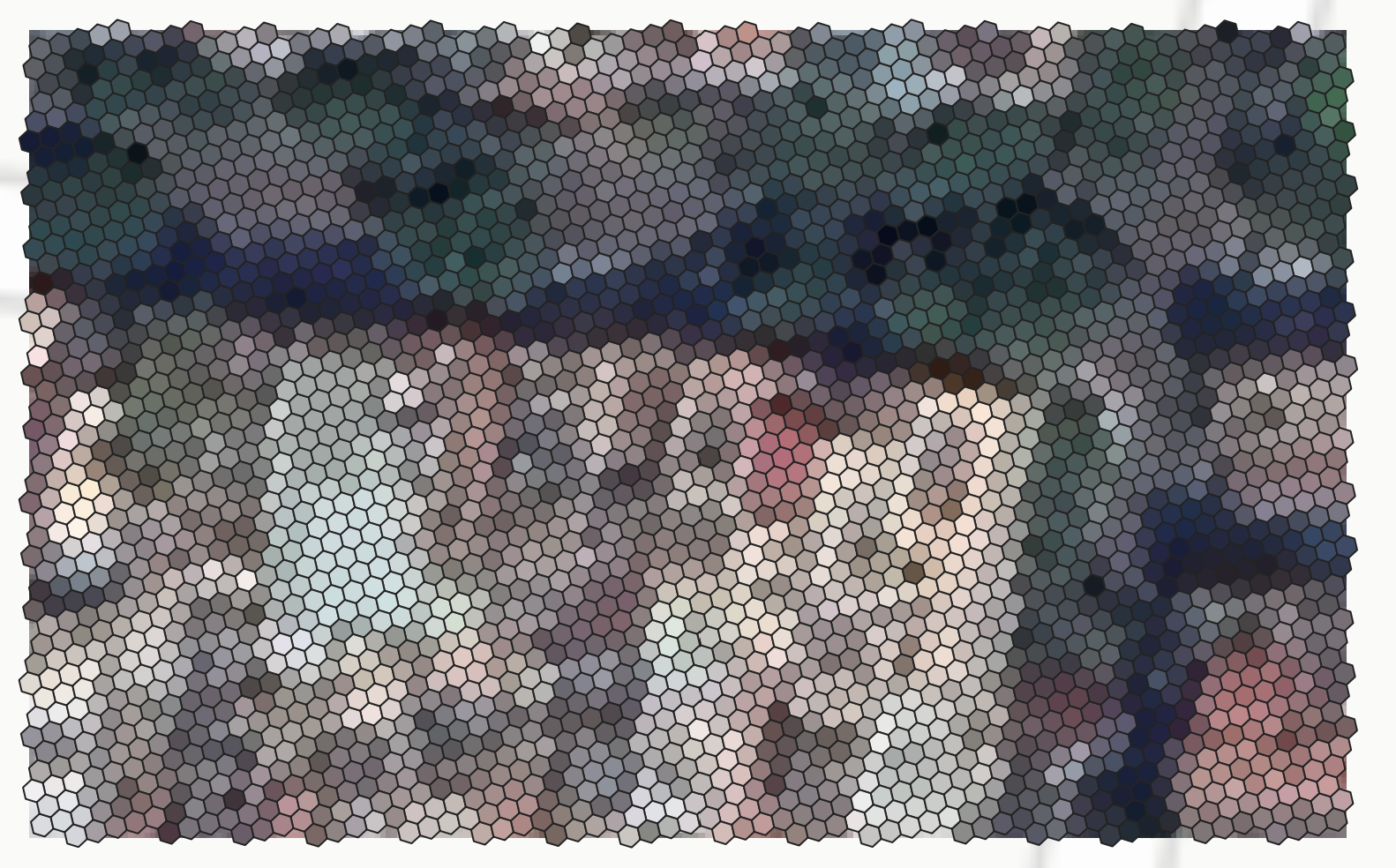
Convert raster layers in geographic CRS to DGGS. Omit -r to use the resolution nearest to the raster cell size. DGGRID/DGGAL support -aggregate for binning mode.
> raster2h3 -raster raster.tif # raster2h3 -raster <raster> [-r resolution[0..15]] [-stats ...] [-fix antimeridian method]
> raster2s2 -raster raster.tif # raster2s2 -raster <raster> [-r resolution[0..30]] [-fix antimeridian method]
> raster2a5 -raster raster.tif # raster2a5 -raster <raster> [-r resolution[0..29]] [-split]
> raster2rhealpix -raster raster.tif # raster2rhealpix -raster <raster> [-r resolution[0..15]] [-fix antimeridian method]
> raster2dggal -raster raster.tif -dggs gnosis # raster2dggal -raster <raster> -dggs <dggal_type> [-r resolution]
> raster2dggrid -raster raster.tif -t ISEA4T # Linux: raster2dggrid -raster <raster> -t <DGGS Type> [-r resolution] [-split] [-aggregate]
> raster2isea4t -raster raster.tif # raster2isea4t -raster <raster> [-r resolution] (Windows)
> raster2qtm -raster raster.tif # raster2qtm -raster <raster> [-r resolution[1..24]]
> raster2olc -raster raster.tif # raster2olc -raster <raster> [-r resolution]
> raster2geohash -raster raster.tif # raster2geohash -raster <raster> [-r resolution[1..10]]
> raster2georef -raster raster.tif # raster2georef -raster <raster> [-r resolution[0..10]]
> raster2tilecode -raster raster.tif # raster2tilecode -raster <raster> [-r resolution[0..29]]
> raster2quadkey -raster raster.tif # raster2quadkey -raster <raster> [-r resolution[0..29]]
> raster2maidenhead -raster raster.tif # raster2maidenhead -raster <raster> [-r resolution[1..4]]
> raster2gars -raster raster.tif # raster2gars -raster <raster> [-r resolution[1..4]]
> raster2digipin -raster raster.tif # raster2digipin -raster <raster> [-r resolution]
DGGS Generator
Generate DGGS at a specific resolution within a bounding box (-b min_lon min_lat max_lon max_lat). Antimeridian: -fix (H3, S2, rHEALPix, ISEA4T/ISEA3H), -split (A5, DGGAL, DGGRID), -aggregate (DGGRID).
> h3grid -r 11 -b 106.699007 10.762811 106.717674 10.778649 -fix split # h3grid -r <resolution[0..15]> -b <bbox> [-fix method] [-f output_format]
> s2grid -r 18 -b 106.699007 10.762811 106.717674 10.778649 -fix split # s2grid -r <resolution[0..30]> -b <bbox> [-fix method]
> a5grid -r 18 -b 106.699007 10.762811 106.717674 10.778649 -split # a5grid -r <resolution[0..29]> -b <bbox> [-split] [-options JSON]
> rhealpixgrid -r 11 -b 106.699007 10.762811 106.717674 10.778649 -fix split # rhealpixgrid -r <resolution[0..15]> -b <bbox> [-fix method]
> dggalgen -dggs gnosis -r 5 -bbox 106.699007,10.762811,106.717674,10.778649 # dggalgen -dggs <dggal_type> -r <resolution> [-bbox min_lon,min_lat,max_lon,max_lat] [-c compact]
> dggridgen -t ISEA3H -r 2 -b 106.699007 10.762811 106.717674 10.778649 -split -aggregate # Linux: dggridgen -t <DGGS Type> -r <resolution> [-b bbox] [-a address_type] [-split] [-aggregate]
> isea4tgrid -r 17 -b 106.699007 10.762811 106.717674 10.778649 -fix split # isea4tgrid -r <resolution[0..25]> -b <bbox> [-fix method] (Windows)
> isea3hgrid -r 20 -b 106.699007 10.762811 106.717674 10.778649 -fix split # isea3hgrid -r <resolution[0..40]> -b <bbox> [-fix method] (Windows)
> easegrid -r 4 -b 106.699007 10.762811 106.717674 10.778649 # easegrid -r <resolution[0..6]> -b <bbox>
> qtmgrid -r 8 -b 106.699007 10.762811 106.717674 10.778649 # qtmgrid -r <resolution[1..24]> -b <bbox>
> olcgrid -r 8 -b 106.699007 10.762811 106.717674 10.778649 # olcgrid -r <resolution[2,4,6,8,10..15]> -b <bbox>
> geohashgrid -r 6 -b 106.699007 10.762811 106.717674 10.778649 # geohashgrid -r <resolution[1..10]> -b <bbox>
> georefgrid -r 4 -b 106.699007 10.762811 106.717674 10.778649 # georefgrid -r <resolution[0..10]> -b <bbox>
> mgrsgrid -r 1 -gzd 48P # mgrsgrid -r <resolution[0..5]> -gzd <Grid Zone Designator, e.g. 48P>
> tilecodegrid -r 20 -b 106.699007 10.762811 106.717674 10.778649 # tilecodegrid -r <resolution[0..29]> -b <bbox>
> quadkeygrid -r 20 -b 106.699007 10.762811 106.717674 10.778649 # quadkeygrid -r <resolution[0..29]> -b <bbox>
> maidenheadgrid -r 4 -b 106.699007 10.762811 106.717674 10.778649 # maidenheadgrid -r <resolution[1..4]> -b <bbox>
> garsgrid -r 1 -b 106.699007 10.762811 106.717674 10.778649 # garsgrid -r <resolution[1..4]> -b <bbox>
> digipingrid -r 10 -b 106.699007 10.762811 106.717674 10.778649 # digipingrid -r <resolution> -b <bbox>
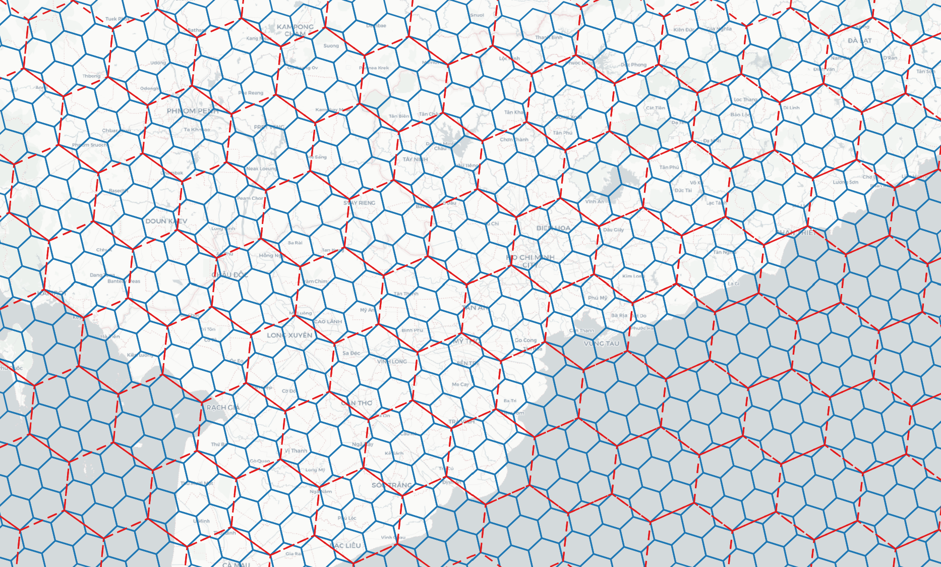
DGGS Inspect
> h3inspect -r 3 # h3inspect -r <resolution>
> s2inspect -r 6
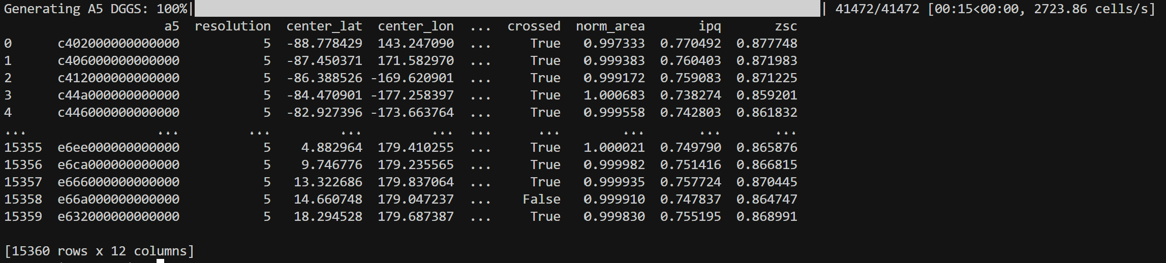
> a5inspect -r 5
> rhealpixinspect -r 4
> dggalinspect -t gnosis -r 5 # dggalinspect -t <dggal_type> -r <resolution>
> dggridinspect -t ISEA4T -r 3 # Linux: dggridinspect -t <DGGS Type> -r <resolution>
> isea4tinspect -r 5
> isea3hinspect -r 3
> easeinspect -r 0
> qtminspect -r 6
> olcinspect -r 4
> geohashinspect -r 3
> georefinspect -r 1
> tilecodeinspect -r 7
> quadkeyinspect -r 7
> maidenheadinspect -r 2
> garsinspect -r 1
> digipininspect -r 10
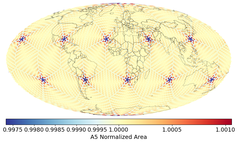
Distribution of DGGS Area Distortions visualized from DGGS Inspect
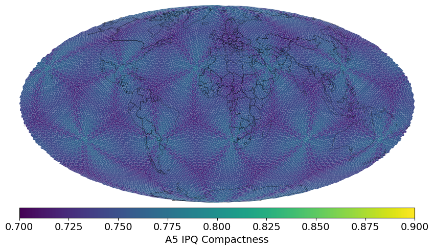
Visualization of DGGS IPQ Compactness visualized from DGGS Inspect
DGGS Stats
> h3stats # Number of cells, avg edge length, avg cell area at each resolution
> s2stats
> a5stats
> rhealpixstats
> dggalstats -t gnosis # dggalstats -t <dggal_type>
> dggridstats -t FULLER3H -r 8 # Linux: dggridstats -t <DGGS Type> [-r resolution] [-aggregate]
> isea4tstats
> isea3hstats
> easestats
> qtmstats
> olcstats
> geohashstats
> georefstats
> mgrsstats
> tilecodestats
> quadkeystats
> maidenheadstats
> garsstats
> digipinstats
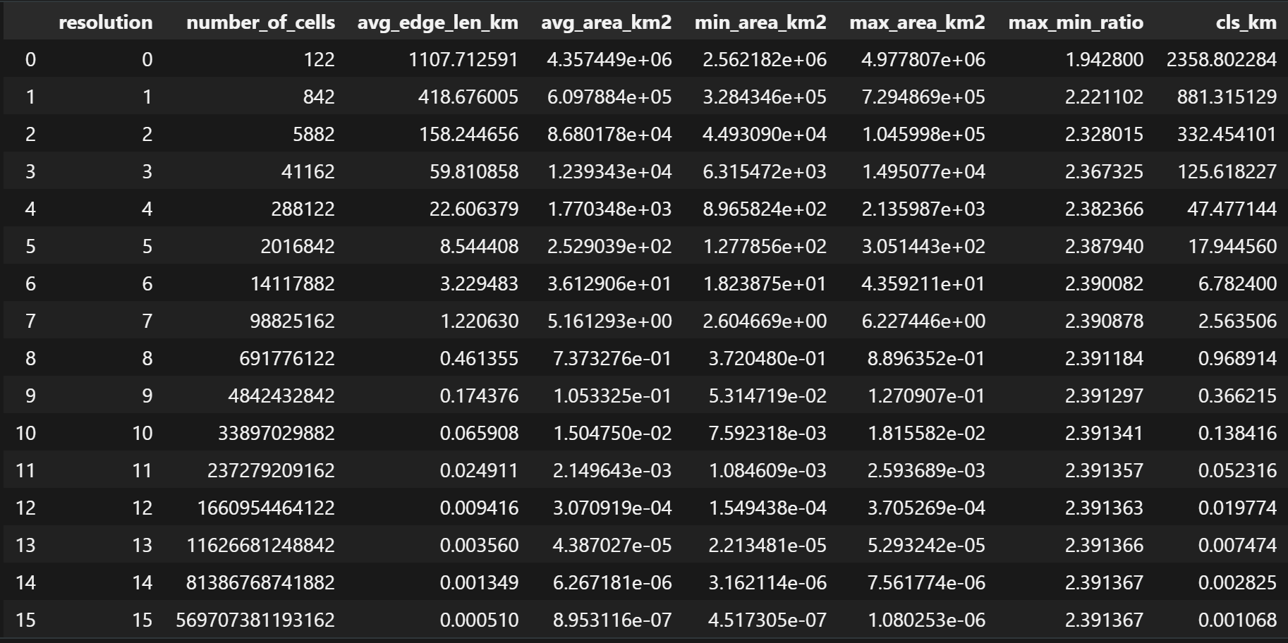
Polyhedra Generator

> tetrahedron  # Generate global tetrahedron
> cube         # Generate global cube
> octahedron   # Generate global octahedron
> dodecahedron # Generate global dodecahedron
> fuller_icosahedron   # Generate global Fuller icosahedron
> rhombic_icosahedron   # Generate global rhombic icosahedron (DGGAL)
1 maintainer

Metadata
1 maintainer
Release files for vgrid 1.4.24
For a detailed explanation of source distributions (sdists) and built distributions (wheels), please see the package formats documentation.
Source distribution (sdist)
| File | Size | Uploaded | |
|---|---|---|---|
| vgrid-1.4.24.tar.gz | 53.3 MB | Details |
Built distribution (wheel)
| File | Interpreter | ABI | Platform | Reset |
|---|---|---|---|---|
| vgrid-1.4.24-py3-none-any.whl | Python 3 | none | any | Details |
Total release size: 107.3 MB
Release files / vgrid-1.4.24.tar.gz
| Download URL | vgrid-1.4.24.tar.gz |
|---|---|
| Size | 53.3 MB |
| Tags | Source |
|
SHA-256 checksum How to use checksums |
a2eb68cd774654acb413080bcd582727bf894d9fcf2502a8a467b99a2af4819a
|
|
BLAKE2b-256 checksum How to use checksums |
10650105ae86f9a8d4f84f95079760355c816b729d00620fba3c5dc623db8ca8
|
| Upload date | |
|
Uploaded using Trusted Publishing? What is trusted publishing? |
No |
| Uploaded via |
uv/0.10.9 {"installer":{"name":"uv","version":"0.10.9","subcommand":["publish"]},"python":null,"implementation":{"name":null,"version":null},"distro":null,"system":{"name":null,"release":null},"cpu":null,"openssl_version":null,"setuptools_version":null,"rustc_version":null,"ci":null}
|
Release files / vgrid-1.4.24-py3-none-any.whl
| Download URL | vgrid-1.4.24-py3-none-any.whl |
|---|---|
| Size | 53.9 MB |
| Tags | Python 3 |
|
SHA-256 checksum How to use checksums |
ab362440e081ac88634765b7731e6994821fba5d3faa66fb72bfdcabeee1770f
|
|
BLAKE2b-256 checksum How to use checksums |
8910a08c241c90351dd0a390c5a95cd6fdf2ccdac1494d0b9786dd41e5526d39
|
| Upload date | |
|
Uploaded using Trusted Publishing? What is trusted publishing? |
No |
| Uploaded via |
uv/0.10.9 {"installer":{"name":"uv","version":"0.10.9","subcommand":["publish"]},"python":null,"implementation":{"name":null,"version":null},"distro":null,"system":{"name":null,"release":null},"cpu":null,"openssl_version":null,"setuptools_version":null,"rustc_version":null,"ci":null}
|














