Is a software to process FURUNO weather radar data.


Project description
WRaINfo - An Open Source Library for Weather Radar Information
is a software for real-time weather radar data processing. It is specifically designed for X-band weather radars of FURUNO.


For detailed information, refer to the documentation. See also the latest coverage report and the pytest HTML report.
Contact: Alice Künzel (alicek@gfz-potsdam.de)
Information on how to cite the WRaINfo Python package can be found in the CITATION file.
- Please cite also the Wradlib Python package as follows:
An Open Source Library for Weather Radar Data Processing Heistermann, M., Jacobi, S., and Pfaff, T.: Technical Note: An open source library for processing weather radar data (wradlib), Hydrol. Earth Syst. Sci., 17, 863-871, doi:10.5194/hess-17-863-2013, 2013
Features overview
The FURUNO raw data can already provide useful visual information about the spatial distribution of precipitation events. But in order to use the FURUNO data for quantitatvie studies, the raw data has to be processed in order to account for typical error sources such as ground clutter, uncertainities in polarimetric variables and in the z-R relationship as well as attenuation of the radar signal. Therefore this python package has been developed for processing FURUNO weather radar data.
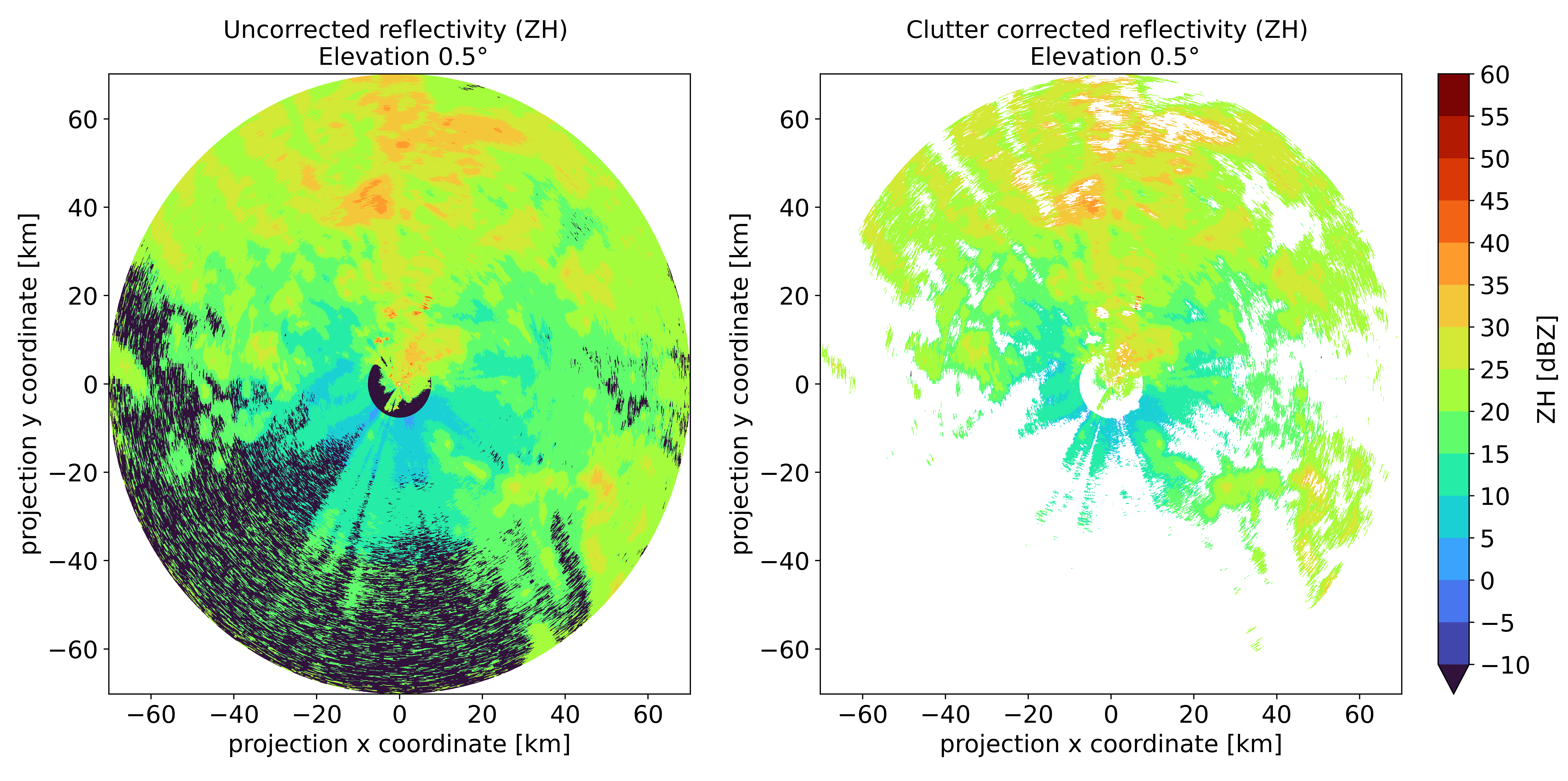
Remove ground clutter
To remove ground clutter from raw data exists a function from wradlib based on all polarimetric variables and on a static clutter map, which is generated over a long time period. Pixel which are identified as clutter were exclude from further processing by set the pixels to NaN. For processing a clutter map, the package includes a function to read only the values from raw data sequentially to not overload the memory. Here is an example before and after removing ground clutter using WRaINfo.
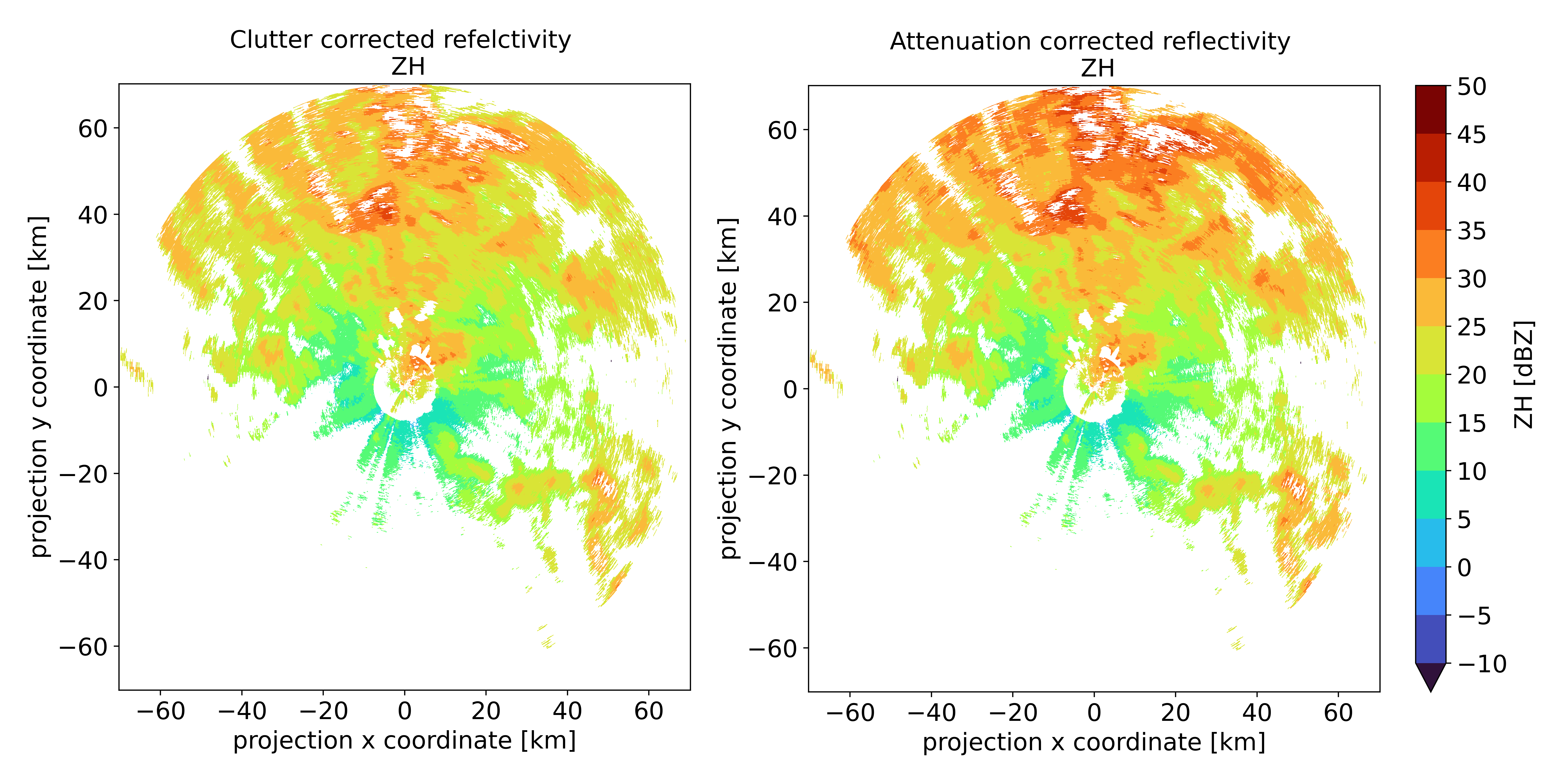
Attenuation correction
Rainfall-induced attenuation is a major source of underestimation for radar-based precipitation estimation at X-band. After phase processing, the attenuation correction is used with the approach of Testud et al. (2001) is used. Here is an example before and after attenuation correction using WRaINfo.
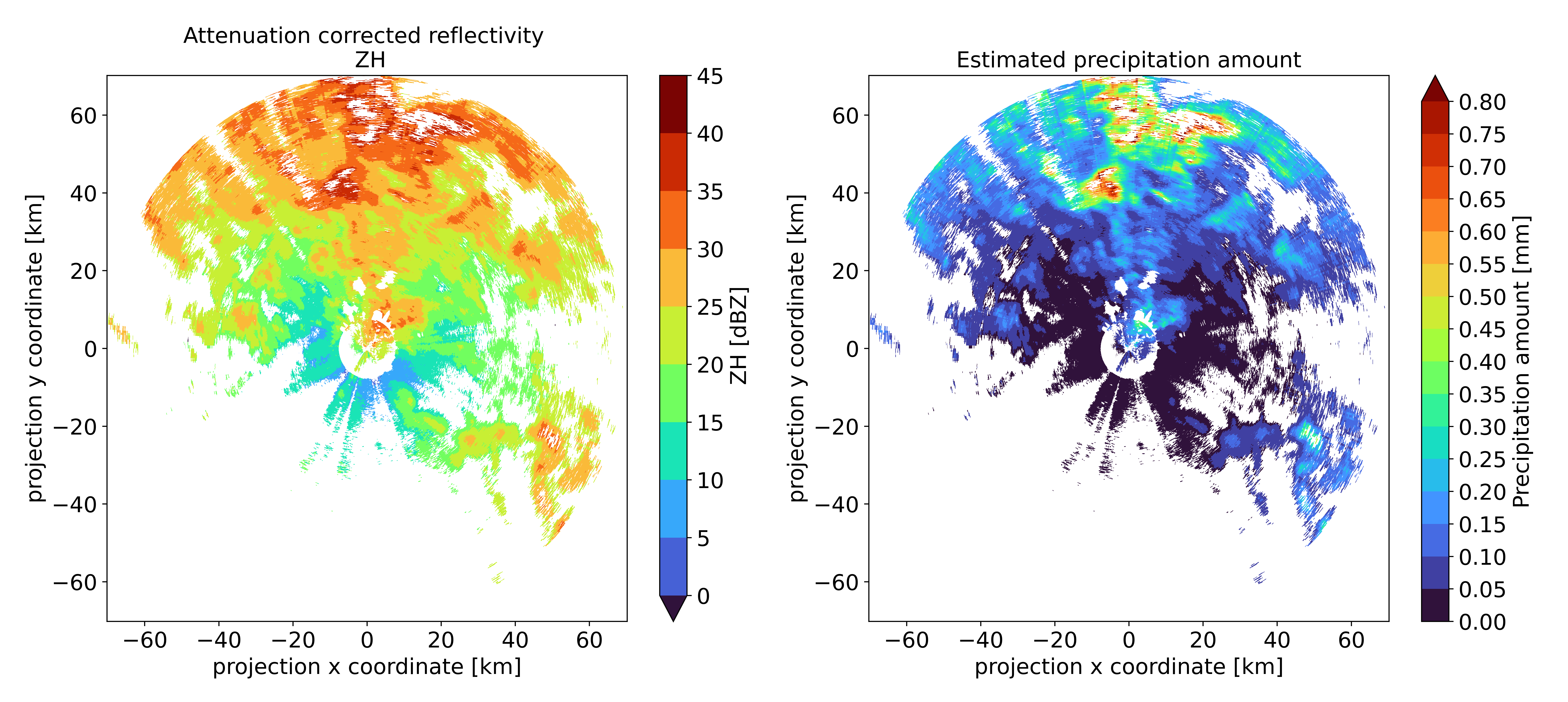
Precipitation Estimation
There are several methods for deriving the amount of precipitation from reflectivity. In general, the z - R conversion is used. The precipitation amount is determined with an integration interval of seconds based on the scan interval.
Georeferencing and gridding
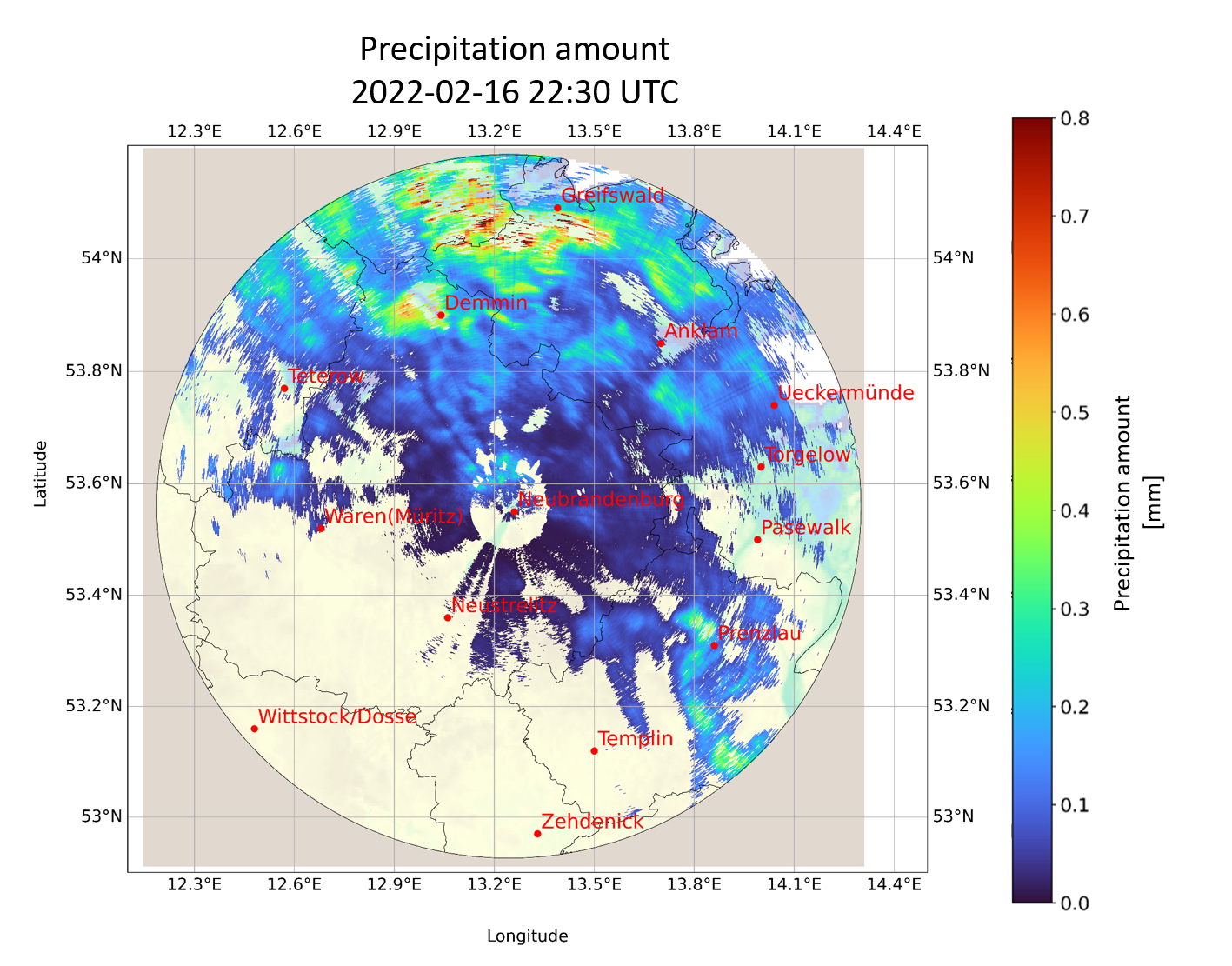
After clutter and attenuation correction and precipitation estimation, the polar data are georeferenced using the specified EPSG code and saved as a NetCDF file. Here is an example of a georeferenced dataset.
Installation
Install wrainfo
History / Changelog
You can find the protocol of recent changes in the WRaINfo package here.
License
The software is available under the Apache 2.0.
Contribution
Contributions are always welcome.
Data availability
Preprocessed FURUNO weather radar data (level 2a) for the Neubrandenburg site are made available in the TERENO Data DiscoveryPortal under the CC BY-NC 4.0 license. Please contact us (fernlab@gfz-potsdam.de), if you wish to use the data under another license (e.g. commercially).
Credits
WRaINfo has been developed by FERN.Lab, the Helmholtz Innovation Lab “Remote sensing for sustainable use of resources”, located at the Helmholtz Centre Potsdam, GFZ German Research Centre for Geosciences. FERN.Lab is funded by the Initiative and Networking Fund of the Helmholtz Association. |

- Development Team:
Alice Künzel, researcher Helmholtz Centre Potsdam German Research Centre for Geosciences GFZ, Section 1.4 - Remote Sensing and Geoinformatics
Kai Mühlbauer, researcher University of Bonn, Institute of Geosciences - Meteorology Section
Julia Neelmeijer, supervisor Helmholtz Centre Potsdam German Research Centre for Geosciences GFZ, Section 1.4 - Remote Sensing and Geoinformatics
Daniel Spengler, supervisor Helmholtz Centre Potsdam German Research Centre for Geosciences GFZ, Section 1.4 - Remote Sensing and Geoinformatics
This package was created with Cookiecutter and the fernlab/cookiecutter-pypackage project template. The test data represent raw data of the weather radar FURUNO and files which are created with the WRaINfo package.


Download files
Download the file for your platform. If you're not sure which to choose, learn more about installing packages.
Source Distribution
File details
Details for the file wrainfo-0.9.5.tar.gz.
File metadata
- Download URL: wrainfo-0.9.5.tar.gz
- Upload date:
- Size: 6.5 MB
- Tags: Source
- Uploaded using Trusted Publishing? No
- Uploaded via: twine/4.0.2 CPython/3.10.5
File hashes
| Algorithm | Hash digest | |
|---|---|---|
| SHA256 |
f590e7d1fa602b1a9d4f2ea6e7fc9a1bee4643216b102d792d85291b6db2fb52
|
|
| MD5 |
6975be4cec116b45352861ac491ce2b6
|
|
| BLAKE2b-256 |
6173ebf55d937fa4531e85ae96fde1e158a56a5fb5b3b96f551a47dc91ee28ab
|


