

One import. A few method calls. A full interactive map.





Documentation: https://egarciamendez.github.io/mapyta
Source Code: https://github.com/egarciamendez/mapyta
Build OpenStreetMap visualizations with hover tooltips, choropleths, heatmaps, and export to HTML or PNG all from Shapely geometries.
Perfect for geotechnical site plans, infrastructure overviews, or any spatial data visualization where you want more control than static images but don't need the full power of a GIS.
Mapyta is standing on the shoulders of giants like Folium and Leaflet, but it's designed to be more intuitive and Pythonic for users who are already familiar with Shapely and GeoPandas. It's not trying to replace a full GIS, but rather to provide a simple way to create interactive maps without needing to learn a whole new set of tools.
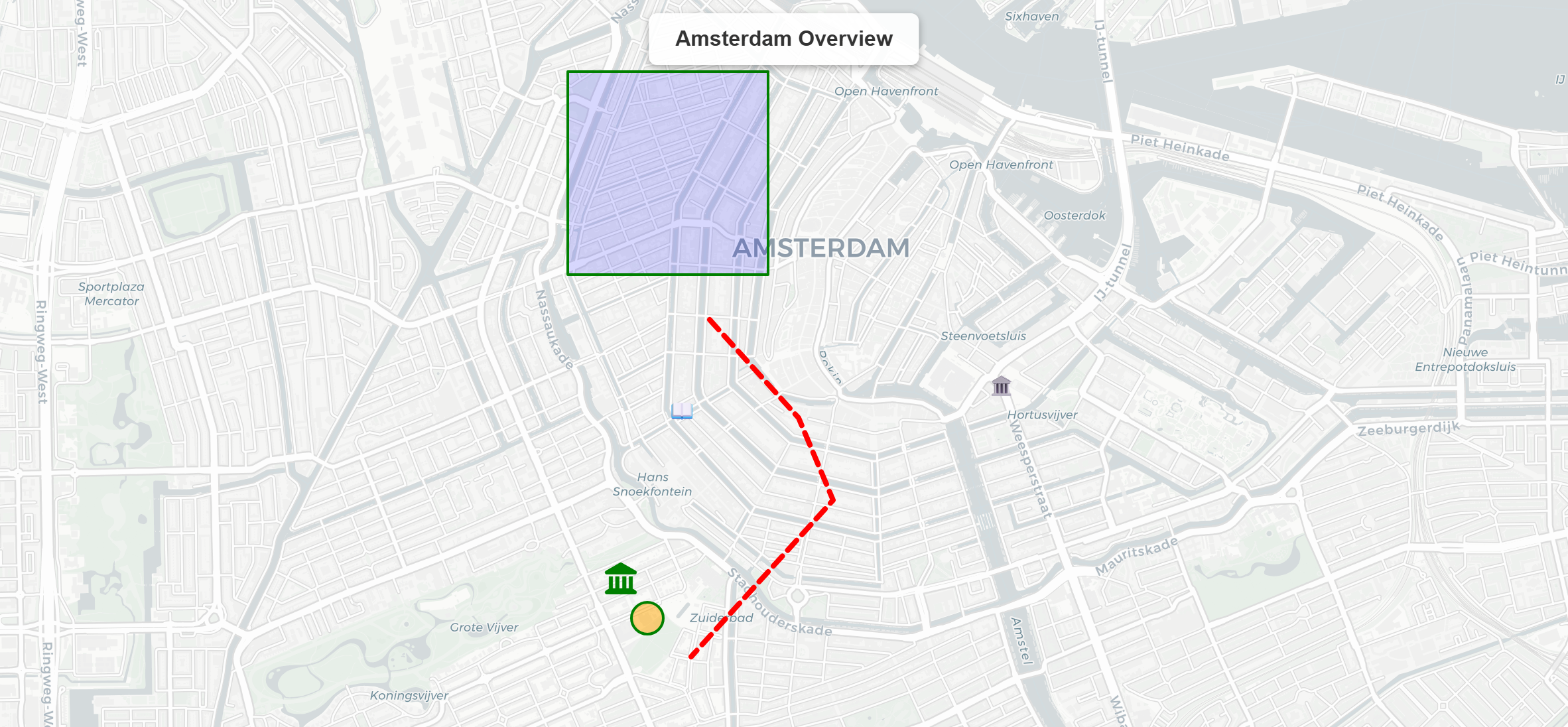
👉 See the Showcase — every feature as a live, interactive map on a single page.
Key features
- 🗺️ Shapely-native — pass
Point,Polygon,LineStringdirectly, including multi-geometries - 📝 Markdown/HTML hover and popup text — bold, italic, links, lists, and code in tooltips
- 📌 Emoji & icon markers — any text or Font Awesome icons as markers
- 🎨 Choropleth & heatmaps — color-coded maps from numeric data
- 📊 GeoPandas integration —
Map.from_geodataframe()one-liner - 🗂️ DataFrame support —
add_dataframe()works with any Pandas or Polars DataFrame with a WKT geometry column - 🌐 Auto CRS detection — RD New (EPSG:28992) coordinates transform automatically
- 📤 Export anywhere — HTML, PNG, SVG, GeoJSON, async variants, and
BytesIObuffers - 🧩 Feature groups — toggleable layers with a built-in layer control
- 🔌 Set of tile providers — OpenStreetMap, CartoDB, Esri, Stamen, and Kadaster
Installation
Mapyta requires Python 3.12+.
uv add mapyta
# or
pip install mapyta
Exporting maps to PNG/SVG images additionally needs a headless browser (Chrome,
Chromium, or Edge) and the export extra:
uv add "mapyta[export]"
# or
pip install "mapyta[export]"
Quickstart
Create your first map:
from shapely.geometry import Point
from mapyta import Map

m = Map(title="Hello Utrecht")
m.add_point(
    point=Point(5.121311, 52.090648),
    tooltip="**Utrecht**",
    popup="**Utrecht**\nCity in the Netherlands\nPopulation: ~350k",
    caption="UTR",
)
m.to_html("hello.html")
Open hello.html in any browser and you're done.
Want the map as an image instead? Get raw PNG bytes or a buffer, no file needed:
png_bytes = m.to_image()   # bytes, for an HTTP response or an email attachment
buf = m.to_bytesio()       # io.BytesIO, e.g. for Flask/FastAPI/Django
See the Showcase for choropleths, heatmaps, clusters, drawing tools, and more — each as a live, interactive map — or work through the Tutorial one concept at a time.
Contributing
Issues and pull requests are welcome. To set up a local development environment:
git clone https://github.com/egarciamendez/mapyta
cd mapyta
uv sync --all-extras --all-groups
uv run pytest
Please open an issue to discuss substantial changes before starting.
License
This project is licensed under the terms of the MIT license.
1 maintainer

Metadata
1 maintainer
Release files for mapyta 1.1.1
For a detailed explanation of source distributions (sdists) and built distributions (wheels), please see the package formats documentation.
Source distribution (sdist)
| File | Size | Uploaded | |
|---|---|---|---|
| mapyta-1.1.1.tar.gz | 3.2 MB | Details |
Built distribution (wheel)
| File | Interpreter | ABI | Platform | Reset |
|---|---|---|---|---|
| mapyta-1.1.1-py3-none-any.whl | Python 3 | none | any | Details |
Total release size: 3.2 MB
Release files / mapyta-1.1.1.tar.gz
| Download URL | mapyta-1.1.1.tar.gz |
|---|---|
| Size | 3.2 MB |
| Tags | Source |
|
SHA-256 checksum How to use checksums |
532d0297d8fbac326a28011ea7e53e1b038681e184bd53963319f2dc40279b37
|
|
BLAKE2b-256 checksum How to use checksums |
815ee4d5b796a840733df8f60234c77aee91f38beb55113231d6dc520d0f45c3
|
| Upload date | |
|
Uploaded using Trusted Publishing? What is trusted publishing? |
Yes |
| Uploaded via |
uv/0.12.8 {"installer":{"name":"uv","version":"0.12.8","subcommand":["publish"]},"python":null,"implementation":{"name":null,"version":null},"distro":{"name":"Ubuntu","version":"24.04","id":"noble","libc":null},"system":{"name":null,"release":null},"cpu":null,"openssl_version":null,"setuptools_version":null,"rustc_version":null,"ci":true}
|
Release files / mapyta-1.1.1-py3-none-any.whl
| Download URL | mapyta-1.1.1-py3-none-any.whl |
|---|---|
| Size | 66.7 kB |
| Tags | Python 3 |
|
SHA-256 checksum How to use checksums |
6c822573f32f9c1d83b4101fdae36d039ca6983ad562b3dcd87067b368d256f9
|
|
BLAKE2b-256 checksum How to use checksums |
66c703d2bf595d6363b1bff660f2937f11437054291aabcd0b2006962296d4c9
|
| Upload date | |
|
Uploaded using Trusted Publishing? What is trusted publishing? |
Yes |
| Uploaded via |
uv/0.12.8 {"installer":{"name":"uv","version":"0.12.8","subcommand":["publish"]},"python":null,"implementation":{"name":null,"version":null},"distro":{"name":"Ubuntu","version":"24.04","id":"noble","libc":null},"system":{"name":null,"release":null},"cpu":null,"openssl_version":null,"setuptools_version":null,"rustc_version":null,"ci":true}
|














