
rio-tiler-crs
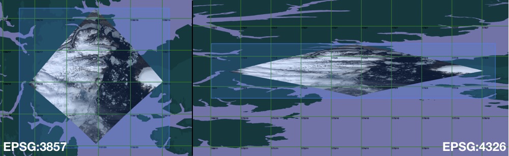
A rio-tiler plugin to create tiles in different projection



Install
$ pip install pip -U
$ pip install rio-tiler-crs

# Or using source

$ pip install git+http://github.com/cogeotiff/rio-tiler-crs
How To
rio-tiler-crs uses morecantile to define the custom tiling grid schema.
- Define grid system
import morecantile
from rasterio.crs import CRS

# Use default TMS
tms = morecantile.tms.get("WorldCRS84Quad")

# or create a custom TMS
crs = CRS.from_epsg(3031)  # Morecantile TileMatrixSet uses Rasterio CRS object
extent = [-948.75, -543592.47, 5817.41, -3333128.95]  # From https:///epsg.io/3031
tms = morecantile.TileMatrixSet.custom(extent, crs)
- read tile
from rio_tiler_crs import COGReader

# Read tile x=10, y=10, z=4
with COGReader("myfile.tif", tms=tms) as cog:
    tile, mask = cog.tile( 10, 10, 4)
API
class COGReader:
    """
    Cloud Optimized GeoTIFF Reader.

    Examples
    --------
    with CogeoReader(src_path) as cog:
        cog.tile(...)

    with rasterio.open(src_path) as src_dst:
        with WarpedVRT(src_dst, ...) as vrt_dst:
            with CogeoReader(None, dataset=vrt_dst) as cog:
                cog.tile(...)

    with rasterio.open(src_path) as src_dst:
        with CogeoReader(None, dataset=src_dst) as cog:
            cog.tile(...)

    Attributes
    ----------
    filepath: str
        Cloud Optimized GeoTIFF path.
    dataset: rasterio.DatasetReader, optional
        Rasterio dataset.
    tms: morecantile.TileMatrixSet, optional
        TileMatrixSet to use, default is WebMercatorQuad.

    Properties
    ----------
    minzoom: int
        COG minimum zoom level in TMS projection.
    maxzoom: int
        COG maximum zoom level in TMS projection.
    bounds: tuple[float]
        COG bounds in WGS84 crs.
    center: tuple[float, float, int]
        COG center + minzoom
    colormap: dict
        COG internal colormap.
    info: dict
        General information about the COG (datatype, indexes, ...)

    Methods
    -------
    tile(0, 0, 0, indexes=(1,2,3), expression="
B1/B2", tilesize=512, resampling_methods="nearest")
        Read a map tile from the COG.
    part((0,10,0,10), indexes=(1,2,3,), expression="
B1/B20", max_size=1024)
        Read part of the COG.
    preview(max_size=1024)
        Read preview of the COG.
    point((10, 10), indexes=1)
        Read a point value from the COG.
    stats(pmin=5, pmax=95)
        Get Raster statistics.
    meta(pmin=5, pmax=95)
        Get info + raster statistics

    """
- COGReader.tile(): Read map tile from a raster
tms = morecantile.tms.get("WorldCRS84Quad")
with COGReader("myfile.tif", tms=tms) as cog:
    tile, mask = cog.tile(1, 2, 3, tilesize=256)

# With indexes
with COGReader("myfile.tif", tms=tms) as cog:
    tile, mask = cog.tile(1, 2, 3, tilesize=256, indexes=1)

# With expression
with COGReader("myfile.tif", tms=tms) as cog:
    tile, mask = cog.tile(1, 2, 3, tilesize=256, expression="B1/B2")
- COGReader.part(): Read part of a raster
Note: tms has no effect on part read.
tms = morecantile.tms.get("WorldCRS84Quad")
with COGReader("myfile.tif", tms=tms) as cog:
    data, mask = cog.part((10, 10, 20, 20))

# Limit output size (default is set to 1024)
with COGReader("myfile.tif", tms=tms) as cog:
    data, mask = cog.part((10, 10, 20, 20), max_size=2000)

# Read high resolution
with COGReader("myfile.tif", tms=tms) as cog:
    data, mask = cog.part((10, 10, 20, 20), max_size=None)

# With indexes
with COGReader("myfile.tif", tms=tms) as cog:
     data, mask = cog.part((10, 10, 20, 20), indexes=1)

# With expression
with COGReader("myfile.tif", tms=tms) as cog:
    data, mask = cog.part((10, 10, 20, 20), expression="B1/B2")
- COGReader.preview(): Read a preview of a raster
Note: tms has no effect on part read.
with COGReader("myfile.tif") as cog:
    data, mask = cog.preview()

# With indexes
with COGReader("myfile.tif") as cog:
    data, mask = cog.preview(indexes=1)

# With expression
with COGReader("myfile.tif") as cog:
    data, mask = cog.preview(expression="B1+2,B1*4")
- COGReader.point(): Read point value of a raster
Note: tms has no effect on part read.
with COGReader("myfile.tif") as cog:
    print(cog.point(-100, 25))

# With indexes
with COGReader("myfile.tif") as cog:
    print(cog.point(-100, 25, indexes=1))
[1]

# With expression
with COGReader("myfile.tif") as cog:
    print(cog.point(-100, 25, expression="B1+2,B1*4"))
[3, 4]
- COGReader.info: Return simple metadata about the raster
with COGReader("myfile.tif") as cog:
    print(cog.info)
{
    "bounds": [-119.05915661478785, 13.102845359730287, -84.91821332299578, 33.995073647795806],
    "center": [-101.98868496889182, 23.548959503763047, 3],
    "minzoom": 3,
    "maxzoom": 12,
    "band_metadata": [[1, {}]],
    "band_descriptions": [[1,"band1"]],
    "dtype": "int8",
    "colorinterp": ["palette"],
    "nodata_type": "Nodata",
    "colormap": {
        "0": [0, 0, 0, 0],
        "1": [0, 61, 0, 255],
        ...
    }
}
- COGReader.stats(): Return image statistics (Min/Max/Stdev)
with COGReader("myfile.tif") as cog:
    print(cog.stats())
{
    "1": {
        "pc": [1, 16],
        "min": 1,
        "max": 18,
        "std": 4.069636227214257,
        "histogram": [
            [...],
            [...]
        ]
    }
}
- COGReader.metadata(): Return COG info + statistics
with COGReader("myfile.tif") as cog:
    print(cog.metadata())
{
    "bounds": [-119.05915661478785, 13.102845359730287, -84.91821332299578, 33.995073647795806],
    "center": [-101.98868496889182, 23.548959503763047, 3],
    "minzoom": 3,
    "maxzoom": 12,
    "band_metadata": [[1, {}]],
    "band_descriptions": [[1,"band1"]],
    "dtype": "int8",
    "colorinterp": ["palette"],
    "nodata_type": "Nodata",
    "colormap": {
        "0": [0, 0, 0, 0],
        "1": [0, 61, 0, 255],
        ...
    }
    "statistics" : {
        1: {
            "pc": [1, 16],
            "min": 1,
            "max": 18,
            "std": 4.069636227214257,
            "histogram": [
                [...],
                [...]
            ]
        }
    }
}
Example
See /demo
Contribution & Development
Issues and pull requests are more than welcome.
dev install
$ git clone https://github.com/cogeotiff/rio-tiler-crs.git
$ cd rio-tiler-crs
$ pip install -e .[dev]
Python >=3.7 only
This repo is set to use pre-commit to run isort, flake8, pydocstring, black ("uncompromising Python code formatter") and mypy when committing new code.
$ pre-commit install

$ git add .

$ git commit -m'my change'
isort....................................................................Passed
black....................................................................Passed
Flake8...................................................................Passed
Verifying PEP257 Compliance..............................................Passed
mypy.....................................................................Passed

$ git push origin


Release files for rio-tiler-crs 2.0.2
For a detailed explanation of source distributions (sdists) and built distributions (wheels), please see the package formats documentation.
Source distribution (sdist)
| File | Size | Uploaded | |
|---|---|---|---|
| rio-tiler-crs-2.0.2.tar.gz | 8.2 kB | Details |
Release files / rio-tiler-crs-2.0.2.tar.gz
| Download URL | rio-tiler-crs-2.0.2.tar.gz |
|---|---|
| Size | 8.2 kB |
| Tags | Source |
|
SHA-256 checksum How to use checksums |
3a6a8e16200c2382a2e465e03905c56abe79cb30d4ceb7b0e183ffdc8033a3c8
|
|
BLAKE2b-256 checksum How to use checksums |
c7dadc4f51a8a4f148955e971789d6107ca86991a716f56dec84c4d8f4f41b39
|
| Upload date | |
|
Uploaded using Trusted Publishing? What is trusted publishing? |
No |
| Uploaded via |
twine/3.1.1 pkginfo/1.5.0.1 requests/2.23.0 setuptools/40.8.0 requests-toolbelt/0.9.1 tqdm/4.46.1 CPython/3.7.2
|














