A GNSS reflectometry software package

Project description
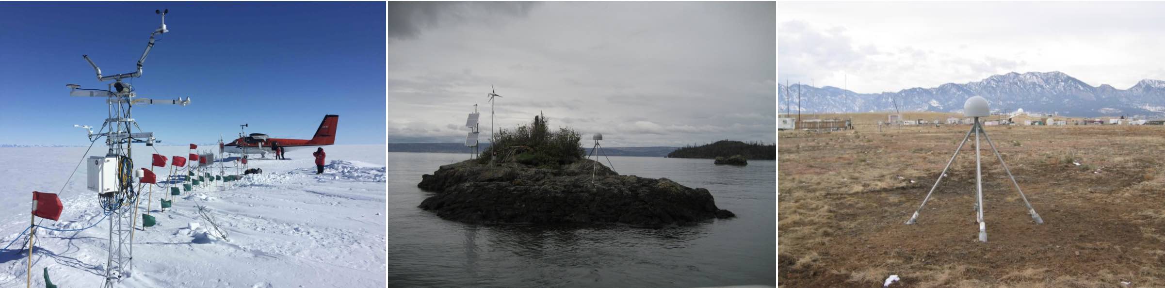
gnssrefl
github version: 1.2.15 


New snowdepth utility.
Specific azimuth regions can now be added at the command line. Use -azlist in make_json_input
There is a new Google Earth utility for reflection zones: refl_zones
We have developed readthedocs style documentation.
We create a new docker every time we update this repository.
We create a new pypi version every time a new version is created.
All access to UNAVCO data will end (unknown date) unless you sign up for an account there
Table of Contents
- Installation
- Understanding the Code
- Products:
- Examples
- Utilities
- Notes about File structure and Formats
- News/Bugs/Future Work
- Publications
- How can you help this project? How can you ask for help?
GNSS-IR was developed with funding from NSF (ATM 0740515, EAR 0948957, AGS 0935725, EAR 1144221, AGS 1449554) and
NASA (NNX12AK21G and NNX13AF43G). gnssrefl was initially developed
as a fun post-retirement project, followed by support from NASA (80NSSC20K1731).
This documentation was updated on January 30, 2023
Kristine M. Larson
Release history Release notifications | RSS feed


Download files
Download the file for your platform. If you're not sure which to choose, learn more about installing packages.
Source Distribution
File details
Details for the file gnssrefl-1.2.15.tar.gz.
File metadata
- Download URL: gnssrefl-1.2.15.tar.gz
- Upload date:
- Size: 8.8 MB
- Tags: Source
- Uploaded using Trusted Publishing? No
- Uploaded via: twine/4.0.1 CPython/3.11.1
File hashes
| Algorithm | Hash digest | |
|---|---|---|
| SHA256 |
da0adea3593dd6324fd661e36db84edc6545c3db279c195ab4a65adad634027f
|
|
| MD5 |
3061a8d0d3fd0304d63c59960ae269a8
|
|
| BLAKE2b-256 |
2dbf1d77f6bcd7a9302539b84cfa3caf83f974b9769d9fe197de50197e09cd83
|


