

roadstyle
Beautiful, interactive road maps from Python.
One offline HTML file with real road cartography, Google Street View and a JavaScript API.





Install · Quickstart · Gallery · Live map · AI agents · Documentation
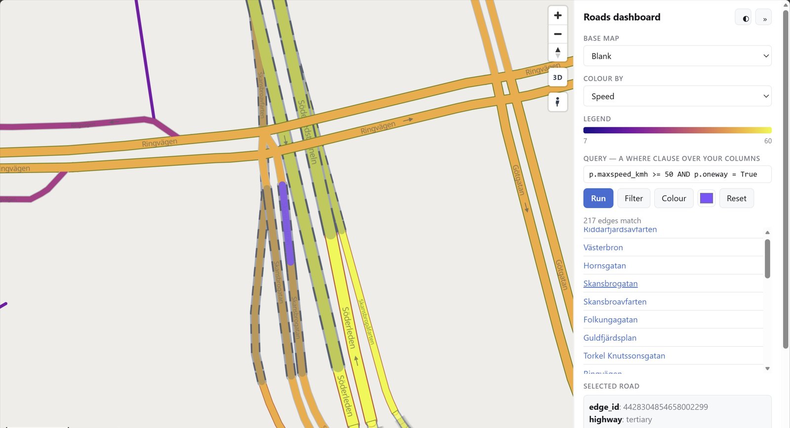
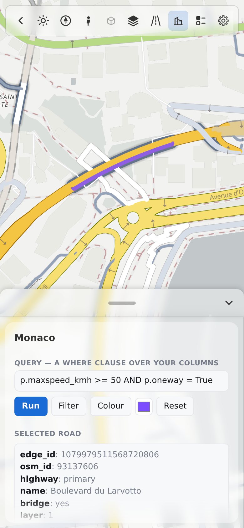
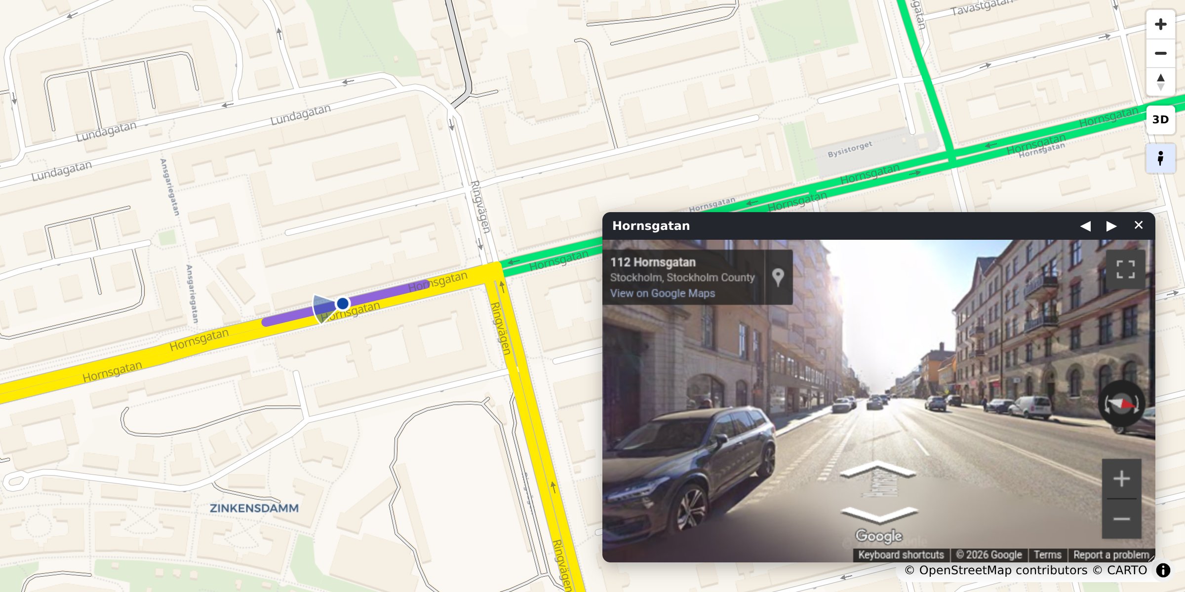
Why roadstyle
- Real road cartography. Casing and fill, widths that change with zoom, street names, one-way arrows, tunnels drawn under and bridges over, and optional 3D bridge decks.
- One offline file. Map, data and styling in a single HTML page: open it without a server, email it, or put it on any website.
- Street View built in. Click any road to see it in Google Street View, facing the way it runs.
- Any road data. A GeoDataFrame, a file, DuckDB, Arrow, osmnx or duckOSM.
- Colour by your data. Speed, traffic or any column, with a legend and a menu of colourings.
- Scriptable. A
window.rs*JavaScript API and events for your own dashboard, and shared parts for its panel: a level editor and a design panel (themes, road colours and widths, names, layers) that any page can open. - Ready for AI agents. An MCP server and an agent skill.
What is new in 0.28.0
- The design panel is a dashboard part: themes, road colours and widths, names and layers, in any page with a dashboard (guide).
- 3D buildings: solid by default (a road behind a building does not show through the roof), an Opacity slider and
buildings_opacity=, and the far buildings of a tilted map. - The open card has an accent ring and an accent title.
What is new in 0.27.0
- The dashboard's panel starts empty, and a page adds what it needs: its own HTML, the query box or the road card, with
dashboard={"panel": {"sections": [...]}}orrs.sections.add. The map of a dashboard has the defaults of a map page. This is a breaking change: see Migrate a dashboard. - Cards: one standard for the panel. A section with a
labelis a card, with or without a background (background: False), that folds or not (fold: True). Every card has the same width, gap, padding and title row, and the "?" ofrs.help.buttonis at the end of the title row. - Every part of the dashboard follows the dark theme, and every scroll area scrolls the same way as the panel.
- Street View: Coverage is an icon after the provider switch, and the close button stays at the top right.
What is new in 0.26.3
- A dashboard manual. Three pages with maps that run: an overview, the Python SDK and the JavaScript API. Each example has a Run button.
- The two directions of a two-way road are two halves of the road at every zoom. A colour on one direction does not hide the other.
- Fewer arrows on a tiled page, and correct arrows on a page with a vector base map. Monaco, zoom 16.5: 9 arrows, not 85.
- Street View: the coverage shows on any road, and the header of the window keeps the name of the road.
duckosm.pagedraws the base map's textures and icons, anddashboard=Falsegives the dashboard without a panel.
What is new in 0.26.1
- One accent colour. The dashboard uses the Sonocount teal in the light and the dark theme, defined once. The corner box has the shape of the bar, a button with a text shows no tooltip box, and every tool of a phone's one-row bar can be reached.
- Street View docked, and a dashboard with no panel.
street_view="dock"puts Street View beside the map with a divider that you drag.dashboard={"panel": None}gives a map with the toolbox only. - Help and folding in the panel.
rs.help.buttonadds a "?" button with its own words to a card or a label, all of them open one window. A Collapse all / Expand all control folds the panel's sections. The level editor has a "?" help window with two links to the levels guide. - Fix: a page that starts in the dark theme no longer shows the error "Style is not done loading".
What is new in 0.26.0
- A standard dashboard and toolbox.
rs.render_dashboard(edges)makes a map with one panel and one bar of tools: navigate (zoom, turn and tilt in one box), road filter, base maps, colour and legend, settings and credits. A tool that the page cannot use is grey, and its tooltip says why. The toolbox is at the right edge and the panel at the left. On a phone the bar is one row that you move sideways, and the panel is a bottom sheet. - Seven base maps, no key. OpenFreeMap Liberty and Positron (the default), OpenStreetMap, Esri Gray, Esri Streets, Esri Satellite and Blank, each with its dark twin when it has one. The CARTO maps are gone, so no base map needs a key. The theme switch also turns the style's own layers dark.
- Tiles by default, one rule. Every page keeps its roads as MLT vector tiles to zoom 16, with one road layer for every zoom. The page, the
browser worker,
export_styleandroadstyle tilesall use the same tiling rule.tiles=Falsegives GeoJSON roads, andtile_format="mvt"gives MVT. - The level editor is in the panel.
roadstyle levels edit AREA_DIRopens it from the Rust program. It uses the page's standard panel, with an apply bar, red and blue picks, the area boundary (levels make --boundary) andedits.csvin the History tab. - Shared dashboard parts. Help window, hover box, tabs, number tiles, tables, charts and chips are in the panel's own look, in both themes.
rs.classifymakes colour classes for roads.
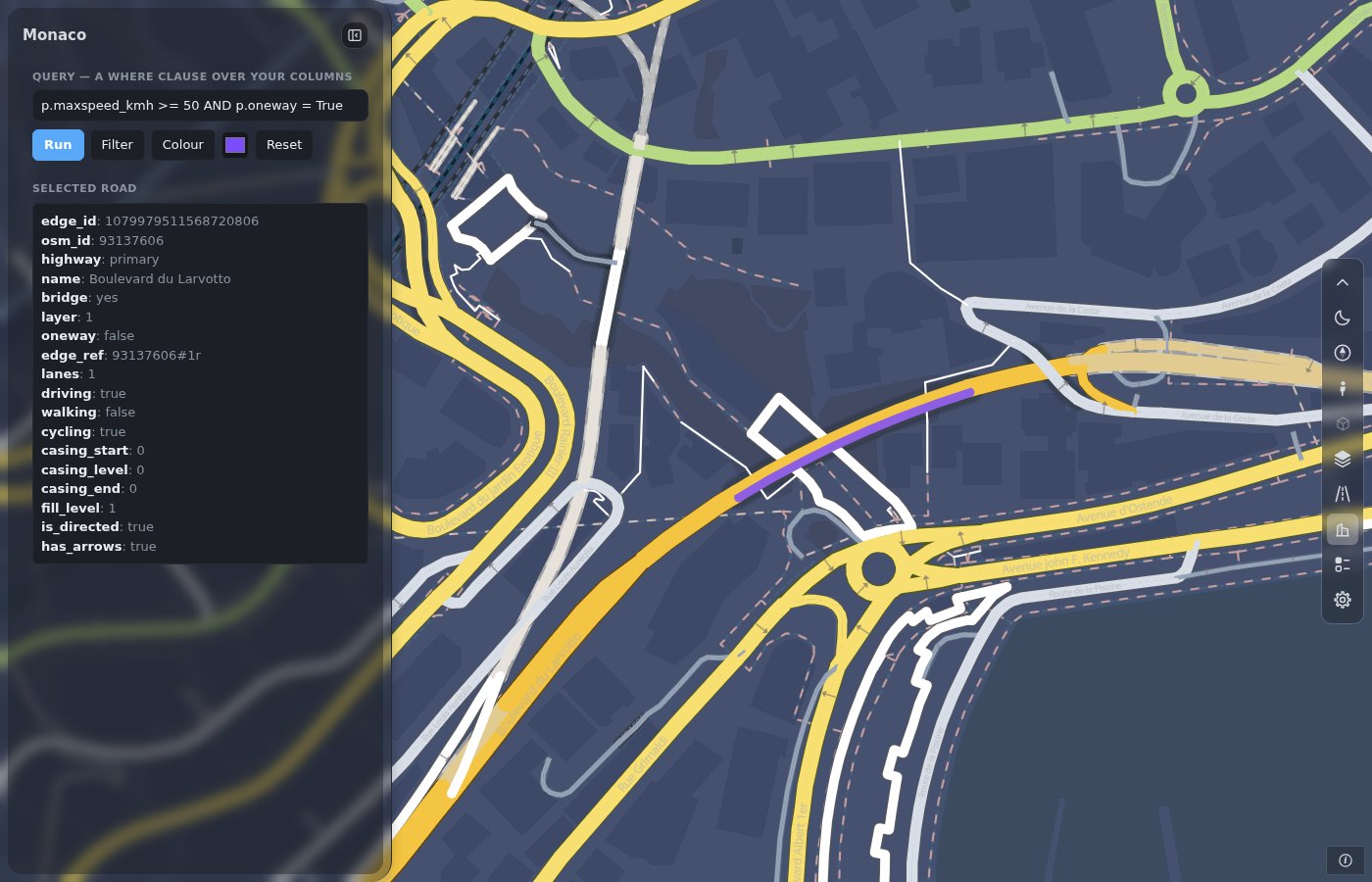
More: What is new in 0.27.0 · Dashboard layout · Dashboard parts · Big networks · Move a script from 0.25 · Documentation.
Install
pip install roadstyle              # core
pip install "roadstyle[all]"       # + studio, DuckDB, …
Python ≥ 3.10. Individual extras and the dev setup: Install.
Quickstart
From OpenStreetMap, no data needed. Any place, with osmnx (pip install osmnx):
import osmnx as ox
import roadstyle as rs

G = ox.graph_from_place("Tartu, Estonia", network_type="drive", simplify=False)
G = ox.simplify_graph(G, edge_attrs_differ=["bridge", "tunnel"])   # keep tunnels and bridges apart
rs.render_edges(ox.graph_to_gdfs(G, nodes=False)).save("tartu.html")
From your own data. Any file or GeoDataFrame with line geometry and a highway column:
import geopandas as gpd
import roadstyle as rs

edges = gpd.read_file("edges.gpkg")        # LineStrings + a `highway` column, any CRS
rs.render_edges(edges).save("map.html")    # open map.html: no server (Street View needs one)
More looks:
rs.render_edges(edges, basemap="ofm_dark", view_3d=True)                # dark, 3D bridge decks
rs.render_edges(edges, palette="carto", basemap="ofm_positron")        # the classic OSM look
rs.render_edges(edges, color_by="aadt", cmap="viridis")                # colour by your data
rs.render_edges(edges, palette="mono", color_options={                 # several colourings,
    "Traffic": {"color_by": "aadt", "cmap": "viridis"},                #   switched in the browser
    "Speed":   {"color_by": "maxspeed_kmh", "cmap": "magma"}})
rs.render_edges(edges, tiles=False)                                    # GeoJSON roads (MLT tiles are the default)
rs.render_dashboard(edges).save("dashboard.html")                      # map + panel + the standard toolbox
rs.render_street_view(edges).save("street_view.html")                  # map and Street View side by side
No Python? roadstyle edges.gpkg -o map.html --basemap ofm_dark, or click through it in the
workbench: pip install "roadstyle[studio]" && roadstyle studio.
Gallery
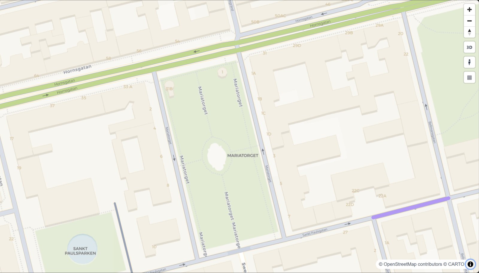 The road map look rs.render_edges(edges) |
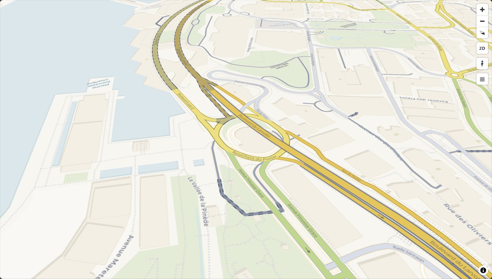 Bridges and tunnels rs.render_edges(edges) |
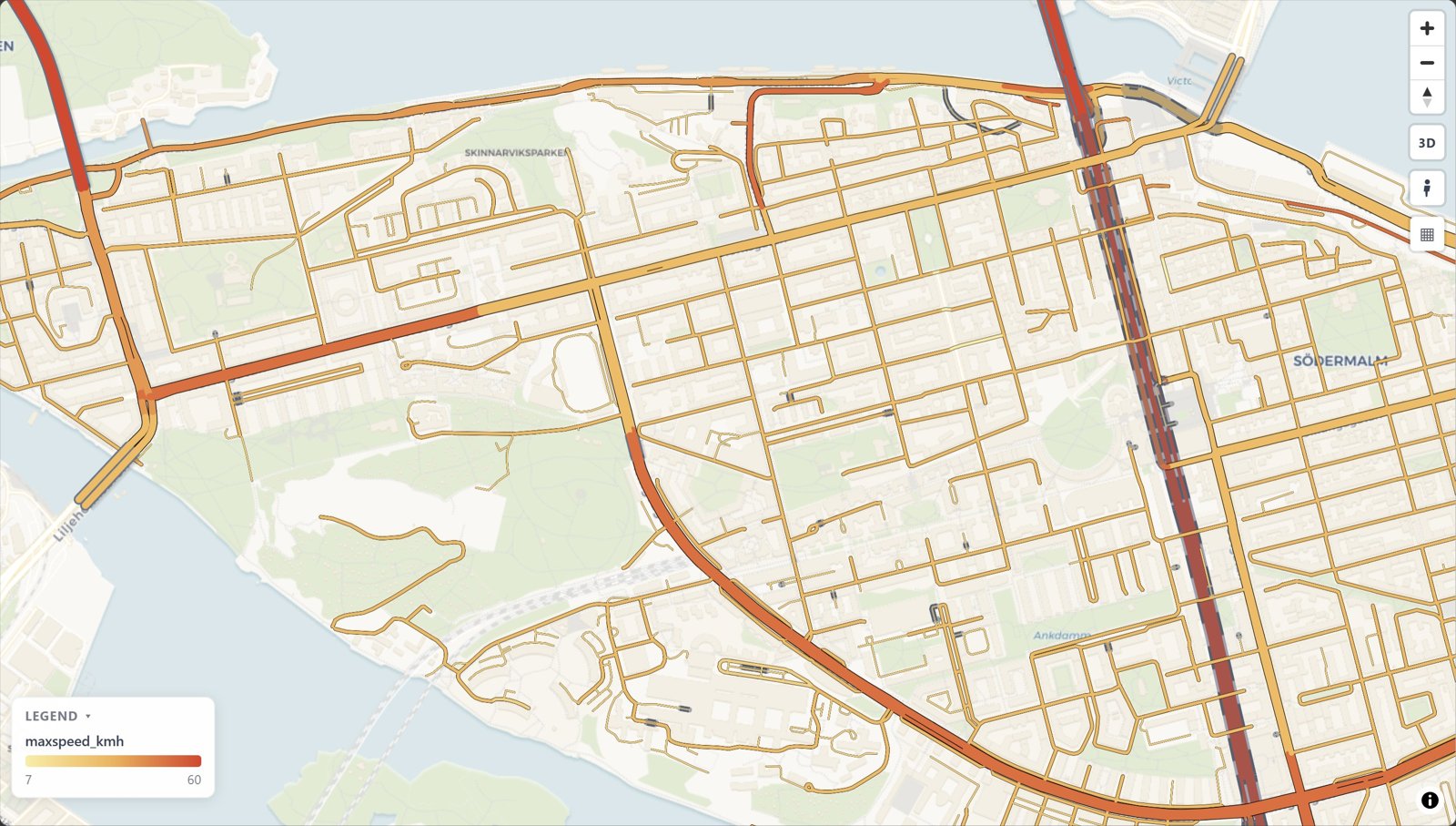 Colour by your data color_by="maxspeed_kmh" |
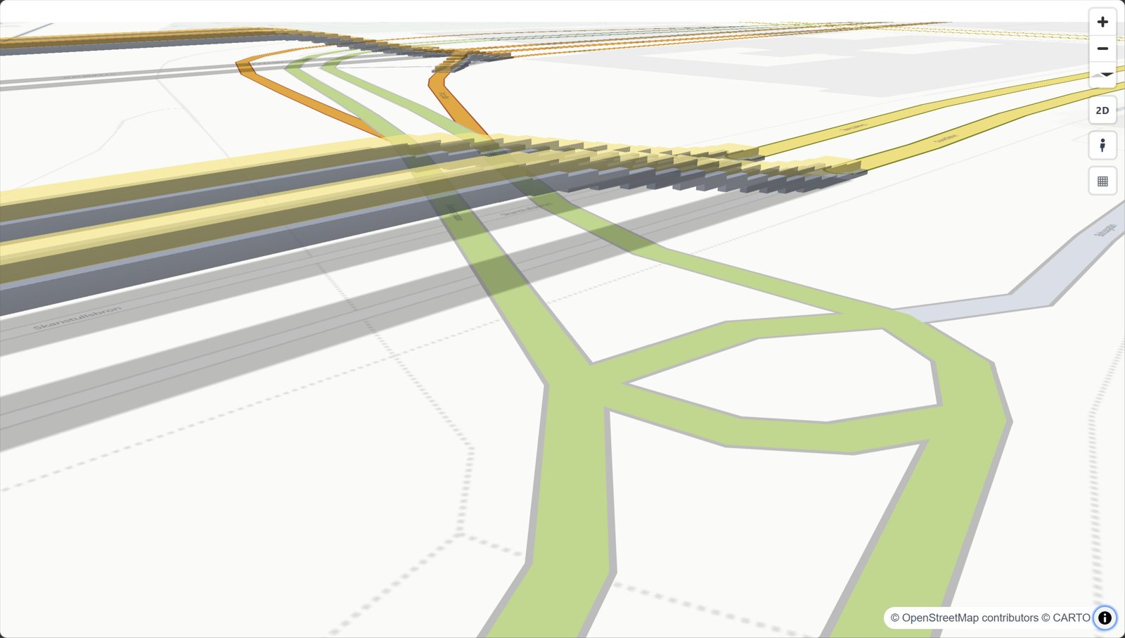 3D bridges view_3d=True |
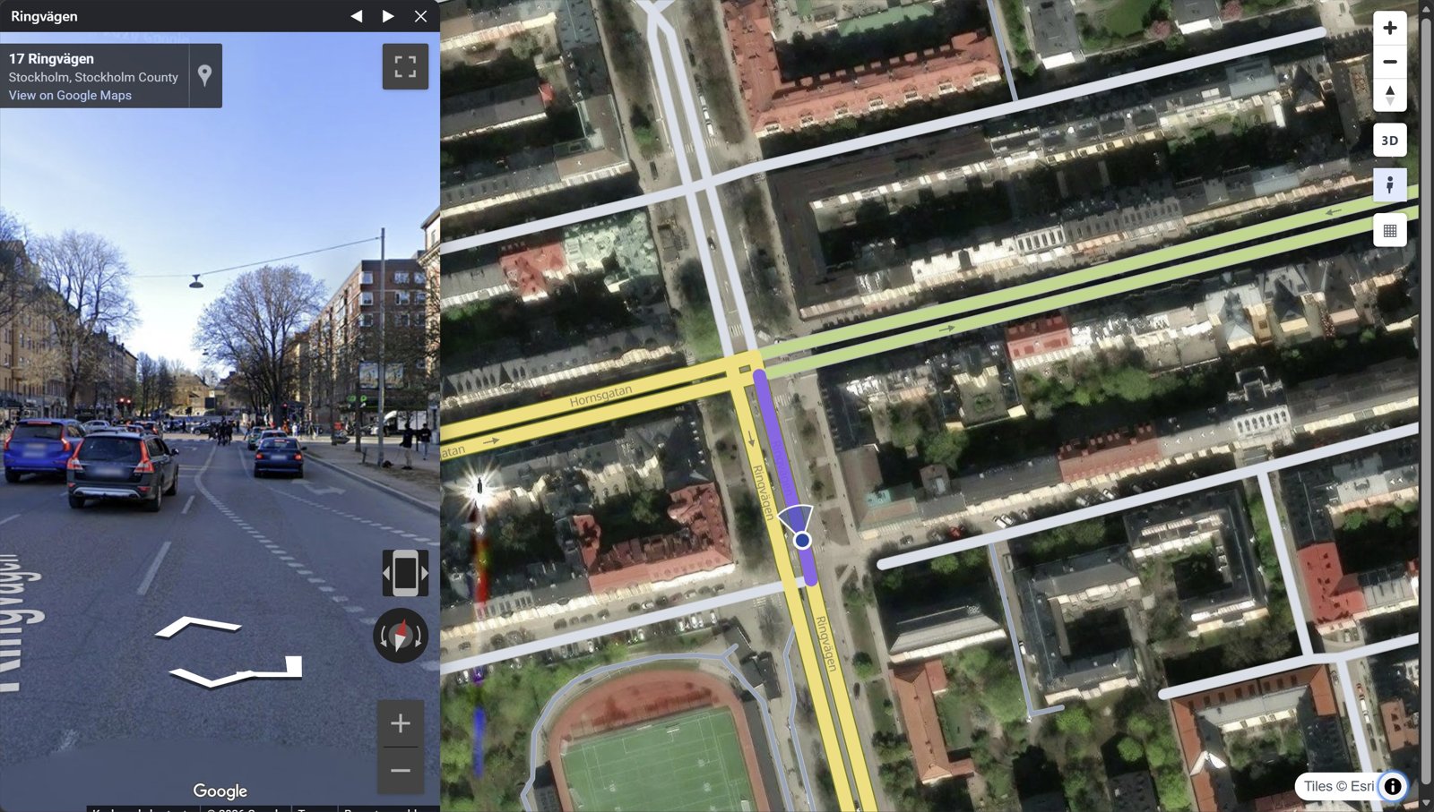 Street View click a road |
Dashboard rs.render_dashboard(edges) |
Every look with its code: the gallery.
What goes in
Only geometry and highway are required. Other columns switch features on:
| Column | Powers |
|---|---|
geometry (LineString, any CRS) |
the edges. Each edge is directed: a two-way road is two edges with reversed geometry |
highway (OSM class) |
colour, width, casing, draw order |
name |
street labels, popup title |
oneway |
direction arrows |
bridge / tunnel / layer |
grade separation: tunnels below, bridges on decks above |
edge_id |
popups; 64-bit ids stay exact |
| anything else | shown in the popup, queryable from JavaScript |
duckOSM (duckosm export-gis) exports exactly this, and
osmnx edges work as they are: rs.render_edges(ox.graph_to_gdfs(G, nodes=False)).
Drive it from JavaScript
The saved page exposes window.rs* functions and rs:* events:
const ids = rsQuery(p => p.maxspeed_kmh > 30); // feature ids whose properties match
rsColor(ids, "#ff00aa");  rsFocus(ids);       // paint them, fit the camera
document.addEventListener("rs:select", e => console.log(e.detail.properties));
Every function and event: JavaScript API.
For AI agents
MCP server. Lets any MCP-capable AI app (Claude Code, Claude Desktop, Cursor, …) draw road maps
without writing code: render_place("Tartu, Estonia"), render_file("roads.gpkg") and snapshot.
Each saves an HTML map and returns its path plus a PNG preview the agent can look at.
claude mcp add roadstyle -- uvx roadstyle-mcp
Claude Desktop, and where the maps go
In claude_desktop_config.json:
{"mcpServers": {"roadstyle": {"command": "uvx", "args": ["roadstyle-mcp"]}}}
Maps are saved in ~/roadstyle-maps/. The PNG preview needs Chromium, once:
uvx --from roadstyle-mcp playwright install chromium.
Claude Code plugin. The MCP server and the skill below in one install:
/plugin marketplace add Khoshkhah/roadstyle
/plugin install roadstyle@roadstyle
For agents that write code:
skills/roadstyle/SKILL.md: a skill for agents that use roadstyle (the one call, the data contract, the JS API, the traps). Install it for Claude Code:mkdir -p ~/.claude/skills/roadstyle && curl -fsSL -o ~/.claude/skills/roadstyle/SKILL.md \ https://raw.githubusercontent.com/Khoshkhah/roadstyle/main/skills/roadstyle/SKILL.md
AGENTS.md: for agents working on this repo.llms.txt: the docs site as a link list for LLMs.
API keys
The key is optional. roadstyle works without it, just with less. The base maps need no key.
- Google Maps, for Street View. Street View works with no key. A key adds a Linked mode: a real panorama, with the map marker walking and turning with you.
Setting up the Google Maps key
Street View works with no key: the keyless Google embed. With a Google Maps JavaScript API key, the Street View panel and window get a Linked / Classic switch. Linked is a real panorama: the map marker walks and turns with you, and only Google's own street photos are shown. Classic is the keyless embed. To get a key:
- In the Google Cloud console, create a project and enable Maps JavaScript API (Google asks for a billing account on the project).
- Under APIs & Services > Credentials, create an API key.
- Restrict it: Application restrictions = Websites, listing your site's addresses
(e.g.
https://example.com/*); API restrictions = Maps JavaScript API only.
Then pass it in:
rs.render_edges(edges, street_view_key="AIza…")         # the floating Street View window
rs.render_street_view(edges, street_view_key="AIza…")   # the side-by-side page
The key is written into the page, as every browser key is, so the site restriction in step 3 is
what protects it. It also means Linked works only on the addresses you listed: to try it on
localhost, add http://localhost:*/* to the list. Keep the key out of git, for example in an
environment variable.
More: settings & base maps · Google Street View.
Documentation
khoshkhah.github.io/roadstyle, with live maps on every page.
| Where | What you find |
|---|---|
| Get started | install, a first map, what your data needs |
| Guides | style the roads · colour by your data · your own layers · Google Street View · big networks · dashboards & JavaScript · dashboard layout · dashboard parts · which road is on top · edit the design of a map · on a website |
| Gallery | a picture and one line of code per look |
| Rust engine | the one engine: the style, the tiles, the levels and the page; the browser package and the crates |
| Reference | every parameter · JavaScript API · settings & base maps · command line |
| Changelog | what changed in each release |
Built on
- MapLibre GL JS (BSD-3-Clause) draws every web map: roadstyle writes its style and data, and a copy of MapLibre is inlined in each saved page so it opens offline.
- OpenStreetMap data (© OpenStreetMap contributors, ODbL) and the openstreetmap-carto style, whose road classes, colours and widths roadstyle follows.
- HiGHS, through SciPy, is the optional Python solver of which road is drawn on top. The default solver is in Rust.
- GeoPandas and Shapely for the geometry.
License
MIT. Base-map tiles come from third-party services (OpenFreeMap, OSM, Esri) with their own attribution and terms.
1 maintainer

Metadata
1 maintainer
Release files for roadstyle 0.28.0
For a detailed explanation of source distributions (sdists) and built distributions (wheels), please see the package formats documentation.
Source distribution (sdist)
| File | Size | Uploaded | Provenance | Actions |
|---|---|---|---|---|
| roadstyle-0.28.0.tar.gz | 3.8 MB | With provenance | Details for roadstyle-0.28.0.tar.gz |
Built distributions (wheels)
| File | Actions Reset | |||
|---|---|---|---|---|
| roadstyle-0.28.0-cp39-abi3-win_amd64.whl | CPython 3.9 | abi3 | Windows x86-64 | Details for roadstyle-0.28.0-cp39-abi3-win_amd64.whl |
| roadstyle-0.28.0-cp39-abi3-manylinux2014_x86_64.manylinux_2_17_x86_64.whl | CPython 3.9 | abi3 | Linux glibc 2.17+ x86-64 | Details for roadstyle-0.28.0-cp39-abi3-manylinux2014_x86_64.manylinux_2_17_x86_64.whl |
| roadstyle-0.28.0-cp39-abi3-manylinux2014_aarch64.manylinux_2_17_aarch64.whl | CPython 3.9 | abi3 | Linux glibc 2.17+ ARM64 | Details for roadstyle-0.28.0-cp39-abi3-manylinux2014_aarch64.manylinux_2_17_aarch64.whl |
| roadstyle-0.28.0-cp39-abi3-macosx_11_0_arm64.whl | CPython 3.9 | abi3 | macOS 11.0+ ARM64 | Details for roadstyle-0.28.0-cp39-abi3-macosx_11_0_arm64.whl |
| roadstyle-0.28.0-cp39-abi3-macosx_10_12_x86_64.whl | CPython 3.9 | abi3 | macOS 10.12+ x86-64 | Details for roadstyle-0.28.0-cp39-abi3-macosx_10_12_x86_64.whl |
Total release size: 47.5 MB
Release files / roadstyle-0.28.0.tar.gz
| Download URL | roadstyle-0.28.0.tar.gz |
|---|---|
| Size | 3.8 MB |
| Tags | Source |
|
SHA-256 checksum How to use checksums |
44c35611e54b24d34b3ec4f8ed8299a45f29b951a201fa548dde48a547d69414
|
|
BLAKE2b-256 checksum How to use checksums |
462ff23a5848f92c674c12e079c6ed36e64a7f5beede53ec39d5d34f922b6067
|
| Upload date | |
|
Uploaded using Trusted Publishing? What is trusted publishing? |
Yes |
| Uploaded via |
twine/7.0.0 CPython/3.13.16
|
Provenance
Provenance describes where a file came from. On PyPI, provenance is shared via attestations, which provide a verifiable record of the build or publishing details. View details, limitations and caveats.


PyPI Publish Attestation
PyPI verified that this artifact, at this checksum, originated from the publisher listed below.
Signed by GitHub Actions, verified by PyPI on Nov 5, 2026.
Transparency logRelease files / roadstyle-0.28.0-cp39-abi3-win_amd64.whl
| Download URL | roadstyle-0.28.0-cp39-abi3-win_amd64.whl |
|---|---|
| Size | 9.0 MB |
| Tags | CPython 3.9 Windows x86-64 abi3 |
|
SHA-256 checksum How to use checksums |
3f2c22382dfc7b5929f1de7a8a721bccb1834bf3014eae6b54eecd9b8f880ef2
|
|
BLAKE2b-256 checksum How to use checksums |
4cd359bfc6a88e03cfd5fbc4bc43b133632d3bd65580fb71ca9d8ee24ea01ce4
|
| Upload date | |
|
Uploaded using Trusted Publishing? What is trusted publishing? |
Yes |
| Uploaded via |
twine/7.0.0 CPython/3.13.16
|
Provenance
Provenance describes where a file came from. On PyPI, provenance is shared via attestations, which provide a verifiable record of the build or publishing details. View details, limitations and caveats.
PyPI Publish Attestation
PyPI verified that this artifact, at this checksum, originated from the publisher listed below.
Signed by GitHub Actions, verified by PyPI on Nov 5, 2026.
Transparency logRelease files / roadstyle-0.28.0-cp39-abi3-manylinux2014_x86_64.manylinux_2_17_x86_64.whl
| Download URL | roadstyle-0.28.0-cp39-abi3-manylinux2014_x86_64.manylinux_2_17_x86_64.whl |
|---|---|
| Size | 9.0 MB |
| Tags | CPython 3.9 Linux glibc 2.17+ x86-64 abi3 |
|
SHA-256 checksum How to use checksums |
f1cb58197fe255cfe93c85fa96592513c51bd6393fd714c5a61eb892f2a5c769
|
|
BLAKE2b-256 checksum How to use checksums |
055585350cda5a94c6d1c43fa8d3e9f49de3a097968c13588042481109ac1ad4
|
| Upload date | |
|
Uploaded using Trusted Publishing? What is trusted publishing? |
Yes |
| Uploaded via |
twine/7.0.0 CPython/3.13.16
|
Provenance
Provenance describes where a file came from. On PyPI, provenance is shared via attestations, which provide a verifiable record of the build or publishing details. View details, limitations and caveats.
PyPI Publish Attestation
PyPI verified that this artifact, at this checksum, originated from the publisher listed below.
Signed by GitHub Actions, verified by PyPI on Nov 5, 2026.
Transparency logRelease files / roadstyle-0.28.0-cp39-abi3-manylinux2014_aarch64.manylinux_2_17_aarch64.whl
| Download URL | roadstyle-0.28.0-cp39-abi3-manylinux2014_aarch64.manylinux_2_17_aarch64.whl |
|---|---|
| Size | 8.6 MB |
| Tags | CPython 3.9 Linux glibc 2.17+ ARM64 abi3 |
|
SHA-256 checksum How to use checksums |
3bffe3a6af54ee00914c1db79e9ed524a7e04490cdd85b005e4c2541b5145fa2
|
|
BLAKE2b-256 checksum How to use checksums |
9dbb15f9837f317667630f12a8ae2edd175d3d9d4b95d8cdbc788601a9e720da
|
| Upload date | |
|
Uploaded using Trusted Publishing? What is trusted publishing? |
Yes |
| Uploaded via |
twine/7.0.0 CPython/3.13.16
|
Provenance
Provenance describes where a file came from. On PyPI, provenance is shared via attestations, which provide a verifiable record of the build or publishing details. View details, limitations and caveats.
PyPI Publish Attestation
PyPI verified that this artifact, at this checksum, originated from the publisher listed below.
Signed by GitHub Actions, verified by PyPI on Nov 5, 2026.
Transparency logRelease files / roadstyle-0.28.0-cp39-abi3-macosx_11_0_arm64.whl
| Download URL | roadstyle-0.28.0-cp39-abi3-macosx_11_0_arm64.whl |
|---|---|
| Size | 8.4 MB |
| Tags | CPython 3.9 abi3 macOS 11.0+ ARM64 |
|
SHA-256 checksum How to use checksums |
c41380058c38bfde591295f6e1199d0f729eb57b770d2b0189c46372653da2be
|
|
BLAKE2b-256 checksum How to use checksums |
863c1d47fe35f8866b399e7575f8abd0db9a41f256b6ece82f37eb7496cb558a
|
| Upload date | |
|
Uploaded using Trusted Publishing? What is trusted publishing? |
Yes |
| Uploaded via |
twine/7.0.0 CPython/3.13.16
|
Provenance
Provenance describes where a file came from. On PyPI, provenance is shared via attestations, which provide a verifiable record of the build or publishing details. View details, limitations and caveats.
PyPI Publish Attestation
PyPI verified that this artifact, at this checksum, originated from the publisher listed below.
Signed by GitHub Actions, verified by PyPI on Nov 5, 2026.
Transparency logRelease files / roadstyle-0.28.0-cp39-abi3-macosx_10_12_x86_64.whl
| Download URL | roadstyle-0.28.0-cp39-abi3-macosx_10_12_x86_64.whl |
|---|---|
| Size | 8.8 MB |
| Tags | CPython 3.9 abi3 macOS 10.12+ x86-64 |
|
SHA-256 checksum How to use checksums |
9406daf8fbaee369c446177939f41af5439c9914d0795d7ac20305ebdbc80921
|
|
BLAKE2b-256 checksum How to use checksums |
26cbd4ba546d262a02e04ad687064e0199b347cf8c326dc7741f6eae8e365ed1
|
| Upload date | |
|
Uploaded using Trusted Publishing? What is trusted publishing? |
Yes |
| Uploaded via |
twine/7.0.0 CPython/3.13.16
|
Provenance
Provenance describes where a file came from. On PyPI, provenance is shared via attestations, which provide a verifiable record of the build or publishing details. View details, limitations and caveats.
PyPI Publish Attestation
PyPI verified that this artifact, at this checksum, originated from the publisher listed below.
Signed by GitHub Actions, verified by PyPI on Nov 5, 2026.
Transparency logSecurity for roadstyle 0.28.0
Provenance
Provenance describes where a file came from. On PyPI, provenance is shared via attestations, which provide a verifiable record of the build or publishing details. View details, limitations and caveats.
Full provenance
All 6 files in this release have been uploaded with provenance metadata.
Attestation for roadstyle-0.28.0.tar.gz
PyPI Publish Attestation
PyPI verified that this artifact, at this checksum, originated from the publisher listed below.
Signed by GitHub Actions, verified by PyPI on Nov 5, 2026.
Transparency logA note on package security
PyPI is a repository for distributing packages, not a service for auditing them. While third-party security researchers and our staff do their best to detect and remove malicious packages, PyPI cannot guarantee the quality, security or suitability of any given package.
To learn more about protecting yourself from malicious actors, visit our package security documentation.














