


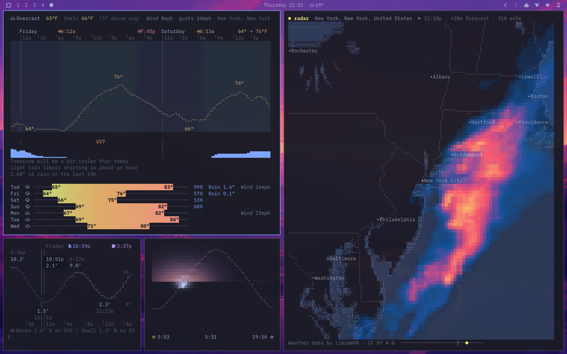
linecast turns free public data into six live, mouse-friendly terminal apps. It is pure Python, has no dependencies, adapts to your terminal theme, and needs no account or API key for its core experience.
| Command | What it shows |
|---|---|
weather |
Current conditions, an hourly braille temperature curve, seven-day forecast, air quality, comparisons, and official alerts |
sunshine |
The Sun moving across its daily arc, with sky gradients, day length, and moon phase |
moon |
A shaded lunar disc, illumination, altitude, rise and set times, and the next full and new moons |
tides |
A sunlight-shaded tide curve, current water level, and high and low times |
radar |
Animated worldwide radar or satellite imagery, warning polygons, temperature, and wind |
maps |
Detailed vector streets, terrain and bathymetry, a spinnable globe with live daylight and clouds, place search, and directions |
Quick try
Run linecast immediately with uv, without installing it:
uvx linecast weather
Install
With uv:
uv tool install linecast
Or use Homebrew:
brew tap ashuttl/linecast
brew install linecast
pipx install linecast and pip install linecast work too. linecast requires Python 3.10+ on macOS or Linux.
Take it outside
weather
sunshine
moon
tides
radar
maps
Every command finds your approximate location from your IP address and opens in live mode when run in a terminal. Drag or scroll where it makes sense; each app shows its keyboard controls along the bottom.
Pass a place name or coordinates to go somewhere else:
weather --location "Québec"
radar --location 41.88,-87.63
maps --view terrain --location "Innsbruck"
maps --to "Portland Head Light" --profile bike
Use --print for one static frame. When output is piped, linecast does this automatically. Weather, sunshine, moon, and tides also offer --json and compact --oneline output for status bars.
If a short command name conflicts with something already on your system, everything also lives under the linecast namespace:
linecast weather --metric
linecast radar --theme rainbow
linecast maps --view terrain
A closer look
Weather
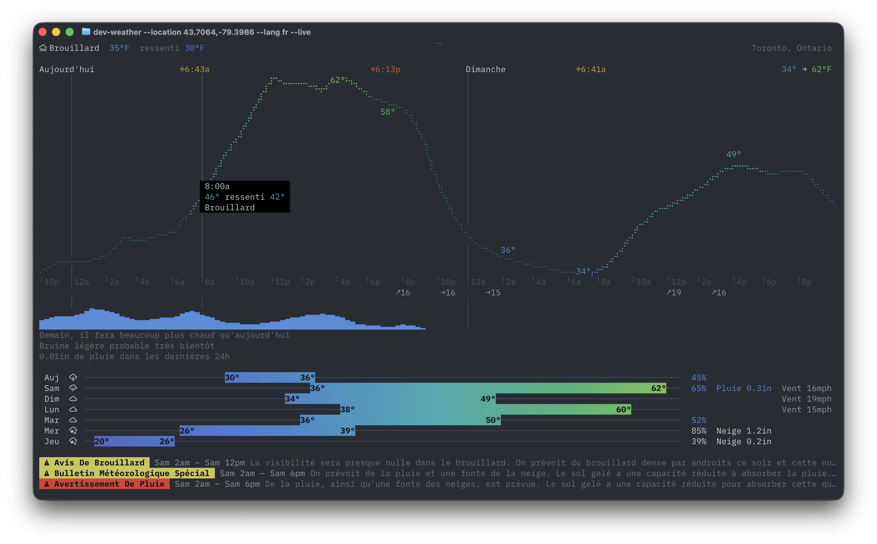
The weather dashboard combines current conditions, daylight-shaded hourly temperatures, precipitation, daily ranges, air quality, and natural-language comparisons. Official alerts are available across 36 countries and open to their full detail in live mode.
Sunshine and Moon
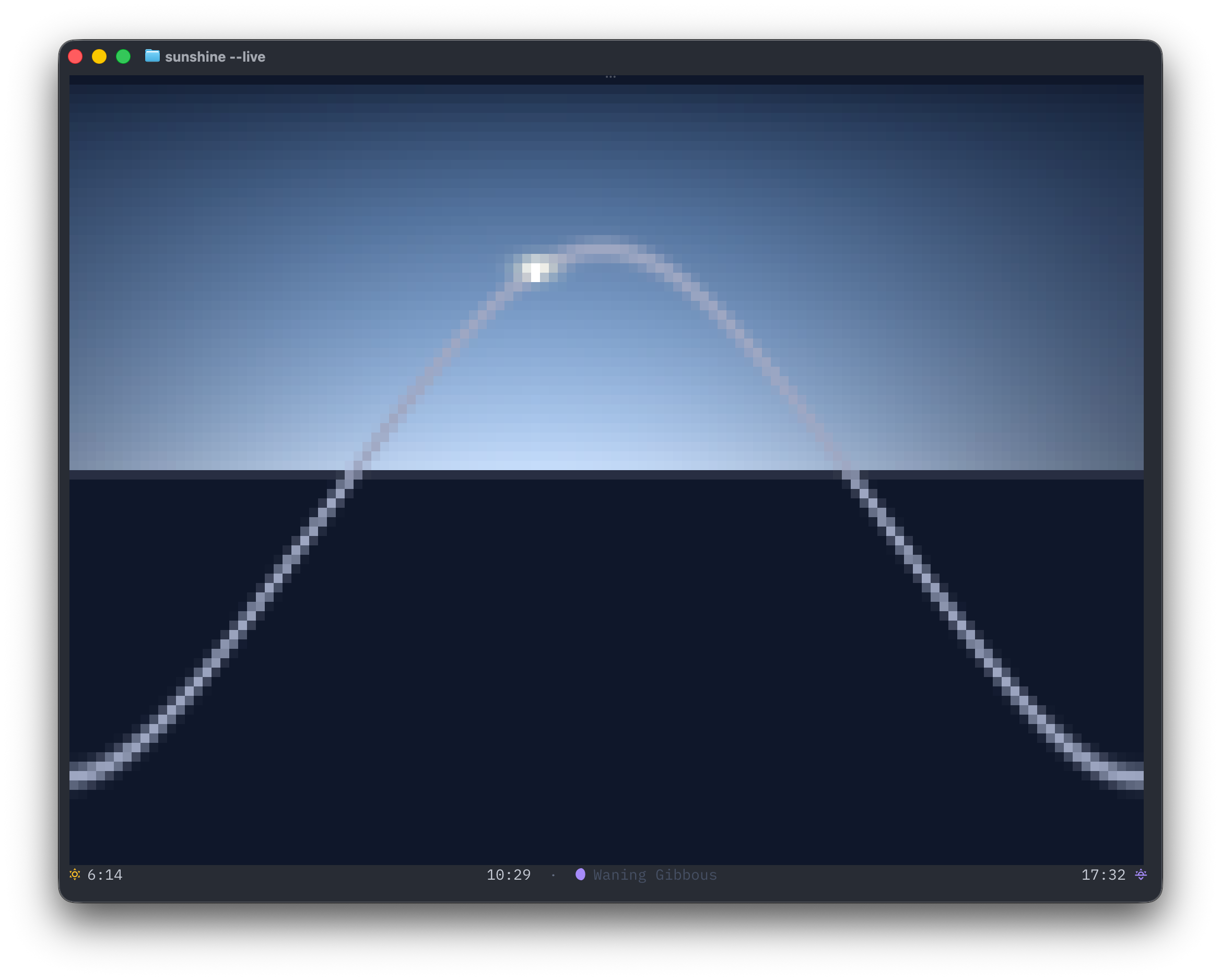
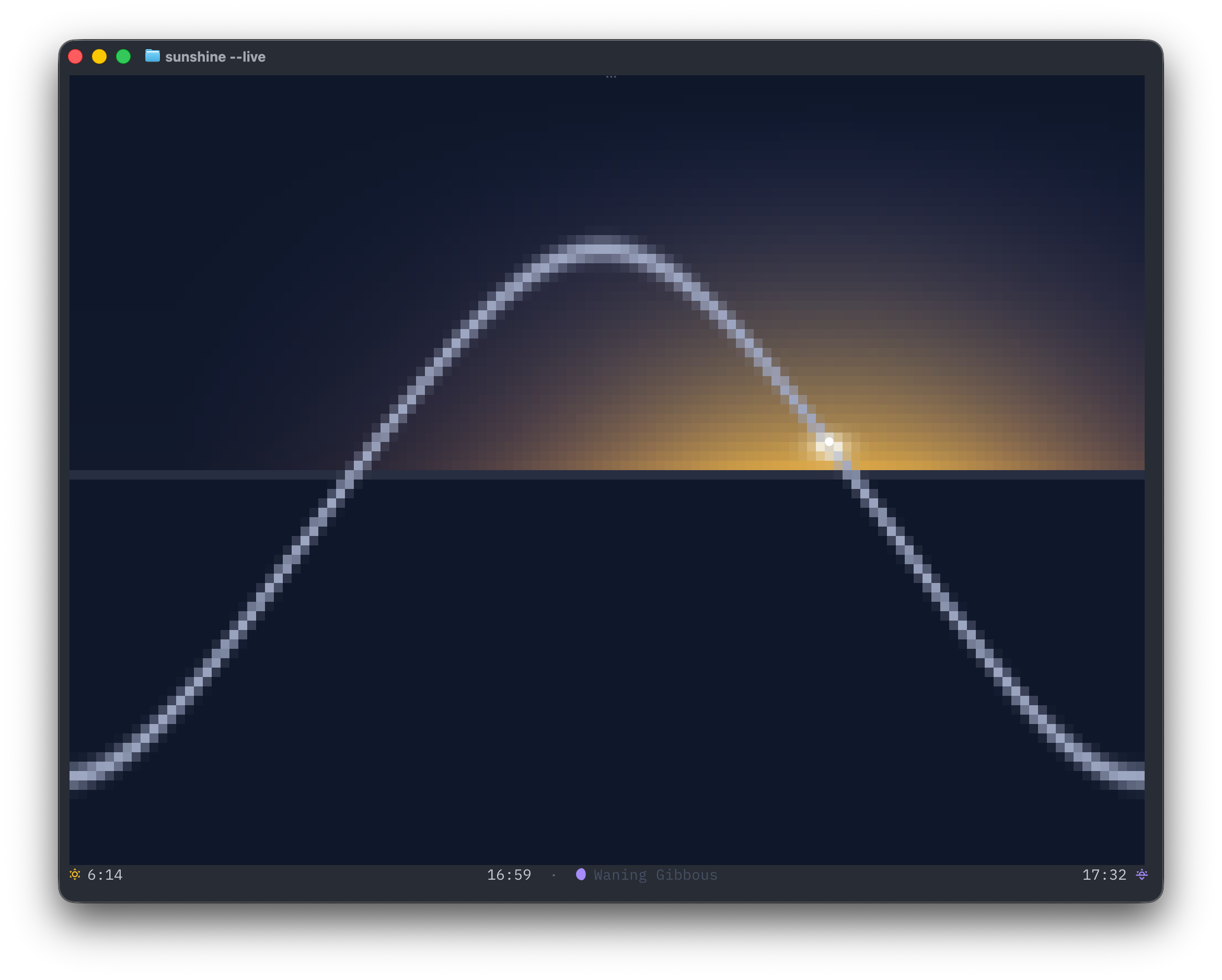
sunshine is inspired by the Apple Watch Solar face. The arc and sky move through dawn, day, dusk, and night; day length includes its change from yesterday.
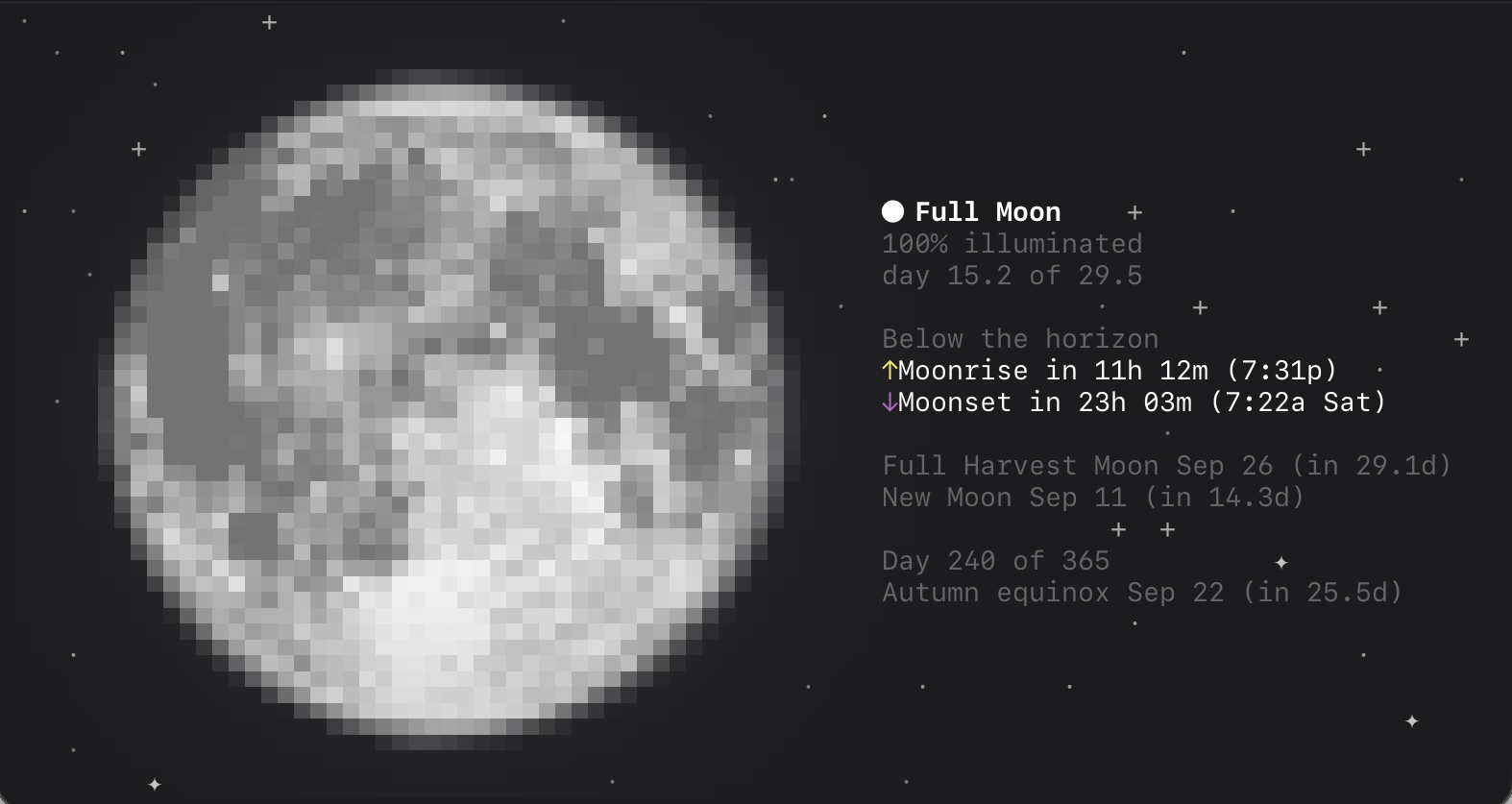
moon draws the current phase with its real terminator, mare shading, halo, and orientation for your hemisphere, then tells you what the Moon is doing next. Try moon --oneline for a status bar.
Tides
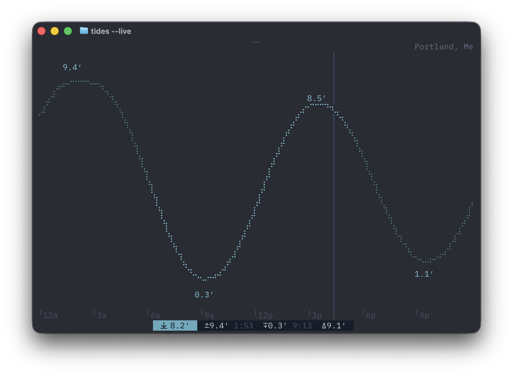
The tide chart scrolls across several days and annotates exact highs, lows, and the current predicted water level. Coverage comes from NOAA in the US, the Canadian Hydrographic Service, and Queensland Open Data; anywhere else, the chart falls back to Open-Meteo's global tide model, so nearly any coastline works out of the box. An optional TideCheck key adds more named stations. Run tides --nearby to list the closest stations, or tides --station <id or name> to pin one.
Radar
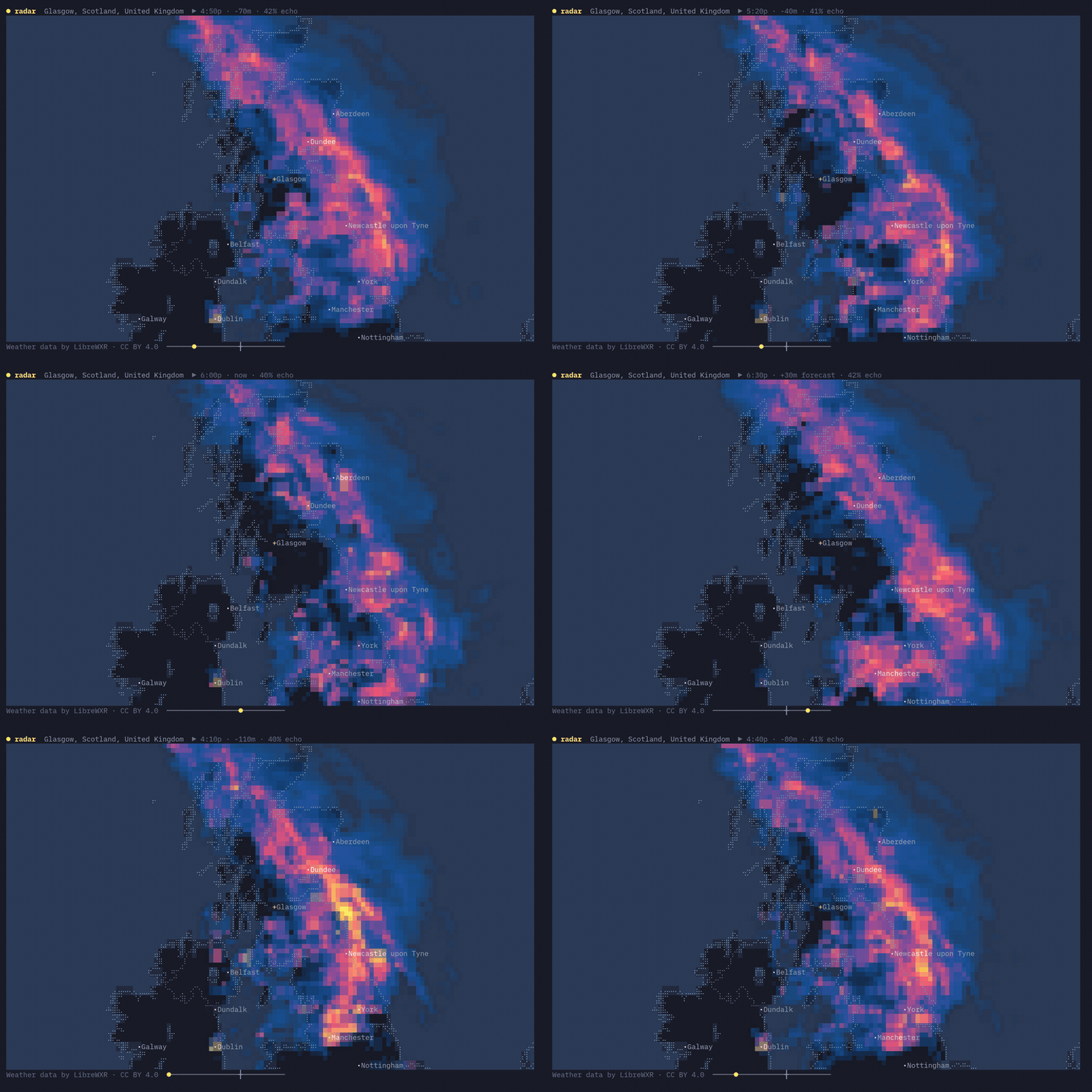
Radar animates recent observations and an hour of forecast over a braille basemap. LibreWXR supplies worldwide composites and fills gaps with model-derived precipitation; linecast adds time-synced US warning polygons, optional temperature and wind layers, 13 colour themes, and hourly infrared satellite imagery.
radar --theme rainbow
radar --layers temp,wind
radar --layer satellite
Maps
Street view renders OpenFreeMap vector tiles as solid water, land, parks, and buildings under a braille road network. Hover a feature to name and highlight it; search with /, ask for directions with d, or switch views with v. Directions open as a small panel: labelled from, to, and mode fields — each showing the key that edits it, and all clickable — above the turn-by-turn steps. Arrow (or click) through the maneuvers and the map flies along the route.
Terrain view turns global elevation into hillshade and a hypsometric ramp, from deep ocean trenches through lowland green to alpine white. Coastlines, borders, water, and cities are drawn over it in braille.
Zoom all the way out and either view becomes an orthographic globe you can rotate by dragging — or set spinning with r. Two keys switch on the sky as it is right now: s shades the planet into actual daylight, with a creeping terminator and cities glowing on the night side, and c lays the current global cloud cover over it from live satellite imagery. maps --view now opens straight to the full picture.
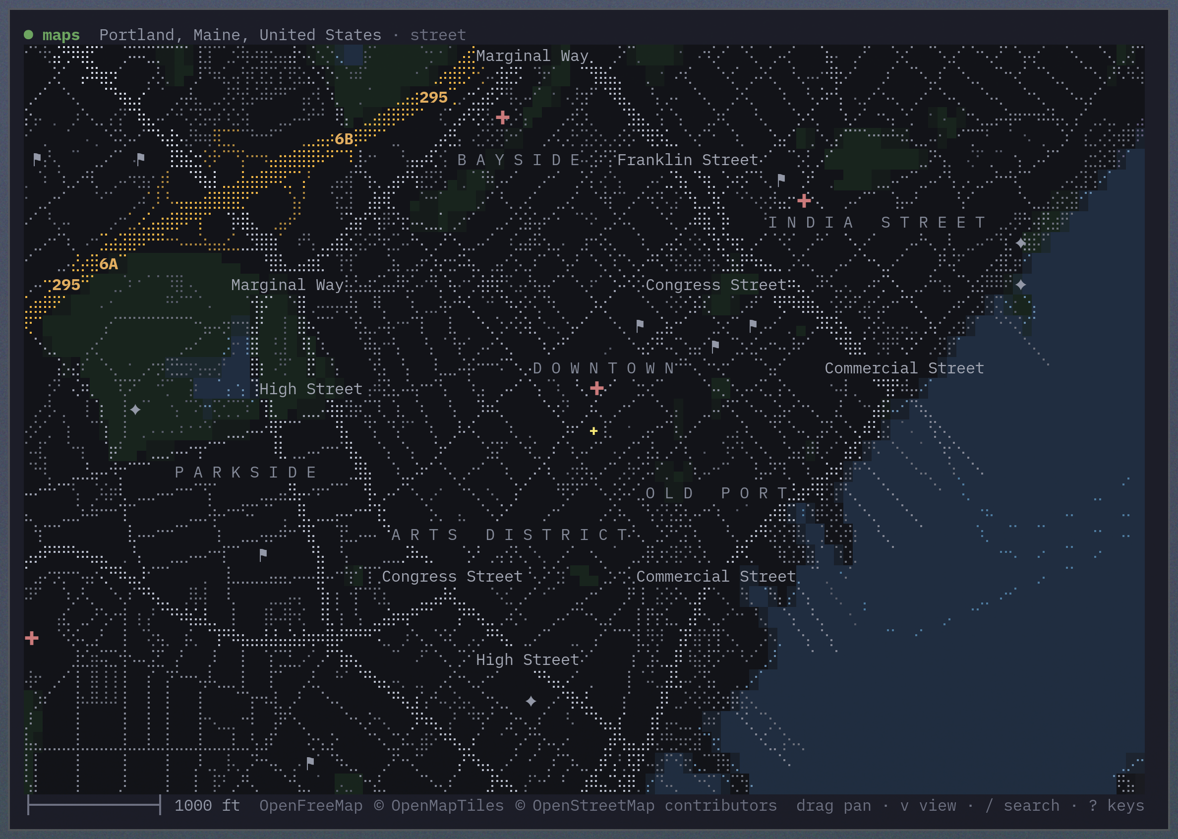
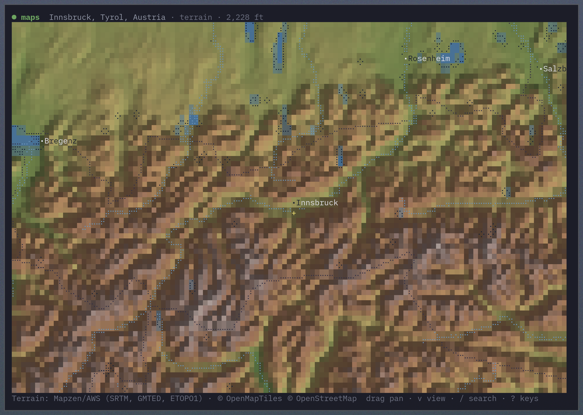
maps --location "Portland, Maine" --zoom 0.01
maps --view terrain --location 60.4,5.3 --zoom 8
maps --view now
maps --from "Gorham, Maine" --to "Portland Head Light" --profile foot
Make it yours
Location
Save one location for every command:
linecast location set "Portland, Maine"
linecast location set 44.54,-68.42
linecast location
linecast location auto
linecast location search fayette
The setting lives in ~/.config/linecast/config.json. A command's --location flag or WEATHER_LOCATION takes precedence.
Language
Use --lang or LINECAST_LANG to localize the interface. Seventeen languages are supported:
English, French, Spanish, German, Italian, Portuguese, Dutch, Polish, Norwegian, Swedish, Icelandic, Danish, Finnish, Japanese, Korean, Chinese, and Indonesian
weather --lang fr
radar --lang zh
Colour and icons
linecast queries the terminal palette so its colours belong in your theme. Set LINECAST_COLOR to truecolor, 256, 16, or none to override colour detection, or use the standard NO_COLOR variable. A Nerd Font gives the best icon rendering; --emoji or LINECAST_ICONS=emoji uses standard emoji instead.
Shell completion
# Bash
source <(linecast completion bash)

# Zsh
source <(linecast completion zsh)

# Fish
linecast completion fish | source
Completion covers both linecast <command> and the standalone commands.
Environment variables
| Variable | Description |
|---|---|
WEATHER_LOCATION |
Default lat,lng for location-aware commands; overrides the saved location |
WEATHER_UNITS |
metric for Celsius, km/h, and mm |
TIDE_STATION |
Default tide station ID |
TIDES_UNITS |
metric for tide heights in metres |
LINECAST_TIDECHECK_KEY |
Optional TideCheck API key for global tide coverage |
LINECAST_LANG |
UI language code: en, fr, es, de, it, pt, nl, pl, no, sv, is, da, fi, ja, ko, zh, or id |
LINECAST_RADAR_THEME |
Default radar colour theme |
LINECAST_LIBREWXR_URL |
Base URL of a self-hosted LibreWXR instance |
LINECAST_ICONS |
emoji to use standard emoji instead of Nerd Font icons |
LINECAST_COLOR |
auto, truecolor, 256, 16, or none |
LINECAST_THEME |
auto (default), or classic / legacy / off for the fixed palette |
LINECAST_THEME_TIMEOUT_MS |
Terminal palette query timeout in milliseconds (default 100) |
NO_COLOR |
Any non-empty value disables ANSI colours |
Data sources and coverage
- Weather — Open-Meteo for forecasts, geocoding, and air quality. Alerts come from the US National Weather Service, Environment Canada, China Meteorological Administration, DWD via Bright Sky, Met Éireann, Japan Meteorological Agency, MET Norway, and MeteoAlarm.
- Sunshine and Moon — computed locally from astronomical equations.
- Tides — NOAA CO-OPS, Canadian Hydrographic Service, Queensland Open Data, Open-Meteo's tide model as a global fallback, and optionally TideCheck.
- Radar — LibreWXR, with NEXRAD via Iowa Environmental Mesonet and RainViewer as fallbacks; warning polygons come from the US National Weather Service via IEM. The basemap is derived from Natural Earth.
- Maps — terrain from AWS/Mapzen elevation tiles; streets and inland water from OpenFreeMap (© OpenMapTiles © OpenStreetMap contributors); search from Photon and Nominatim; directions from FOSSGIS OSRM (© OpenStreetMap contributors); globe cloud cover from LibreWXR (CC BY 4.0) satellite imagery.
License
1 maintainer

Download files
Download the file for your platform. If you're not sure which to choose, learn more about installing packages.
Source Distribution
Built Distribution
Filter files by name, interpreter, ABI, and platform.
If you're not sure about the file name format, learn more about wheel file names.
Copy a direct link to the current filters
File details
Details for the file linecast-1.10.0.tar.gz.
File metadata
- Download URL: linecast-1.10.0.tar.gz
- Upload date:
- Size: 14.5 MB
- Tags: Source
- Uploaded using Trusted Publishing? Yes
- Uploaded via:
twine/7.0.0 CPython/3.13.14
File hashes
| Algorithm | Hash digest | |
|---|---|---|
| SHA256 |
f5c411bbe5a9d2604fd34ae91ddb2c2de14077295f45be59c4db4ddca20ca3a2
|
|
| MD5 |
ae219a9be7eb00d85ece77d19311abbc
|
|
| BLAKE2b-256 |
d67ae863adf6991ee7870a77463da407ee2c47d646bece88e6a1bcd7ac1c65ba
|
Provenance
The following attestation bundles were made for linecast-1.10.0.tar.gz:
Publisher:
publish.yml on ashuttl/linecast
-
Statement:
-
Statement type:
https://in-toto.io/Statement/v1 -
Predicate type:
https://docs.pypi.org/attestations/publish/v1 -
Subject name:
linecast-1.10.0.tar.gz -
Subject digest:
f5c411bbe5a9d2604fd34ae91ddb2c2de14077295f45be59c4db4ddca20ca3a2 - Sigstore transparency entry: 2518770223
- Sigstore integration time:
-
Permalink:
ashuttl/linecast@94bc893f0e514409a1f9e869c9c1341aa7b449de -
Branch / Tag:
refs/tags/v1.10.0 - Owner: https://github.com/ashuttl
-
Access:
public
-
Token Issuer:
https://token.actions.githubusercontent.com -
Runner Environment:
github-hosted -
Publication workflow:
publish.yml@94bc893f0e514409a1f9e869c9c1341aa7b449de -
Trigger Event:
push
-
Statement type:
File details
Details for the file linecast-1.10.0-py3-none-any.whl.
File metadata
- Download URL: linecast-1.10.0-py3-none-any.whl
- Upload date:
- Size: 2.3 MB
- Tags: Python 3
- Uploaded using Trusted Publishing? Yes
- Uploaded via:
twine/7.0.0 CPython/3.13.14
File hashes
| Algorithm | Hash digest | |
|---|---|---|
| SHA256 |
8a214cd06e9419b001ae9b088225827d35f246bb216e52a216ec315433ab74e2
|
|
| MD5 |
4105939a4a1270c13e87bc34ae8d2e9f
|
|
| BLAKE2b-256 |
813d5a018b465b4b4322fd80934f4a18a16a917e2311d0cc9cb102708080f87a
|
Provenance
The following attestation bundles were made for linecast-1.10.0-py3-none-any.whl:
Publisher:
publish.yml on ashuttl/linecast
-
Statement:
-
Statement type:
https://in-toto.io/Statement/v1 -
Predicate type:
https://docs.pypi.org/attestations/publish/v1 -
Subject name:
linecast-1.10.0-py3-none-any.whl -
Subject digest:
8a214cd06e9419b001ae9b088225827d35f246bb216e52a216ec315433ab74e2 - Sigstore transparency entry: 2518770343
- Sigstore integration time:
-
Permalink:
ashuttl/linecast@94bc893f0e514409a1f9e869c9c1341aa7b449de -
Branch / Tag:
refs/tags/v1.10.0 - Owner: https://github.com/ashuttl
-
Access:
public
-
Token Issuer:
https://token.actions.githubusercontent.com -
Runner Environment:
github-hosted -
Publication workflow:
publish.yml@94bc893f0e514409a1f9e869c9c1341aa7b449de -
Trigger Event:
push
-
Statement type:














